Notice: I've taken a part-time job, and it's definitely affecting my blogging time. I'll continue to add content here as often as possible. Pertinent guest posts are always welcome.

-

Tuesday, March 29, 2011

Trailspotters Offers Discounted Tickets for NCT Members

alt text

received from Tom Funke

Trailspotters is a Michigan corporation that owns and operates shuttle and carspotting services for quiet sports enthusiasts. We operate in the eastern Upper Peninsula serving the North Country Trail between Munising and Lower Tahquamenon Falls.

The walk-up rate for a shuttle between Munising and Grand Marais is $20. A NCT chapter member covered under this agreement would be $7.50.

I would like to offer an opportunity for your chapter, for an exchange of advertising services in your newsletter and/or website, to secure a discount for your members. I'm offering 50% off for any chapter member using our services on the North Country Trail during our 2011 season, which runs from mid-June through Labor Day. Â I will also donate $100 to the chapter that has the most members using our service in 2011 (Minimum 20 total users from all chapters combined).

I am a long time member of the North Country Trail and author of 50 Hikes in Michigan's Upper Peninsula. This business opportunity presented itself because of my love of the trail.

If you are interested in taking advantage of this offer, all I need is a simple agreement, given below, to be signed and mailed or scanned/emailed back to me no later than May 15, 2011. When I receive the agreement, I'll email the Trailspotter logo and some example text, along with a code to be used when registering online

See Trailspotters of Michigan

Friday, March 11, 2011

Sam Gardner Leaves Trail with Hip Problem

Sam Gardner

compiled from Sam Gardner's journal

On January 1, Sam Gardner left Crown Point, New York on what he hoped would be a 12,500-mile trek. He planned to hike the North Country, Pacific Crest, Continental Divide, and Appalachian National Scenic Trails in one huge walk.

However, tendonitis in a hip has forced him to take a break. Sam reached Portageville, in western NY, and has returned home, to Houghton, Michigan, for medical treatment and therapy.

The pain in his hip had reduced him to completing only about six miles a day- not nearly enough to stay on a resupply schedule for his long trek.

He writes on March 6, "Today I made a very hard decision. I have chosen to leave the trail to seek medical care. The tendentious in my hip has only gotten worse in the past month. Every day i cover less and less miles before the inflammation triggers enough pain to stop me in my tracks. I was hoping to take care of this on the trail but I believe it’s well beyond that point."

This morning, he posted from home, "[The chiropractor says] my pelvis is out of alignment big time. The bad news is that it could take 6 months of physical therapy. I sincerely hope that his estimate is wrong by a long shot. I am super bummed. There is no doubt about it. However I’m doing my best to work around it. I’ve been scheming all night. So I’m coming up with a plan."

We'll have to stay tuned to see what Sam decides to do.

You can follow his journey at The Initiative

Monday, February 21, 2011

NCTA Unveils New Website

NCTA web site home page

received from Andrea Ketchmark

The new and improved northcountrytrail.org is online. Check it out and you will find a new look, more detailed trail information, better volunteer resources and greater functionality and navigability. Best of all, we see this as the next step in building a seamless national and chapter web presence, owned and updated by the membership, with huge potential for member and chapter engagement.

With the leadership of Matt Rowbotham, this process has engaged the entire staff, our Board of Directors and many chapter leaders and volunteers along the way. We hope you like what you see but the great thing about this new system is the way it provides for endless customization and the ability to be as flexible as we need to be. It is not a finished product in the traditional sense but rather a dynamic tool for communication that can meet our needs as quickly as those needs change.

Pay special attention to the new Chapter/Affiliate/Partner portal pages, a new exciting feature to insure you get the recognition you deserve on the national level. We will be contacting you all in the coming months in an effort to gather your thoughts and ideas to make these pages even better.

So for now, take a few minutes to explore northcountrytrail.org and all of its new features. Let us know what you think, what you like and what else you would like to see. And please help us get the word out by including an announcement in your newsletter or at your next meeting.

We hope you enjoy it!

Andrea Ketchmark
Director of Trail Development

See North Country Trail Association

Wednesday, February 16, 2011

Calhoun County Trailway Possible Route Needs Support

hikers on the North Country Trail

by Tom Garnett and Mick Hawkins, of the Chief Noonday Chapter, NCTA

The Calhoun County Board of Commissioners will decide soon the fate of the Calhoun County Trailway in Emmett Township on the east side of Battle Creek, and with it part of the fate of the North Country Trail. Very likely the CCTA trail would replace pretty much all of the roadwalk currently in place from the east boundary of Battle Creek down to Historic Bridge Park in Emmett Township.

A Master Plan was completed in 2006, and grants have been obtained in the past two years through the work of the Calhoun Country Trailway Alliance (CCTA) to build 5.3 miles of multi-use off-road trail connecting the Battle Creek Linear Path with Historic Bridge Park through the county parks of The Ott Biological Preserve, Kimball Pines, and Historic Bridge Park.

Beyond this first segment, planning is being developed to take this trail all the way to Homer, connecting with Marshall, and Albion on the way. This will be a great extension of trails within the area.

After several Commission votes in support of the trailway in recent years, an opposition group, Friends of the Ott, have been successful in creating some "doubt" particularly in the minds of the "new" commissioners. The trailway is one part of the CCTA's vision of a trail across Calhoun County and the State of Michigan's vision of a trail connecting Lake Michigan and Lake Huron.

The Chief Noonday Chapter of the North Country Trail Association has been much involved in the CCTA project from the get-go. Chief Noonday obtained funding for early feasibility studies for the project. See map on Chief Noonday site that shows approximately where the CCTA corridor would go.

Contact the Calhoun County Trailway Alliance at cfc-cc.org

This segment is on NCTA map MI-02

See Chief Noonday Chapter of the NCTA

Tuesday, February 8, 2011

Promoting the NCT and Tahquamenon Heritage

Tahquamenon Falls
Tahquamenon Falls (photo by jhy)

by Kay Kujawa, excerpted from the Hiawatha Shore-to-Shore newsletter, February 2011

Hiawatha Shore-to-Shore Chapter of the North Country Trail Association representatives, Stan and Kay Kujawa, attended the January 19th Tahquamenon Scenic Heritage Route (TSHR) Committee meeting. The TSHR was designated by Michigan legislature and is recognized by MDOT. The general purpose of the TSHR Council is to enhance and promote the recreation, history and cultural opportunities of the Eastern UP.

The North Country Trail crosses M-123 just north of the Tahquamenon River Mouth bridge, meanders through the Tahquamenon Falls State Park and crosses M-123 again just west of the Upper Falls Road.

The economic benefits of a community having a National Scenic Trail nearby can be profitable, if the trail is properly maintained, improved and promoted. Hiawatha Shore-to-Shore joined the TSHR committee to promote awareness of the NCT and to inform communities of the potential economic possibilities.

The NCT also provides health and recreation opportunities for local residents as well as guests and visitors to the region.

This segment is on NCTA map MI-08

For more about the TSHR, contact Nathan Frazer
See Hiawatha Shore-to-Shore Chapter of the NCTA

Tuesday, February 1, 2011

Guidebook Author Named

Ron Strickland
Ron Strickland (photo by jhy)

received from Andrea Ketchmark, Director of Trail Development, NCTA

Many of you know that, with the generous support of the National Park Service, the NCTA has been able to embark on the development of a Guide to the NCNST. We've contracted with Ron Strickland to be its author; among many other qualifications (including getting the Pacific Northwest Trail established and spearheading the Sea-to-Sea Route) Ron is well-known as a guidebook author.

Contact Andrea Ketchmark

Saturday, January 29, 2011

Do You Live in Northeastern Minnesota?

Gooseberry River
view of the Gooseberry River from the NCT/SHT (photo by jhy)

from Matt Davis, Regional Trail Coordinator for MN & ND, North Country Trail Association

The North Country Trail Association is looking for hikers in Minnesota's 8th Congressional District to contact Rep. Chip Cravaack and ask him to support the North Country National Scenic Trail's (NCT) Arrowhead Re-route by introducing legislation in the U.S. House of Representatives.

The Arrowhead Re-route would change the official route of the NCT in northeastern Minnesota and make the Superior Hiking Trail, Border Route Trail, and Kekekabic Trails official components of the NCT - the nation's longest hiking trail.

A small group of NCTA folks met with a staff member from Rep. Cravaack's Minnesota office on Wednesday to introduce the issue and a team will visit his Washington, DC office next month as part of Hike the Hill Trails Advocacy Week. We are hoping that some constituents will contact his office before then and let him know that this issue is important to them and that they'd like him to act.

If you should have any questions about this issue, feel free to contact Bruce Matthews at NCTA HQ at bmatthews@northcountrytrail.org / 1-866-HIKE-NCT.

If you don't live in the 8th District, don't worry. You can help later once the House bill is introduced when we will try to get all of Minnesota's House delegation to sign onto the bill as co-sponsors. Feel free to forward this message onto others who live in the 8th District and would consider making a contact.

Thanks for your support of the North Country Trail!

See Minnesota's 8th Congressional District
status of S553
Contact Matt Davis

Thursday, January 27, 2011

New Trail to Little Garlic River

hikers wearing orange
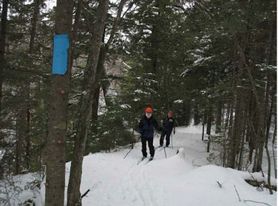
Chuck Ganzert & Puck Bates skiing on new trail along the south side of the Little Garlic River. (photo from NCT Hikers "Footprints")

from Footprints, Winter 2011

Once the season’s trail maintenance was completed, the NCTH trail crew began building a 4.2 mile new segment of trail. From the north end of Segment 16 - Little Presque Isle Point to Echo Lake Road, the new trail segment crosses Echo Lake Road and then enters the woods winding up the hill, following the ridge to a nice view (when leaves are off the trees) of Lake Superior. From here it turns northwesterly meandering through the woods sometimes following old logging roads as it passes Gokey Rock.

Eventually a spur trail up Gokey Rock will give hikers a chance to climb up, take a break and enjoy the view. From Gokey Rock, the trail continues more northerly as it heads to the south side of the Little Garlic River. At the river it turns east following the ridge to County Road 550.

At 550 turn left to cross the Little Garlic River bridge and then into the parking area at Elliott Donnelley Wilderness.

hikers wearing orange
new trail map (from NCT Hikers "Footprints")


This new segment replaces Segment 17 - Eagles Nest Road (Echo Lake Road) to Elliott Donnelley Wilderness and eliminates two crossings of County Road 550.

This segment is on NCTA map MI-11

See North Country Trail Hikers Chapter of the NCTA

Tuesday, January 25, 2011

National Geographic to Feature Andy Skurka's Alaska-Yukon Adventure

Andy Skurka in Danali
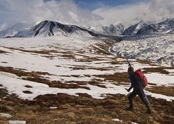
Denali Park (photo from Andy Skurka)

received in Andy Skurka's newsletter

Andy Skurka is the first person, and still the only person, to hike the Sea-to-Sea route which includes the North Country Trail. Since that adventure, in 2004-5, he's gone on to become a professional hiker. But many people along the NCT met Andy, and still follow his exploits. He writes:

"The big news from 2010 is that I completed my third mega trip: the Alaska-Yukon Expedition, a 4,700-mile 6-month journey via skis, foot, and packraft. Highlights included a traverse of Denali National Park and a 24-day 657-mile stretch across northern Yukon and the Arctic National Wildlife Refuge (ANWR) during The expedition was supported by National Geographic, and National Geographic Magazine is running a 16-page story about it in the March 2011 issue. Pre-order a signed copy today. All pre-order customers will be entered in a raffle for a GoLite backpack.

"I think my mom is going to sleep much better in 2011, with no big trips planned. But there'll be different challenges: writing two books, giving presentations and clinics, and guiding trips in the West and Alaska -- plus, trying to find inspiration for another biggie in 2012 or 2013."

See andrewskurka.com

Saturday, January 22, 2011

Fall Softies Hike in Michigan's UP

hikers wearing orange
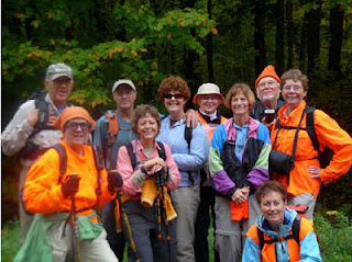
Fall 2010 Softies hikers (photo from NCT Hikers "Footprints")

from Footprints, Winter 2011 by Sarah Fisher

This hike is in Michigan's Upper Peninsula. The Softies group continually hikes across the UP, but prefers to "camp" indoors. -Ed.

Jeff and I joined our first North Country Trail Softies Walk at 10:00 am at Koski Corners. After brief introductions we caravaned with Marge and John Forslin, Reggie and LuAnn Krueger, Lorana Jinkerson, and Carole Bard. Our first stop was brunch at the Hardwood Inn in Covington. We then continued to the Loop Road Lodge in Trout Creek, our base camp for the next few days.

Because of rainy conditions and possible flooding, we decided to postpone our first hike for a day. Instead we took a short walk on the road and admired the fall foliage. Jan Lindstrom Wester and Nancy Bradbury arrived to join us for a delicious pot luck dinner and evening of conversation. We entertained ourselves playing golf and Nordic ski-jumping with the WI game the Forslins brought. Jan excelled at golf while LuAnn turned out to be quite the skijumper!

Friday, after a leisurely breakfast we embarked on the first leg of the trek from FH16 where Gale Jamsen met us to South Laird Road. We covered 6.5 miles which was quite sufficient due to the rain and wet terrain. We all appreciated hot showers and the use of the clothes dryer upon our return to the Lodge. The trail along a ridge with deep ravines on both sides. We then enjoyed a gourmet pork loin dinner provided by masterchef, John.

Saturday our plan was to walk all of segment 18 and half of segment 19 from South Laird Road and the Sturgeon Falls Trail. Gale Jamsen met us at the beginning of the trail. Marge and Jan decided to take a short walk and go down to see the Falls. (2-3 mile round trip on a non NCT trail). Doug Welker, President of the Peter Wolfe Chapter, had provided an alternate route for us to avoid crossing some deep rivers. In spite of that we had extremely wet conditions and hidden deep holes to navigate.

We had quite an adventurous day. Part of the time the blazes were difficult to follow due to lack of trees. Just after our lunch break while crossing a very high ridge we came upon an abandoned bicycle in good condition, as if it had been left there quite recently. We searched and called out, but discovered no one. Lorana entered the coordinates into her GPS to report to the police. Then Reggie knocked his glasses off while kicking a branch off the path. After a 15 minute search Gale found them and we continued. We walked a few miles extra before finding the exit to the road, so we decided to do the Sturgeon Falls in the morning when we were fresh.

We finished the evening with great hamburgers at UP Chucks in Kenton. Nancy, LuAnn and Reggie returned home for family obligations.

Sunday was a beautiful day to complete our walk. Lorana, Carole, Jeff and I began with the sharp descent to the Falls. The waterfalls were especially beautiful and full after the previous few days of rain. We found the switch backs in the path to make the climb back easier and were off to join Jan and Marge on the trail. We walked 5.82 miles to FR2236 (the rest of segment 19 and half of segment 20. The terrain was much different: a more open plains like area.

Since we had packed and neatened up the lodge before starting we were ready to caravan to lunch at the Hardwood Cafe and then on home.

A great time was had by all. The walks were invigorating. The fall colors were magnificent. The meals were were delicious. The company was compatible. A big THANKS goes to Marge for planning, John for shuttling and cooking, and Lorana for leading the walks. Another softies walk was successfully completed. We are looking forward to the Spring Softies Hike 2011.

This segment is on NCTA map MI-13

See North Country Trail Hikers Chapter of the NCTA