Notice: I've taken a part-time job, and it's definitely affecting my blogging time. I'll continue to add content here as often as possible. Pertinent guest posts are always welcome.

-

Wednesday, December 28, 2011

Chief Noonday Chapter's Huge Cleanup Project of 2011

alt text
Jason Buckner, left, and Mary Rebert work to clear tree limbs blocking a path on the North County Trail near Battle Creek (photo by Aaron Ogg)

based on a news article in the Grand Rapids Press

As a result of a bad blowdown in May of 2011, the Chief Noonday Chapter has been working all year to clean up the North Country Trail through Kimball Pines.

Wind gusts between 75 and 100 miles per hour sheared the tops off dozens, if not hundreds, of trees during the Memorial Day weekend storm, and the entire character of the trail was changed. However, the volunteers were primarily concerned with making it hikeable once again.


This segment is on NCTA map MI-02

See Chief Noonday Chapter of the NCTA

Wednesday, December 21, 2011

Royal River Bluff
Royal River bluff from the Border Route on the Minnesota Arrowhead (photo by jhy)

received from Ed Solstad esolstad@pressenter.com


The Border Route (northern portion of the Minnesota Arrowhead North Country Trail) is doing well in comparison to the other trails, being No. 2 in use for 2009 and No. 1 in 2010 & 2011. In 2009 the Kekekabic Trail was No. 1. The Kek is also part of the NCT, just to the west of the Border Route.

The Forest Service recently issued this report of all Boundary Waters Canoe Area Wilderness trail entry points permits.

In 2009, 2010, and 2011, the Kek had 76, 51, 45 permits issued, respectively.

The Border Route, for the same three years was 42,54, and 55.

Ed says, "Thanks go out to all of you that have helped in our maintenance efforts. Without your dedication, the trail wouldn't be what is is today."

See the full Trail Use Report (an xls file)

This segment is in the Border Route guide

See Border Route Trail

Monday, December 19, 2011

Wisconsin Eagle Scout Clears NCT


based on a news story in the Northland News Center

Jonathon Gilbertson of Ashland, Wisconsin recently received his Eagle Scout award in a ceremony with two other boys. For his project Jonathan cleared the North Country Trail in one of the Chequamegon Forest's designated wilderness areas. (Could be Porcupine Lake or Rainbow Lake- the article did not specify)

"All the trees we cut out we used a cross cut saw and a hand saw. The brush was cut with little clippers and we had to haul it back by ourselves." said Gilbertson.

This segment is on NCTA map WI-02

See Chequamegon Chapter of the NCTA


Saturday, December 17, 2011

Hiking Allegany State Park

stream in Allegany State Park
a stream in Allegany State Park, NY (photo by Pat Coate)

from Mon@arch's Nature Blog used with permission

Pat Coate, of Mon@arch Nature Blog, recently took a hike on the North Country/Finger Lakes Trail in Allegany State Park, New York. This is the westernmost section in NY, just before the trail slips into Pennsylvania.

She writes, "The section of the trail along Brown Hollow looked down on a babbling brook whose sound was drowned out by the constant sloshing of many feet through the deep carpet of fallen leaves."

"The following weekend my family hiked the other end of the FLT in Allegany State Park. The trail starts off of exit 19 (Red House Lake exit) on Bay State Road. This too is a beautiful trail. The trail climbs fairly steadily from 1440’ to 2060’ over about a 2 mile stretch, including switchbacks. There are glimpses of the Allegheny River to the west and some nice rock formations along the way."

Follow the link above to read the rest of her entry and see more pictures.

This segment is on FLT map M1/CT1

See Finger Lakes Trail

Friday, December 16, 2011

Still Time to Comment on Manistee NF Quiet Areas

alt text
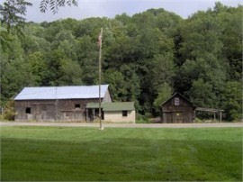
Bowman Lake Semi-Primitive Area (photo by jhy)

by JHY

You have until December 23 to comment on the following situation in the Manistee.

Some people may be aware of a lawsuit brought against the Manistee National Forest which has required them to consider increasing the number of acres set aside for quiet sports. This has set off a huge firestorm among hunting, snowmobiling, and ATV interests. These groups have strongly organized to oppose the proposals. From the Forest Service perspective, it has created a huge amount of paperwork and chewed up time which could not be spent doing other things.

Personally, I have mixed feelings about the whole thing. I deplore the amount of money it has taken the Forest Service to prepare alternative solutions and all the accompanying documentation. However, I do agree with the basic idea that quiet recreation often gets the short end of the stick.

You may have seen media coverage of this issue if you live in Michigan. All the news reports I've seen have made it sound as if hunters and motorized vehicles will be banned from the whole forest. The media seems to have worked hard to make this as hot of an issue as possible.

In truth, only 70,000 acres, out of a million in the forest, will be affected. That's less than 1% of the land!

In addition to recreational uses, the Forest has included rare plants, wildlife management, and timber management in their SEIS (Supplemental Environmental Impact Statement), but these are outside the scope of this blog post.

It's really hard to sift through the documents to the crux of the issue, but I believe I've got it right... I made a couple of phone calls, and have searched the web for info from others who have read all the paperwork. The Forest has prepared three alternatives:

  • A. Do nothing. This would leave all areas as they are- open to the same uses.
  • B. Combine all semiprimitive nonmotorized areas into a single management area and ban hunting in addition to the current ban on motorized vehicles. This is the FS preferred alternative because it creates the least amount of additional work (about 64,000 acres). See additional comments below.
  • C. Change all semiprimitive motorized areas to nonmotorized, thus increasing the nonmotorized areas by 17,000 acres. This would ban both hunting and motorized use.


The North Country Trail passes through all three of the existing semiprimitive nonmotorized areas. These are the Manistee River SPA, Bowman Lake SPA, and Condon Lakes West SPA. Therefore, with either B or C, there will be increased places where one can walk on the NCT without encountering hunters. If Alternative C is implemented, then the Loda Lake Motorized SPA would also become nonmotorized, creating a fourth "quiet" area along the NCT. Condon Lakes East would also become nonmotorized, and this is adjacent to the trail.

Opponents say that there is so much noise encroaching from adjacent properties that this whole idea is silly. And of course, there has been the huge outcry that the Forest is trying to ban "noisy" users from the whole Forest. It's just not true.

The court decision stated that "the [Forest] Service failed to identify the various recreation preferences of user groups. Specifically, just because the Forest Plan may allow a variety of "activities" (i.e., snowshoeing, snowmobiling, hunting, cross-country skiing, bird watching) does not mean that the Plan is adequate. Rather, the Service should focus on the "quality" of those recreational opportunities and the recreational preferences for the users." Finally, someone noticed that low-tech users do not receive a quality experience in shared areas!

This post has gotten long. There is a nice table comparing the alternatives at The Alternatives. This is a pdf which lists the alternatives, and has a chart near the end.

If you would like to see more of a quality experience for hikers, with little actual impact on hunters and motorized users of the Forest, please send a comment and endorse Alternative B or C. The deadline is Dec 23, 2011.

HOW TO COMMENT • U.S. Mail - Send written comments to Lee Evison, Forest Planner, Huron-Manistee National Forests, 1755 S. Mitchell Street, Cadillac, MI 49601 • Fax - 231-775-5551 • Electronic - comments-eastern-huron-manistee@fs.fed.us (Comments sent via email should contain the subject line "Forest Plan SEIS"

This segment is on NCTA map MI-04, and MI-05

See Index to all the Manistee National Forest Documentation on the SEIS.

Thursday, December 15, 2011

Years of Low Acorn Production Can Boost Lyme Risk

alt text
white oak acorns (photo by jhy)

based on a news article in the New York Times

The Northeast is experiencing a year of low acorn production, in contrast to Michigan, where I found the forest floor layered with sweet acorns. But I was not aware that the variations in acorn production can have an influence on the prevalence of Lyme Disease the next year. Here's how it works.

Acorn production normally runs in a series of high and low production years. That's a given. It's what happens when a good year is followed by a lean year that things get interesting for the humans who spend time in the woods. When acorn production is up, the wildlife that depends on the nuts for food flourish, and their populations rise. If a good year is followed by a year of few acorns the large populations of squirrels, mice, and ground-nesting birds will crash, as they will have a hard time finding enough food.

Of course, when the wildlife increases, so do the tick populations. And when the wildlife dies off, all those ticks will be looking for fresh blood. Humans in the woods make them very happy.

So, if you live in the Northeast, be sure to take your DEET to the woods next spring!


Wednesday, December 14, 2011

Still Time to Comment on Hydrofracking in New York

alt text
how the Marcellus Shale is located in relation to the North Country Trail. Right click the map to enlarge or follow the FLT link below to see the full-size version (graphic from the Finger Lakes Trail Conference)


based on a press release from the New York DEC

In New York City, on November 30, the New York State Department of Environmental Conservation held its fourth and final public hearing on the agency's draft SGEIS, draft regulations and draft stormwater permit for high-volume hydraulic fracturing. Previous hearings were held in Dansville, Binghamton and Loch Sheldrake.

In total, approximately 6,000 people attended the hearings, which each had an afternoon and evening session, and approximately 590 people gave verbal comments. An additional 669 written comments were also submitted at the hearings.

Hydrofracking will have a strong impact on the North Country Trail simply because the Marcellus Shale bed underlies so much of the area through which the trail passes.

"The turnout of 6,000 people at the hearings demonstrates how strongly New Yorkers feel about this important issue," DEC Commissioner Joe Martens said. "Nearly 600 individuals took the time to voice their opinions."

"I appreciate the public's unprecedented attendance and attention to this issue. The comments made at the hearings will be seriously considered as we move forward with developing the final rules and conditions. I encourage New Yorkers to continue to read the documents and submit their feedback to DEC before the comment period ends on January 11."

See to submit comments on High-Volume Hydraulic Fracturing

This affects all FLT maps M1-M33 and NCTA map PA-01, 02, 03

See Marcellus Shale Gas Drilling and the NCT


Tuesday, December 13, 2011

Continuing Mineral Extraction Controversy in the Allegheny National Forest

alt text
Allegheny National Forest Hills in autumn (photo by jhy)

based on news articles in the Pittsburgh Post-Gazette: In Rebuttal / Two different standards and Stand up for states' rights

The problems of mineral and timber extraction in the Allegheny National Forest of Pennsylvania are an old and bitter news item. For the issues of oil and gas drilling the problem is intensified by the fact that the Forest does not own the sub-surface rights. Thus, the government has no legal right to prevent the industry from taking what is legally theirs.

Problems arise, however, due to the fact that oil wells, tanks, roads and pipelines have to be built on the surface in order to extract the minerals. This infrastructure does intrude on the landscape that belongs to the National Forest. Many law suits over these issues have been brought over the years. With the recent hoopla about the potential for the development of the Marcellus Shale, and hydrofracturing processes, the issue is hot once again.

Because there are nearly 100 miles of North Country Trail within the Allegheny National Forest, the trail is often impacted.

The legal issues surrounding the Allegheny battles are much more complex than recreation vs industry. Two-century-old laws concerning the acquisition and uses of federal land come into play. Recently the U.S. Third Circuit Court of Appeals held that the Allegheny National Forest has almost no authority to permit (or not) the surface infrastructure needed to extract sub-surface minerals.

Those who feel that the modern recreational uses of National Forests is paramount in importance are outraged.

The battle goes on. Meanwhile, be prepared to see plenty of oil and gas rigs in Pennsylvania and Ohio along the trail.

This segment is on NCTA map PA-01

See Allegheny National Forest Chapter of the NCTA


Friday, December 9, 2011

Take the Grand Traverse Hikers 100-Mile Challenge

alt text

from the Grand Traverse Hiking Club

Can you hike 100 miles in a week?
In 10 days? That would be just 10 miles a day!
Could you do it in a month?
Could you hike 100 miles within one year?

If you can do any of the above, completing the 100 miles maintained by their chapter, Grand Traverse Hiking Club will award a decal and certificate and a Michigan NCT patch.

A Hiking Log has been developed to record each section with the date completed. You can do the sections in any order you want. The requirement is to travel the whole 100 miles of our section of trail under your own power in one year.


This segment is on NCTA map MI-05, 06

See Grand Traverse Hiking Club Chapter of the NCTA

Thursday, December 8, 2011

An October Hike in the UP

fall leaves
frosty fall leaves (photo by lily)

excerpted from Serendipitous Intentions (used with permission)

The exact location of this North Country Trail hike is not identified, but the pictures are beautiful. Go visit Lily and read the rest of her entry!

"After a short drive and vehicle staging, we were on the trail by 9:45, Dunloe in the lead, K and then me bringing up the rear. It was chilly, but beautiful...and the smell of the woods? Heavenly. I kept breathing deeply to take in more of the scent. I love the rich, heavy scent of the woods when they are wet."

"Oh yes, we went up, and then we went down and around, turning this way and that as the trail led us. The trail is well marked with blazes and we had no question about which direction to go."

This segment is on NCTA map MI-10 (I think)


Wednesday, December 7, 2011

Ash Cave- One of Ohio's Wonders


video by BuckeyeTrailTV

Ash Cave, in Ohio's Hocking Hills (central southeast) is one of the premier attractions. Here is an excerpt from North Country Cache concerning the area.

"On Tuesday we approach the spectacular Ash Cave, the largest rock wall in Ohio. A chunky, blocky overhang spreads across the head of a gorge, and beneath this overhang, a high and shallow cave defines the end of the declivity. The entire rock face is covered with fine, powdery gray ash. The origins of the ash are lost in the history of the indigenous peoples. Perhaps the ashes come from centuries of fires, lit to warm bodies, cook meals, or host council meetings. Or perhaps the cave was used for less innocent purposes; another theory has it that gunpowder was made there. Nearby are natural saltpeter mines, necessary to make the explosive powder."

Never discount Ohio for interesting sights!

Buy North Country Cache

This segment is on Buckeye Trail Map "Old Man's Cave"

See Buckeye Trail Association


Tuesday, December 6, 2011

Announcement Concerning NPS Superintendent


received from Bruce Matthews, Executive Director, NCTA

I just got off the phone with NPS Regional Director Mike Reynolds, who informed me of a drastic change in the NPS's plans. You'll recall we were expecting to welcome Dr. Wade Vagias early in January as our new North Country/Ice Age NST Superintendent. As I understand it, Wade's formerly temporary detail to Yellowstone NP, which involved developing/implementing the Yellowstone's winter management plan, has suddenly taken on more urgency/priority within the NPS. Wade's position became permanent and that's where he is staying.

Mike Reynolds was very apologetic. He is pursuing some immediate as well as longer term options to help us get the administrative coverage we need.

I will keep you posted on further developments. Insofar as my previous request to chapter and affiliate/partner leadership to let me know of upcoming events, please do keep them coming. At the very least we will use this list to help us make staff travel decisions.

Thank you, and let me know your questions.

Contact Bruce Matthews
See New National Park Service NCNST Superintendent Named


Monday, December 5, 2011

Three New Bridges in Newaygo County, MI

One Year, Three Bridges from Paul Haan on Vimeo.


from the Western Michigan Chapter of the NCTA

The bridges span Bear Creek, Rattlesnake Creek and Second Cole Creek. Great accomplishment!


This segment is on NCTA map MI-04

See Western Michigan Chapter of the NCTA


Sunday, December 4, 2011

NCT News Makes Top 50 Camping Blogs


Each year, Justbackpacksonline spends weeks reading and ranking hiking, backpacking, and camping blogs to determine who has the best content, advice, and ideas in the outdoor blogging world. This blog has been judged to have been proven to be one of those. On January 1st, 2012. Then we will choose from the field of 100 to determine who is the best. How will the winner be chosen?

Each week we will narrow the field by 25. The blogs chosen will be those with content updates and whoever sends traffic via the badge in this post, or in the right sidebar.

If North Country Trail News makes the top 25, it will go to a vote to help in the consideration of the winner. Stay tuned! If we make the top 25, we'll need your help.


Saturday, December 3, 2011

NCTA Board Approves End-to-End Hike Trip Policy

alt text
format mock-up

by jhy

Much to my personal delight, today, the North Country Trail Association Board of Directors has approved a policy for End-to-End Hikes and Trips following the North Country Trail.

The policy lays down what is expected of anyone who aspires to hike the entire trail. Traditionally on long trails, the "honor system" is the only method of policing the policy, and this will also be true on the NCT.

Nevertheless, there has never been any statement of what is expected, so in theory, someone could have hiked from Crown Point, New York to Lake Sakakawea, North Dakota, by any route and claimed that they had hiked the NCT. Now, some standards of expectation have been articulated.

Essentially, two kinds of end-to-end accomplishments will be recognized: completions all on foot, and completions under mixed muscle-powered means.

Those who have completed intermediate milestones will also be recognized: any of the states, and mileage totals which pass the 1000, 2000, 3000, and 4000-mile marks.

The mock-up above shows that there will be a central patch (yet to be designed) with rockers around that for intermediate completions. When the trail is completed, an outer rocker, with either "End to End Hike" or "End to End Trip" will be awarded, along with a certificate and a pin.

Download the full NCT End-to-End Hike/Trip Policy
Download the application for status as a long-distance hiker
Download the quick and dirty Recognition Instruction Sheet

Applications will be handled by the Long Distance Hiker Committee: Joan Young (chair), Lorana Jinkerson, Gaylord Yost, and Lyle Bialk. Applications may be sent beginning now, but the actual patches have not been designed yet.

Contact Joan Young

Sunday, November 27, 2011

Grand Rapids Press Article about Jeff McCusker

Jeff McCusker
Jeff McCusker- NPS Manager for the NCT (photo from Andrea Ketchmark)

based on a news article in the Grand Rapids Press

Jeff McCusker joined the North Country Trail family quietly. I've had the chance to spend some time with him on several occasions, and he's a quiet guy. But don't equate that with ineffectual. Jeff is the National Park Service Manager for the North Country Trail (the past two people in that post have been Fred Szarka and Bill Menke).

With McCusker came a big change that highly benefits the NCT. Instead of being based in Madison, Wisconsin, McCusker's office is in Lowell, Michigan, where the headquarters for the North Country Trail Association are located. This arrangement should save lots of money for both the agency and the association, since they need to spend so much time working together.

Today, the Grand Rapids Press featured McCusker. He's quite the world traveler, and hard worker. Two years were spent in Morocco working for the Peace Corps. Mongolia's first national park, under the United Nations, benefited from his efforts. He's worked on trails in Gombe National Park in Tanzania, and has an upcoming trip to Mozambique to help train locals for trail building in the Gorongosa National Park.

If you've had a chance to meet Jeff, you know that he's been watching and analyzing what needs to happen to complete the NCT. He told Howard Meyerson, of the Press, "“I am optimistic. We are in the phase of trail construction where we have miles and miles of suburban and agricultural lands to get across. It’s private land, and some of it isn’t the most endearing. The big thing that has hit me since I’ve come to Michigan is the dedication of the volunteers who are building this trail. They aren’t getting paid to do it. They do it because they love the trail,”


See North Country Trail Association


Monday, November 21, 2011

Agate Lady Hikes NCT Near Grand Marais

NCT in Burt Township School Forest
NCT in Burt Township School Forest (photo by Karen)

excerpt from School Forest North Country Trail Hike by Karen, used with permission

Karen, the Agate Lady hiked in early November from the bridge in the Burt Township School Forest to the Lake Superior shoreline down the North Country Trail.

This section of the North Country Trail goes through different forest ecosystems as well as along ancient dunal formations. I'm not sure how long the hike is -- probably around three miles. It is like a reward to finally reach the shore. Yesterday the color of the lake was summer-like-blue. The waves seemed to patiently roll in with six foot curls.

Lake Superior shoreline
Lake Superior shoreline (photo by Karen)

Visit Karen's blog for more pictures and the rest of the story!

This segment is on NCTA map MI-09

See The Agate Lady: Adventures and Events


Sunday, November 20, 2011

Clarion shelter
new Clarion shelter (photo from the Clarion Chapter)

from the Clarion Chapter

The Clarion Chapter of the North Country Trail Association recently completed work on a hiking shelter near the Highland Drive trail head.

This shelter is the first hiking shelter ever built on Clarion Chapter’s section of the trail. It was paid for mostly by the chapter’s efforts selling chapter president Ed Scurry’s homemade hiking sticks. Several chapter members attended tthe geocaching event Geowoodstock IX in Warren, PA this past 4th of July weekend and were able to sell about $700 worth of Ed’s sticks and other items to the geocaching community throughout the weekend.

We decided that a good use of these funds was to build a hiking shelter.

The shelter was built during several work sessions in September and October. On October 23, 2011 Clarion Chapter held a picnic to serve as the grand opening for the shelter. Many members came out to celebrate Clarion Chapter’s first hiking shelter.

And now we will rest for the holidays and winter and plan to pick up our tools and build Clarion Chapter’s second hiking shelter in the Maple Creek area as soon as the weather breaks in the spring. Hikers next summer will have plenty of comfortable options for overnighting in Clarion County.

This segment is on NCTA map PA-03

See Clarion Chapter of the NCTA

Saturday, November 19, 2011

What Kind of Training Would You Like from American Hiking?


National Trails Training Partnership Logo

from the American Hiking Society

The National Trails Training Partnership (NTTP) is conducting research on training needs and satisfaction. The goal is to improve the quality and availability of trail-related skills. American Trails is conducting the online survey and will be compiling and interpreting the data with NTTP member groups and agencies.

Anyone involved in trails as an employee, volunteer, or supporter may take the survey. They would like to know your experience and ideas, such as:
• What types of training and delivery methods do you feel are effective?
• What important skills do you think are lacking in your agency or organization?
• What good examples of training are you acquainted with?

The "National Trails Training User Satisfaction Survey" was requested by the Federal Interagency Council on Trails (a partnership of the Bureau of Land Management, National Park Service, Fish and Wildlife Service, Forest Service, Army Corps of Engineers, and the Federal Highway Administration). The intent of the survey is to "determine the level of service and customer satisfaction of national training related to trails. The information obtained from the survey would be used to evaluate current trail training programs, partnerships, and training delivery and processes; to ask for input on trail training needed, quality, providers, and availability; and to initiate training improvements."

The deadline to take the survey is November 30, 2011.

Take the survey

Note- I did take the survey, and in order to complete it with integrity you will need time to look over the NTTP web site. Keep this in mind.

See American Trails

Friday, November 18, 2011

NCT News in Top 75


This blog has made it to the top 75 in the Camping Blogs Excellence selection process. The blogs chosen will be those with content updates and whoever sends traffic via the badge on the right.

Each week they will also "feature" one blog from the list who has displayed excellent quality that week on their site. During the Final 25 round, we will take it to a vote to help in the consideration of the winner.

On January 1st, 2012 there will be only 1 blog remaining as the top outdoors blog.


Thursday, November 17, 2011

Land Purchases Could Preserve NY Trail

land for sale
real estate photo of the Virgil property

from Mike TenKate via the Finger Lakes Trail newsgroup

There are two plots of land for sale in Virgil, New York, that either have trail or could have trail on them that are currently for sale. As you all know changes in ownership can sometimes be a little scary for permissions. I have included links below in the hopes that maybe we can find a friend of the trail who wants to buy one (or both).

Item #1 - 238 Acres currently has about only about 50 feet of trail on it due to a funky property line we only recently became aware the trail was even on this property. It is crucial to linking Kennedy State Forest to Tone Road. This property could have the possibility with a permitting landowner to host miles of trail and eliminate nearly all of the Tone Road, Route 392, Carson Road Road walks and replace them with really nice trail and lots of it. This is a really nice property and includes a lot of Gridly Creek.

Item #2 - 28 AcresThis property is one that we worked on getting a permanent easement on over the last few years. It seemed as though it was a done deal when the property owner decided to sell it instead. She decided against an easement first due to fear of lowering the value. This property is also very nice. It is only 26 acres but due to its shape could have about a half mile of trail. It could replace the Carson Road portion of the road walk and rejoin the current trail near the Woodchuck Hollow Lean- to.

Contact Mike TenKate with questions.

These segments are on FLT map M19

See Finger Lakes Trail Conference

Tuesday, November 15, 2011

Grand Marais Seeks to Be Identified as a Trail Town

Grand Sable Dunes
Grand Sable Dunes (photo by jhy)

based on a story at M-Live.com

Grand Marais, Michigan has always been a small town at the end of the road: a gravel road, on the eastern edge of Pictured Rocks National Lakeshore. If you want to hike through, east to west, on the North Country/ Lakeshore Trail, you must stop at the ranger station there to get your entry permit. You also have this great view of the Grand Sable Dunes.

There is camping at the city park, and a couple of places in town to get some food. Not much else.

However, now Alger County H-58 has been paved, making the drive between the ends of Pictured Rocks much less time-consuming. In the past, most of the "action" has been at Munising, but now that it is easier to reach Grand Marais, things may change.

Grand Marais Outfitters is a fairly new business on the county road which caters to many types of activities. "We’re trying to make this a destination for outdoors activities and we’ve got a chance to be a trailhead for the North Country Trail," said Dennis Weaver, adding that he will host ski tours of the Grand Sable Dunes in the winter and paddling seminars during the warmer months. He and his wife, Kim, opened in July.

"There’s no other sports shop around for two hours, so we have a little of everything. We’ve got backpacking foods, kayaks and fishing gear," he said. They also carry items for motorcycle enthusiasts. A one-stop shop.

The recently revived Superior Shoreline Chapter of the NCTA replaces the defunct Grand Sable chapter. Based in Alger County in the eastern Upper Peninsula (U.P.) of Michigan, the Superior Shoreline Chapter is responsible for a 120-mile section of the NCT from the mouth of the Two-Hearted River on the East to Rock River Road on the West, passing through Grand Marais, Pictured Rocks National Lakeshore, and Munising.

This segment is on NCTA map MI-09 and MI-10

See Superior Shoreline Chapter of the NCTA


Monday, November 14, 2011

NCT News Nominated for Top 100 Camping Blogs


from JustBackpacksOnline.com

North Country Trail News has been nominated as one of the top 100 Camping Blogs. Here's what they say:

Your Blog Has Been Chosen As One of the Top 100.

Each year, Justbackpacksonline spends weeks reading and ranking hiking, backpacking, and camping blogs to determine who has the best content, advice, and ideas in the outdoor blogging world. We have read your blog and we believe that you have proven yourself to be one of those. By simply putting the badge on your site, you will automatically enter yourself to win an Amazon $100 and more on January 1st, 2012. Then we will choose from the field of 100 to determine who is the best. How will the winner be chosen?

Each week we will narrow the field by 25. As of next week, we will release our first "Top 75" list. We have read each and every blog closely and will continue to do so. The blogs chosen will be those with content updates and whoever sends traffic via the badges provided below. Each week we will also "feature" one blog from the list who has displayed excellent quality that week on their site.

On January 1st, 2012 there will be only 1 blog remaining as the top outdoors blog.

I think this is a nice honor, and winning a few dollars would sure help this blog stay in "business." If you are willing, why not click on the logo, either in this post or in the sidebar. You might even find a nice pack you like.

In any case, thanks for reading!


Saturday, October 29, 2011

Transportation Enhancements Still Under Fire


a news release of Rails-to-Trails Conservancy

Transportation Enhancement Funds are meant to be applied to other forms of transportation than highways. These funds have benefited the North Country Trail in certain places where we follow urban pathways, or to provide pedestrian walkways on bridges. Although TE funds will never be a big portion of North Country Trail funding, this source of cash had been critical in building the country's multi-use trail system.

In his Senate Amendment 821, Senator Rand Paul (Ky.) is trying to force us to choose between safe bridges and safe places to walk and bike in our communities.

See RTC Vice President of Program Kevin Mills discussing in the video why we need your support:

Choosing between bridges and safe walking and bicycling is a false choice.

In truth, most states already have funds that they could use for bridge repair, but that instead go for new roadways. Further, last year, states sent back $530 million in unspent bridge funds.

It’s shameful and disingenuous to claim to be promoting safety by pushing to cut funds for trails, walking and bicycling when 47,000 cyclists and pedestrians have died during the past decade.

Sen. Paul’s is the third attack on TE in a single month.

In late September, Senator Tom Coburn (Okla.) attempted to eliminate dedicated funding for this crucial program. Working through a broad coalition, supported of trails joined together to send more than 50,000 messages to your senators, asking them to support TE.

Unfortunately, some in Congress believe that if they keep hammering away at a wildly popular, low-cost, highly efficient program, we’ll finally get tired and let them destroy a 20-year legacy of building a balanced transportation system.


See Rails to Trails

Monday, October 24, 2011

Kekekabic Trail Reopens After Pagami Creek Fire


aftermath of Pagami Creek Fire
Carl Skustad of the U.S. Forest Service surveyed the fire damage near campsite 7 on Lake Three, charred by the Pagami Creek fire. in the BWCA. (photo by David Joles)

based partly on a news article in the Star Tribune

U.S. Forest Service officials took members of the news media on a paddling tour through the Boundary Waters Canoe Area Wilderness last Wednesday, to show them the effects of the Pagami Creek Fire. The burn pattern is called a mosaic, with some places charred and others not.

While the fire is comparable in size to the Ham Lake Fire of 2007, this fire did not burn across the North Country Trail. However, it did close the Kekekabic portion of the NCT because of the close proximity. The Kek is now open again.

The Pagami Creek fire burned across 51 BWCAW campsites, but only 5 are damaged enough that they are expected to be closed next year. Forest Service personnel will go through and cut down snags (leaning trees) which are a major danger after fires. Come spring, new growth will begin covering the black earth.

Over 1000 firefighters worked on the Pagami Creek fire, which is not yet quite 100% contained. The Pagami Creek fire area covered about 145 square miles, about 9.2 % of the entire BWCA. It burned down one structure -- a remote Minnesota DNR cabin.

This segment is in the Kekekabic Trail Guide

See Kekekabic Trail

Wednesday, October 19, 2011

New National Park Service NCNST Superintendent Named


Wade Vagias
Wade Vagias in 2004 (photo from the Pittsburgh Post-Gazette )

from a news release of the National Park Service

Wade Vagias, currently the acting Management Assistant at Yellowstone National Park (NP) in Wyoming, has been named the new Superintendent for Ice Age and North Country National Scenic Trails (NST), headquartered in Madison, Wisc. He replaces Tom Gilbert, who retired from Federal service in May. Vagias will take this new position effective January 1, 2012.

“Wade’s strong partnership skill set, including his extensive work with varied stakeholder groups within and outside the Federal government, makes him an excellent choice to lead these two premiere trail systems,” said National Park Service (NPS) Midwest Regional Director Michael T. Reynolds. “We look forward to having Wade as part of our Midwest Region management team.”

Vagias has been on a detail assignment as Management Assistant at Yellowstone NP since April, focusing his efforts primarily on the park’s Winter Use Plan/Environmental Impact Statement. His home office is the Wilderness Stewardship Division in the NPS Headquarters in Washington, D.C., where his work focuses primarily on wilderness stewardship planning. Vagias serves as Co-Chair of the NPS Wilderness Character Integration Team, an 18-member team from across the Service seeking ways to integrate wilderness character into NPS planning, monitoring, and management, as guest editor for the forthcoming Wilderness Edition of Park Science, and oversees the Wilderness Fellows Program.

Prior to working for the NPS, Vagias was a post-doctoral fellow in the Department of Parks, Recreation, and Tourism Management at Clemson University in South Carolina. He earned his Doctor of Philosophy in Parks, Recreation, and Tourism Management at Clemson, where his dissertation evaluated the Leave No Trace visitor education program in three NPS units. Vagias’ professional experience includes faculty appointments with Lock Haven University and Butler County Community College, both in Pennsylvania; river ranger with the Bureau of Land Management in Maupin, Ore.; raft guide with the Nantahala Outdoor Center in Long Creek, S.C.; mountain operations at Snowbird Ski Resort in Utah; as well as research projects for the National Audubon Society and the NPS.

“I am both humbled and honored by the opportunity to work with the staff of the Ice Age and North Country Trails and the many partners that work collaboratively with the NPS to help meet the mission of these two partnership parks,” Vagias said. “Trails connect us to the land and to each other, and I look forward to strengthening these connections.”

Vagias, his wife, Jenna, their daughter, Brooke, and chocolate lab, Charlie, will be relocating to Madison this winter and look forward to integrating into the Madison community and dusting off their cross-country skis.


See North Country Trail Association
See Ordinary People, Extraordinary Deeds for a 2004 story about Vagias


Sunday, October 16, 2011

Crown Point Bridge Update

Crown Point Bridge arch
new Crown Point Bridge arch span being put in place (photo from NY DOT)

compiled from several sources

The Crown Point, NY bridge across Lake Champlain to Vermont has been the eastern terminus of the North Country Trail. In Dec 2009, the old bridge was demolished, and the estimated date for reopening of the new bridge has been October 2011.

Although progress has been steady, the bridge is not open, and the New York DOT has declined to give a final date for opening. In light of this, the Lake Champlain Bridge Community group has scheduled a celebration for May 19, 20, 2012.

The new bridge is important to the NCT because of the expected connection with the Appalachian Trail through Vermont. Hikers continuing east would need to cross the bridge, and the new bridge does, indeed, have a pedestrian walkway.

At this point, the bridge looks very close to completion. The approaches were completed first, and the central arch was brought to the site, complete, by barge and then lifted into place on August 26, 2011. But there is work to be done on the surface and other details which have postponed the opening.


See New York DOT Bridge updates
See Lake Champlain Bridge Community
See Crown Point Bridge Demolition
See Vermont Connection Seriously Considered


Friday, October 14, 2011

A 30 Hour Thru-Hike of the Border Route

from Gear Junkie

In September 2011, The Gear Junkie and friends attempted a 24-hour thru-hike of the Border Route Trail, on the Minnesota Arrowhead section of the NCTA. They didn't quite make that goal, but came close, covering the 68 rugged miles in just over 30 hours.

It's my opinion that hiking shouldn't be about simply how fast you can cover the ground. Nevertheless, this type of adventure will appeal to many people.

Fast & Light on the Border Route Trail, Minnesota - Brought to you by Timberland™ from Gear Junkie on Vimeo.


See Border Route Trail

Wednesday, October 12, 2011

Florence Hedeen Honored by Northwest Minnesota Foundation


Florence Hedeent
Florence Hedeen- taken on a hike (photo by Lyle Bialk)

based on a news article in thePark Rapids Enterprise

Anyone who has attended NCTA annual conferences knows Florence Hedeen, and any NCTA volunteer in Minnesota knows that she works tirelessly for the North Country Trail. Her dedication to this, and other, causes has now be noted by the Northwest Minnesota Foundation. She is one of three recipients of their 25th Anniversary excellence awards. Florence was "selected for strong leadership and for continually enhancing the quality" of places she lives and works.

Florence and her husband, Carter, live in Park Rapids, Minnesota.

She is active with the Northwest Minnesota Women’s Fund, serving on the advisory committee for 10 years and also served as the chairperson. She helped restart the Park Rapids League of Women Voters and was elected to the state board. Her work on increasing League membership in Minnesota resulted in her nomination to become a Ruth S. Shur Fellow in 2009 and she was among the first class of 12 national coaches serving state and local Leagues.

Just in case that isn't enough to keep Florence busy, she is also a member of the local school board.

Florence is living proof that if you want something done, you should ask a busy person. Her energy always amazes us, and we salute her for this honor.


See Itasca Moraine Chapter of the NCTA


Monday, October 10, 2011

Finger Lakes Trail Website Offers Interactive Map

elevation example map for Finger Lakes Trail
example of an elevation profile

from the Finger Lakes Trail Conference

An interactive map for the whole Finger Lakes Trail system of ~950 miles is now online at www.fingerlakestrail.org.

You can zoom in and pan the map. Zooming in twice shows waypoints for trailhead parking, shelters, campsites (including primitive), and hunting closures (red flag waypoints). Clicking on a waypoint brings up more info about it (closure dates for hunting closures).

Clicking on an FLT copyright symbol gives the last revision date for a map and gives a link to the FLT store.

Clicking on a track (main or branch) brings up an elevation profile for that map; this can be enlarged.

Creating this map for over 950 miles of trail is an amazing accomplishment. It will be a great aid to planning hikes. It should be noted that there is much more detailed information on the printed maps, and one should not attempt a long hike without purchasing those.


This refers to the entire Finger Lakes Trail System in NY

See Finger Lakes Trail Conference

Saturday, October 8, 2011

New Kekekabic Trail Guide Issued in 2011

Terry Bernhardt with Kekekabic Trail Guide
Terry Bernhardt with the new Kek Guidebook (photo from NCTA)

based on a post on the North Country Trail Association blog

In April of this year, a new and updated guide to the Kekeabic Trail section of the NCT was quietly introduced. The original guidebook was issued in 1996 and needed serious overhauling. Both the big blowdown of 1999 and several fires have impacted the trail since that time.

A Field Grant from the NCTA was used to fund the book. The project was led by Terry Bernhardt (former KTC President), Mark Stange (current KTC President), the author, and NCTA’s Matt Rowbotham who produced the trail maps.

The Kekekabic Trail is the western section of the top portion of the Minnesota Arrowhead. This part of the trail is within the Boundary Waters Canoe Area Wilderness.

This segment is in the new Kekekabic Trail Guide

See Kekekabic Trail Club


Thursday, October 6, 2011

New Bridge Near Napoleon, Ohio

bridge on Buckeye Trail
completed Buckeye/NCT bridge (photo by Bob Morrison)

based on a blog post of the Henry County Parks

With the dedication and enthusiasm of local volunteers, on July 23, 2011, the new bridge was opened on the Buckeye Trail/North Country Trail in northwest Ohio. This bridge is about a quarter-mile east of the Henry County Hospital near Napoleon.

With the completion of this bridge, the entire trail in Henry County is clear. Read more, and see more pictures at New Bridge Built on the Buckeye Trail / North Country Trail


This segment is on Buckeye map Defiance section

See Buckeye Trail


Tuesday, October 4, 2011

Ferrying Materials for Wisconsin Puncheon

lumber carried on canoes
canoe ferrying construction material (photo by Bill Menke)

excerpted from NCTA blog by Bill Menke

We had a very productive (but also very strenuous) outing last week. For several years we puzzled over how to get our puncheon materials into the trail segment that is on the north side of the St. Croix River and between the Gordon Dam ATV Trail and West Mail Road (map), Because of the flat rocks that we used to construct a walking surface on the upland portions, our powerwagon would have bounced around and literally destroyed the work we had already done while we were waiting for the WI-DNR to issue the permits we needed to construct the wetland structures.

We considered a helicopter contract (too expensive at a minimum $100,000), and draft horses, snowmobiles, and ATVs dragging or trailering the materials through the woods. All of these latter three modes would have also destroyed the trail. We also thought about boating the materials down the river from Gordon Dam but there are too many shallow places which would prevent passage with a loaded boat.

Finally, crew member Phil Anderson came up with the idea of working them across the river with two canoes that were fastened together to form a carrying platform.

This was a tremendous transportation job. All in all, we moved over 100 4x6x16 foot beams, 100 telephone pole sills (5 feet long), and almost 1900 deck boards (3 feet long) across the river. All that is left of the south side for next month is about 15 sills and 15 beams and these are all already at the river edge or at the top of the bluff.

For lots more pictures and more explanation see the NCTA blog- link below.

This segment is on NCTA map WI-02

See Rover’s unique puncheon material canoe ferry operation


Sunday, October 2, 2011

Bruce Matthews Interviewed on "A Watershed Moment"

Bruce Matthews
Bruce Matthews, Executive Director NCTA (photo by jhy)

excerpted from the West Michigan Environmental Action Council blog

On the September 27th episode of the West Michigan Environmental Action Council's "A Watershed Moment," Bruce Matthews was interviewed about the North Country Trail. “A Watershed Moment” is a weekly radio program focused on environmental news and happenings in West Michigan, plus solutions for living a greener life.

Matthews is the Executive Director of the North Country Trail Association. He gives an overview of what and where the trail is, and urges more people to try it out. You can listen to the entire interview at WMEAC. Many audio formats are available.

See North Country Trail Association

The North Country Trail News blog is happy to welcome a new sponsor, Black Friday Deals. See the green ad box in the right sidebar. They offer lots of outdoor products, including many for hunting and fishing. Although those are not the primary focus of the NCT, we know that lots of sportsmen and women use the trail. If you browse their sales lists you'll find lots of items for camping or other outdoor pursuits, at a discount.