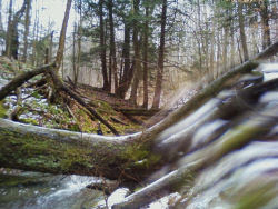
 view from TenKate Bridge (photo by Terry McConnell) |
by Terry McConnell
What better way to end the calendar year than with a hike on the FLT? Earlier in hunting season I had "knocked off" the long road walk of M20 along Route 11 and W. River Road, and in early October I had hiked the eastern half of M19, returning to my car on Babcock Hollow Road along the orange blazed "Dabes diversion". That left the mostly-trail segment from River Road to the top of Virgil Mt still to be done. Together with the return trip, the leg would fall neatly into my 15-20 mile sweet spot, so I slung on my day pack and headed west and uphill from my car on River Road.
From River Road the trail heads steeply uphill along the scenic rim of a small river gorge, quickly to emerge smack in the back yard of somebody's house. "Sure hope they're members," I thought as I gingerly crept by within 5 feet of a picture window, trying my best to look like a normal part of the scenery. Further along I snapped a quick cell phone pic looking upstream at the Tenkate bridge, my shaky hands conspiring with the laws of optics to produce an interesting effect I never could have gotten with forethought.
Trail conditions can be summarized in one word: slippery! Above 1600 ft. there was a uniform 1-2 inch layer of slushy snow that required a kind of stiff-legged strut to navigate any grade steeper than 5%, and which made side hill traverses dicey and dangerous. On downhill stretches through Tuller Hill SF I worked to perfect a primitive form of 'skiing' on hiking boots made possible by this slick layer. The speed gained thereby partially made up for the slow-going, but nevertheless I emerged on Carson Road a good hour behind schedule.
Read the rest of Terry's interesting adventure at Finger Lakes Trail email group, and consider joining to always know what's going on.
 This segment is on FLT map M19


1 comment:
feel poor for that :(
regards,
jasionline.com
Post a Comment