Notice: I've taken a part-time job, and it's definitely affecting my blogging time. I'll continue to add content here as often as possible. Pertinent guest posts are always welcome.

-

Saturday, January 29, 2011

Do You Live in Northeastern Minnesota?

Gooseberry River
view of the Gooseberry River from the NCT/SHT (photo by jhy)

from Matt Davis, Regional Trail Coordinator for MN & ND, North Country Trail Association

The North Country Trail Association is looking for hikers in Minnesota's 8th Congressional District to contact Rep. Chip Cravaack and ask him to support the North Country National Scenic Trail's (NCT) Arrowhead Re-route by introducing legislation in the U.S. House of Representatives.

The Arrowhead Re-route would change the official route of the NCT in northeastern Minnesota and make the Superior Hiking Trail, Border Route Trail, and Kekekabic Trails official components of the NCT - the nation's longest hiking trail.

A small group of NCTA folks met with a staff member from Rep. Cravaack's Minnesota office on Wednesday to introduce the issue and a team will visit his Washington, DC office next month as part of Hike the Hill Trails Advocacy Week. We are hoping that some constituents will contact his office before then and let him know that this issue is important to them and that they'd like him to act.

If you should have any questions about this issue, feel free to contact Bruce Matthews at NCTA HQ at bmatthews@northcountrytrail.org / 1-866-HIKE-NCT.

If you don't live in the 8th District, don't worry. You can help later once the House bill is introduced when we will try to get all of Minnesota's House delegation to sign onto the bill as co-sponsors. Feel free to forward this message onto others who live in the 8th District and would consider making a contact.

Thanks for your support of the North Country Trail!

See Minnesota's 8th Congressional District
status of S553
Contact Matt Davis

Thursday, January 27, 2011

New Trail to Little Garlic River

hikers wearing orange
Chuck Ganzert & Puck Bates skiing on new trail along the south side of the Little Garlic River. (photo from NCT Hikers "Footprints")

from Footprints, Winter 2011

Once the season’s trail maintenance was completed, the NCTH trail crew began building a 4.2 mile new segment of trail. From the north end of Segment 16 - Little Presque Isle Point to Echo Lake Road, the new trail segment crosses Echo Lake Road and then enters the woods winding up the hill, following the ridge to a nice view (when leaves are off the trees) of Lake Superior. From here it turns northwesterly meandering through the woods sometimes following old logging roads as it passes Gokey Rock.

Eventually a spur trail up Gokey Rock will give hikers a chance to climb up, take a break and enjoy the view. From Gokey Rock, the trail continues more northerly as it heads to the south side of the Little Garlic River. At the river it turns east following the ridge to County Road 550.

At 550 turn left to cross the Little Garlic River bridge and then into the parking area at Elliott Donnelley Wilderness.

hikers wearing orange
new trail map (from NCT Hikers "Footprints")


This new segment replaces Segment 17 - Eagles Nest Road (Echo Lake Road) to Elliott Donnelley Wilderness and eliminates two crossings of County Road 550.

This segment is on NCTA map MI-11

See North Country Trail Hikers Chapter of the NCTA

Tuesday, January 25, 2011

National Geographic to Feature Andy Skurka's Alaska-Yukon Adventure

Andy Skurka in Danali
Denali Park (photo from Andy Skurka)

received in Andy Skurka's newsletter

Andy Skurka is the first person, and still the only person, to hike the Sea-to-Sea route which includes the North Country Trail. Since that adventure, in 2004-5, he's gone on to become a professional hiker. But many people along the NCT met Andy, and still follow his exploits. He writes:

"The big news from 2010 is that I completed my third mega trip: the Alaska-Yukon Expedition, a 4,700-mile 6-month journey via skis, foot, and packraft. Highlights included a traverse of Denali National Park and a 24-day 657-mile stretch across northern Yukon and the Arctic National Wildlife Refuge (ANWR) during The expedition was supported by National Geographic, and National Geographic Magazine is running a 16-page story about it in the March 2011 issue. Pre-order a signed copy today. All pre-order customers will be entered in a raffle for a GoLite backpack.

"I think my mom is going to sleep much better in 2011, with no big trips planned. But there'll be different challenges: writing two books, giving presentations and clinics, and guiding trips in the West and Alaska -- plus, trying to find inspiration for another biggie in 2012 or 2013."

See andrewskurka.com

Saturday, January 22, 2011

Fall Softies Hike in Michigan's UP

hikers wearing orange
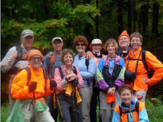
Fall 2010 Softies hikers (photo from NCT Hikers "Footprints")

from Footprints, Winter 2011 by Sarah Fisher

This hike is in Michigan's Upper Peninsula. The Softies group continually hikes across the UP, but prefers to "camp" indoors. -Ed.

Jeff and I joined our first North Country Trail Softies Walk at 10:00 am at Koski Corners. After brief introductions we caravaned with Marge and John Forslin, Reggie and LuAnn Krueger, Lorana Jinkerson, and Carole Bard. Our first stop was brunch at the Hardwood Inn in Covington. We then continued to the Loop Road Lodge in Trout Creek, our base camp for the next few days.

Because of rainy conditions and possible flooding, we decided to postpone our first hike for a day. Instead we took a short walk on the road and admired the fall foliage. Jan Lindstrom Wester and Nancy Bradbury arrived to join us for a delicious pot luck dinner and evening of conversation. We entertained ourselves playing golf and Nordic ski-jumping with the WI game the Forslins brought. Jan excelled at golf while LuAnn turned out to be quite the skijumper!

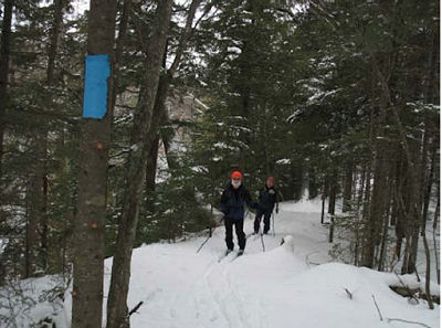
Friday, after a leisurely breakfast we embarked on the first leg of the trek from FH16 where Gale Jamsen met us to South Laird Road. We covered 6.5 miles which was quite sufficient due to the rain and wet terrain. We all appreciated hot showers and the use of the clothes dryer upon our return to the Lodge. The trail along a ridge with deep ravines on both sides. We then enjoyed a gourmet pork loin dinner provided by masterchef, John.

Saturday our plan was to walk all of segment 18 and half of segment 19 from South Laird Road and the Sturgeon Falls Trail. Gale Jamsen met us at the beginning of the trail. Marge and Jan decided to take a short walk and go down to see the Falls. (2-3 mile round trip on a non NCT trail). Doug Welker, President of the Peter Wolfe Chapter, had provided an alternate route for us to avoid crossing some deep rivers. In spite of that we had extremely wet conditions and hidden deep holes to navigate.

We had quite an adventurous day. Part of the time the blazes were difficult to follow due to lack of trees. Just after our lunch break while crossing a very high ridge we came upon an abandoned bicycle in good condition, as if it had been left there quite recently. We searched and called out, but discovered no one. Lorana entered the coordinates into her GPS to report to the police. Then Reggie knocked his glasses off while kicking a branch off the path. After a 15 minute search Gale found them and we continued. We walked a few miles extra before finding the exit to the road, so we decided to do the Sturgeon Falls in the morning when we were fresh.

We finished the evening with great hamburgers at UP Chucks in Kenton. Nancy, LuAnn and Reggie returned home for family obligations.

Sunday was a beautiful day to complete our walk. Lorana, Carole, Jeff and I began with the sharp descent to the Falls. The waterfalls were especially beautiful and full after the previous few days of rain. We found the switch backs in the path to make the climb back easier and were off to join Jan and Marge on the trail. We walked 5.82 miles to FR2236 (the rest of segment 19 and half of segment 20. The terrain was much different: a more open plains like area.

Since we had packed and neatened up the lodge before starting we were ready to caravan to lunch at the Hardwood Cafe and then on home.

A great time was had by all. The walks were invigorating. The fall colors were magnificent. The meals were were delicious. The company was compatible. A big THANKS goes to Marge for planning, John for shuttling and cooking, and Lorana for leading the walks. Another softies walk was successfully completed. We are looking forward to the Spring Softies Hike 2011.

This segment is on NCTA map MI-13

See North Country Trail Hikers Chapter of the NCTA

Monday, January 17, 2011

Weekend Hiking in New York

winter hikers
Howard Beye hike (photo by J Wintski)

received from Cate Concannon

Seventeen hardy souls braved the cold to hike on Howard's section of the Bristol Hills Trail in Naples. As John & Judy pointed out, we had a wide range of hikers and I hope everyone enjoyed talking with each other while enjoying the trail. Although the sun came out when we set out, the wind picked up and a soft snow fell during the day. Although warm when moving, the wind made things pretty cool so not a lot of time was spent at Howard's bench, and only a quick lunch was had at the lean-to at the lookout spot.


leanto
Stoney Brook leanto (photo by gbd001)


received from gbd001 on fingerlakestrail hikers

My son and I spent the weekend in Allegany State Park to get in some hiking before he returns to school next week. (Don't feel bad for him - he goes to Paul Smith's and is majoring in outdoor recreation. We should all be so lucky.)

On Saturday morning we hiked into the Stoney Brook lean-to from ASP 2. Other than a xc skier who passed us on the trail it was 2 feet of virgin snow and slow going despite our snowshoes.

The lean-to was in great shape, and despite all the snow it was dry inside. We were sorry we hadn't planned to stay there (but we had one of the few cabins with a wood stove so it was a bit more rustic than a motel room.)

These segments are on FLTC maps

See Chief Finger Lakes Trail

Sunday, January 16, 2011

Trail Register Fun

drawing of girl rolling down hill
from a Chief Noonday Chapter trail log (from the CND newsletter)

excerpted from the Chief Noonday Chapter Newsletter, Jan 2011

The Chief Noonday Chapter (Battle Creek, Michigan area) posted comments from one of last summer's trail registers in their newest newsletter. They included this delightful drawing, with the comment: "Rolling down the hill! John, Amree, Sadna"

Other comments include:

"Just passing through. Great trail. One Step"

"Went exploring the trail south toward M-89; heard the wildflowers are art!"

"Now you can justify more pumpkin pie!"

"Flagged and cleared updated modification of re-route to south and north from top of wooden steps & kiosk"

"I’ve been camping out here. You’ll never find me, I’ve been eating your animals and chopping your trees down. I’ve been waiting for you for a good meal for once. I hide in your bushes. I hide in your trees. I hide in your house. Sincerely, Bigfoot."

If you pass a trail register, it's always good for a smile and and even a laugh if you have time to stop and read!

This segment is on NCTA map MI-02

See Chief Noonday Chapter of the NCTA

Monday, January 10, 2011

Sam Gardner Starts All-In Trek on NCT

Sam Gardner
Sam Gardner at Crown Point, NY (photo from his journal)

based on Sam Gardner's All-In Trek Journal

On January 1, Sam Gardner left Crown Point, New York on what he hopes will be a 12,500-mile trek. He plans to hike the North Country, Pacific Crest, Continental Divide, and Appalachian National Scenic Trails in one huge walk.

The first day out, he discovered that the route of the NCT in the Adirondacks is poorly defined, and admitted that perhaps he should have done a little more advance planning. He doesn't post exactly where he walked, but from his location on January 10 suggests that he hiked through on Route 8- doing all road walk. This road is south of the proposed NCT trail.

Sam's stated purpose for his hike is "is to prove a simple but important point: Life is what we make it. We all have choices. We can choose to change or not. We can be content with who we are or we have the option to work towards the person we want to be."

Sam Gardner
Sam Gardner (photo from his journal)
He's already found a little more excitement than he bargained for, with party-ers shooting toward where he was camped (innocently, he hopes!). Of greater concern is that he is already having some trouble with an Achilles tendon, and a sore leg. With a planned average of 34 miles a day, this is troublesome.

Sam is a long-time lover of the North Country Trail. He's from Michigan's Upper Peninsula, and a member of the Peter Wolfe Chapter of the NCTA. Peter Wolfe was the NCT's very first end-to-end hiker, completing his trek in 1980. If Sam completes the trail according to his timeline, he will be number 11 to hike it all!

You can follow his journey at The Initiative

Wednesday, January 5, 2011

A View of the NCT

Manistee River in Winter
Manistee River (photo from GHTC newsletter)

by Arlen Matson

Hidden under wind blown Lake Michigan ice crystals, our portion of the NCT lies deep in freshly fallen snow. A blizzard attempts to blow it off the path; instead random drifts careen off the trunks of trees. Vertical blue blazes remain through this white season on guard to direct any attempt by a hiker on snowshoes or skis to find some destination.

The summer caterpillars and their silky parachute cords have vanished from sight. Even the imprints on the tread from the trail crew laden with tools and heavy planks are only history from labors well done. Adopters too have their cuttings submerged in a true Michigan winter.

This is an invitation for you to enter into the “treasures of the snow. Valley of the Giants
Valley of the Giants (photo from GHTC newsletter)


This segment is on NCTA map MI-05

See Grand Traverse Hiking Club Chapter of the NCTA