Notice: I've taken a part-time job, and it's definitely affecting my blogging time. I'll continue to add content here as often as possible. Pertinent guest posts are always welcome.

-

Saturday, January 31, 2009

Michigan Rep Wants to Remove Beaver Basin from Wilderness Plan

Beaver Basin map
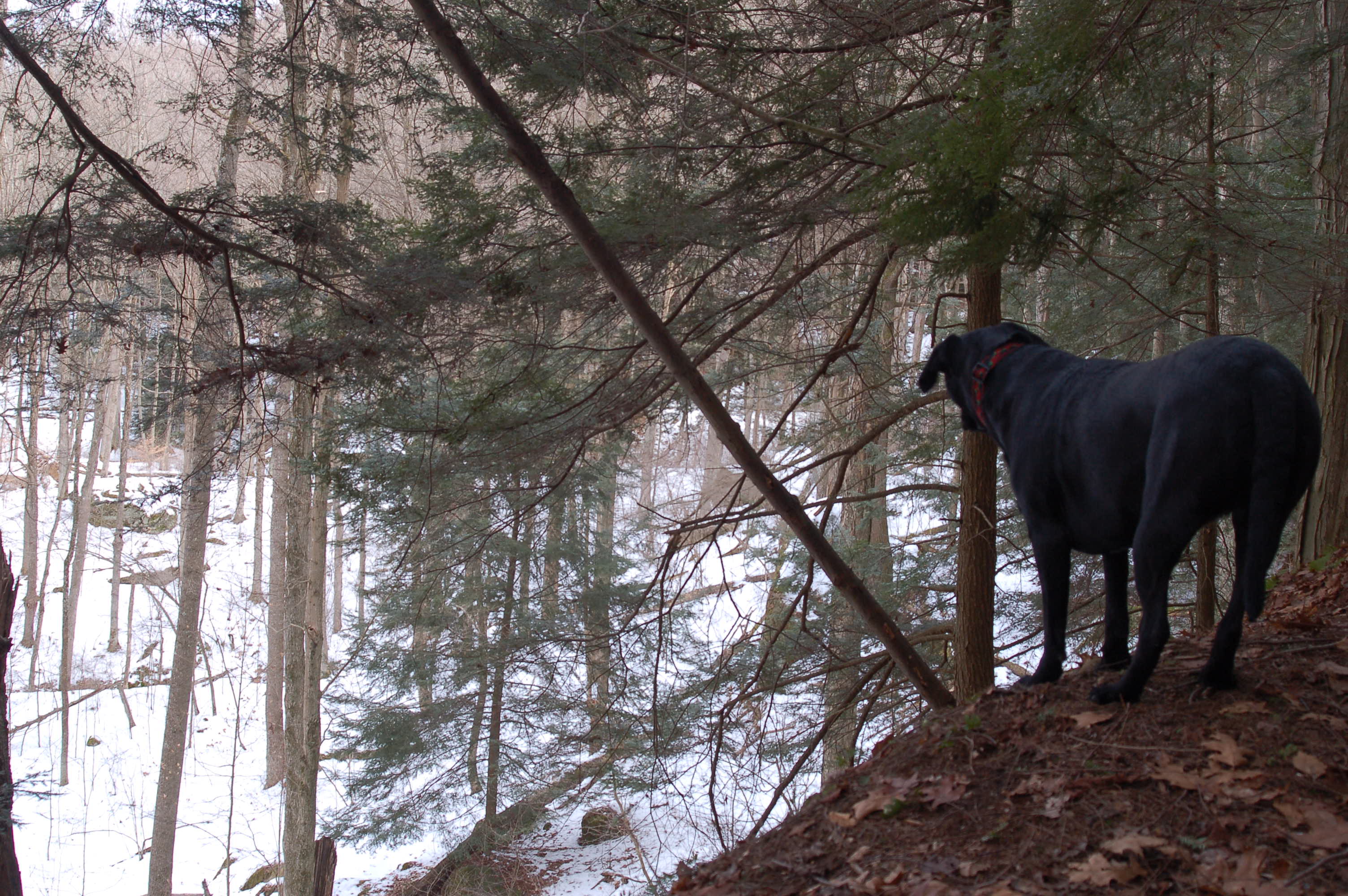
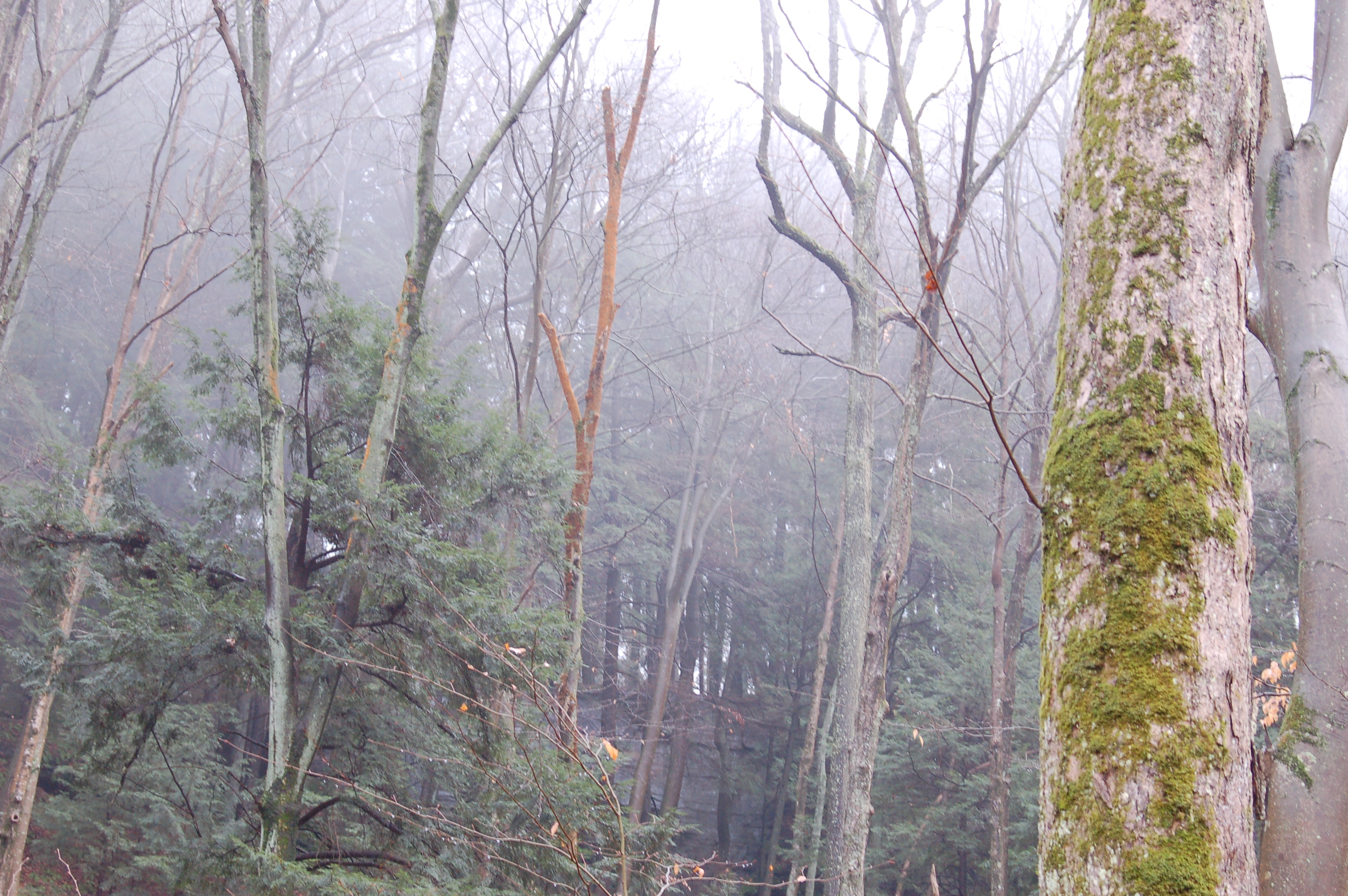
Beaver Basin area, which is just east of Chapel Rock (from NPS map)
based on a news article in The Mining Journal

U.S. Rep. Bart Stupak, D-Menominee, plans to introduce an amendment to the omnibus lands bill to remove a provision designating the Beaver Basin area within Pictured Rocks National Lakeshore as wilderness.

"I have an amendment to strike out the wilderness designation for Beaver Basin area in the Pictured Rocks," Stupak said Friday during a taping of WNMU's "Media Meet" which will air next weekend. "Hopefully, I can get my amendment through. If not, I don't know what I'll do. It's a massive bill."

Another Upper Peninsula area is included in the bill, benefitting Keweenaw National Historical Park. Stupak supports that provision. However, he feels quite differently about the 11,739 acres within Pictured Rocks. He says that he supports Pictured Rocks, but does not want to see any more designated wilderness there because it imposes restrictions on use.

"I have a real aversion to restricting access to property. And when you start going from national park -there's some restrictions on you there - into a wilderness area, then they really do restrict trails, snowmobiles, four-wheelers, some kind of camping, no motorized vehicles," Stupak said. "I'm just not ready to go there. We have enough of those areas in the U.P. we don't need more." He adds that neither Alger County nor the city of Munising support the designation.

The Beaver Basin area is about 16% of the total 71,000 acres of Pictured Rocks National Lakeshore. Park officials say that nothing about the management of the area will change if the designation is made, but Stupak says that because the management plans are renewed every five years there are no guarantees.

Stupak did say that he is not likely to vote against the bill even if he cannot get the Beaver Basin provision removed. Often, in considering amendments, other lawmakers will defer to the judgment of local legislators.

Although the North Country Trail runs through Pictured Rocks, the most important provision in the Public Lands Bill is that it would authorize the federal government to purchase land from willing sellers for the North Country National Scenic Trail. Since the 1990's several of the National Trails have been trying to get this bill through Congress. In many years it passed one congressional body, but not the other. In one year both houses passed a bill, but did not include the same language, so it did not become law.

The House of Representatives is expected to vote on the bill next week. It was recently passed by the Senate. If it passes, this will be one of the most significant milestones for the NCT.

See Pictured Rocks National Lakeshore
See Representative Bart Stupak

Outdoor Industry Sees Opportunities as Hiking Diversifies

a news release of the Outdoor Industry Association

Key findings in the recently released 2008 Outdoor Recreation Participation Report suggest significant opportunities exist for increasing participation in outdoor recreation among Hispanics and African Americans. The findings – covering the trends and motivations of diverse participants and non-participants – are critical for outdoor industry companies working to engage growing numbers of outdoor enthusiasts and non-profits nationwide working to connect youth and the outdoors.

Perhaps the most interesting finding in the report is that, although the participation rate in outdoor activities is lower among Hispanics and African Americans than Caucasians, those who do participate get outside more frequently than Caucasians. This encouraging news emphasizes the significance of the opportunity diverse groups offer the outdoor industry.
    Other highlights from the report include:
  • Participation in outdoor activities is highest among Caucasians for all age groups. Participation is lowest among African Americans. Participation among African American youth is markedly lower than Caucasian, Hispanic and Asian/Pacific Islander youth, and the consequences of this are evident in participation rates throughout adulthood.
  • When youth are asked what motivated them to start participating in outdoor activities, youth ages 6 to 17 of all major ethnicities cite parents, family, relatives and friends as the top motivations. Parents are the leading motivator for all groups, although parents are cited more often by Caucasians (74%) than Hispanics (59%), African Americans (59%) and Asians/Pacific Islanders (65%).
  • School programs are the fourth most common motivation for youth of all four ethnicities and cited most often by African American youth and Asian/Pacific Islander youth.
  • When youth participants ages 6 to 17 of all ethnicities are asked why they choose outdoor activities, they cite “fun” most often by a large margin.
  • Hispanic and African American youth cite a lack of access to places to enjoy outdoor activities in greater numbers than Caucasian and Asian/Pacific Islander youth.

In the coming years, the United States will become a majority minority population, and more than 85% of the population will live in urban communities. The insights in the 2008 Outdoor Recreation Participation Report will help businesses and organizations nationwide connect Americans and the outdoors, reverse the inactivity and obesity crisis and ensure future generations conservationists.

See the 2008 Outdoor Recreation Participation Report
See 2008 Outdoor Sales Gain 5%

Frazee Focused on Trail Themes

dawn on the otter tail river
dawn on the Otter Tail River (photo by O Young)

based on a news article in the Frazee Forum, "Frazee Planning Commission sets goals for 2009," by Barbie Porter, Jan 28, 2009

Frazee, Minnesota has been discussing the North Country Trail a lot lately. And they are serious about finding a way through town for the NCT and improving the river canoe options on the Otter Tail River water trail. At the Jan. 20th meeting, regular village business took the bulk of the time. Yet discussions held at earlier meetings were not forgotten.

A goal set for 2009 for the planning commission includes optimizing river route opportunities by conducting three projects. The first would be providing a safe space for canoes and kayaks near the end of Main Avenue and getting a business that would offer food and refreshments. The second would be providing a safe area for canoe and kayakers to walk around the dam at Lion's Park. The third project, removing a piece of hanging steel from a bridge, Smith reported was already being addressed.

In addition to providing a new aspect of river traffic through town, Planning Commission member Ryan Rustad noted the committee should also start preparing for the construction of the North Country Trail and the Heartland Trail. "When the final plans are available for the trails we should review them and make sure the zoning is appropriate," Rustad suggested. "Preparing ahead of time will also ensure we're maximizing our opportunity to bring travelers into town."

Its been a long time coming, but enthusiasm for the North Country Trail in western Minnesota is growing.

See Frazee Working to Become a Trail Town
See Western Minnesota, Frazee Route Options to be Discussed
See Otter Tail River

Thursday, January 29, 2009

Adirondack Birding Book

Adirondack Birding
a news release of Adirondack Mountain Club First Comprehensive Guidebook to Adirondack Birding Hot Spots Published Adirondack Birding

Two of the Adirondack Park region’s most skilled birders have collaborated on the first comprehensive guidebook to birding hot spots in the region.

John M.C. Peterson of Elizabethtown and Gary N. Lee of Inlet drew on decades of experience in selecting the sites described in Adirondack Birding: 60 Great Places to Find Birds, recently released by Lost Pond Press ($20.95, softcover, 240 pages).

The book is being distributed by the Adirondack Mountain Club (ADK), the Park’s largest environmental organization, with 30,000 members.

John Kettlewell, ADK’s publications and marketing director, said, “Like ADK’s line of hiking guidebooks and maps, Adirondack Birding provides all the information needed to find trails and locations that are great birding hot spots.”

Birders will be able to use the guidebook to search for the Park’s most-coveted species, including boreal birds not found in the state outside the Adirondacks as well as uncommon winter visitors and rare migrants.

“It’s the indispensable guide to birding in the Adirondacks by two of the best birders around,” said John Thaxton, the “Birdwatch” columnist for the Adirondack Explorer newsmagazine. “Beautifully designed and illustrated.”

Adirondack Birding contains 46 color photographs of wild birds taken by Jeff Nadler, one of the region’s premier bird photographers. They include the Park’s boreal species, such as the Bicknell’s thrush, gray jay, rusty blackbird and spruce grouse, and other birds of interest, such as the bald eagle and common loon. The book also has more than 90 black-and-white photos of birds and landscapes. Many of the landscape shots were taken by Carl Heilman II, one of the Park’s most celebrated photographers.

Other features include a history of Adirondack birding, tips on finding boreal birds, an Index of Birds, and hand-drawn maps by Matthew Paul, a Saranac Lake artist. The site chapters not only list resident birds, but they also include records of rare sightings (such as the yellow-nosed albatross that flew over Crown Point in 1994).

Peterson, the longtime regional editor of The Kingbird, an ornithological journal, and Lee, a retired forest ranger, have been birding in the Adirondacks since the 1960s. Both contributed to the Atlas of Breeding Birds in New York State, published by Cornell University Press in 1988, as well as its successor, which was scheduled to be released in December.

In 2004, the authors collaborated on Birds of Hamilton County, N.Y., a brochure that lists all the species observed in the county, with dates and locations. Peterson also has authored or edited similar compilations for Franklin and Essex counties.

But both saw a need for a guidebook that covered the whole 6-million-acre Adirondack Park and that offered detailed descriptions of sites and their birding potential

“Hardly a day passes without someone posting a query on birding chat lines asking for directions or suggestions,” Peterson said. “Where’s this Noblewood place? Any good birding spots near Lake Placid? How do I find a gray jay? Adirondack Birding has the answers.”

“The book will show people many of the great places in the Adirondacks to see birds, including some sites few know about,” Lee said. “It should take pressure off some of the more popular areas."

Most of the 60-plus sites described in the book are in the Champlain Valley (such as Crown Point and Noblewood Park), the Tri-Lakes Region (including the High Peaks) or the boreal lowlands in the northwestern Adirondacks (such as Massawepie Mire), since these are the places that attract the species of most interest to birders. However, there are some sites in the southern Adirondacks as well.

Adirondack Birding may be purchased in stores or on the Lost Pond and ADK Web sites.

UP Softies Trap Hills Fall Hike

hikers at fall overlook
hikers at Trap Hills overlook
from the Hiawatha Shore to Shore Chapter Winter 2008 newsletter


For years the Upper Peninsula Softies have been hiking their way across the UP of Michigan. But their "rules" include motels. They've hike a lot of miles that way! Ed.

The fall Softies Hike took place the first weekend in October, Friday, the 3rd, through Sunday, the 5th in the Trap Hills near Bergland. Marge Forslin, Kathy Davis, Jan Lindstrom Wester and Lorana Jinkerson, with John Forslin as their support person, partook of the beautiful fall colors and great hiking weather.

Friday the hikers left Old M-64 and hiked 3.7 miles spooking up 7 grouse as they traversed hills and valleys. Saturday brought 8.9 miles of ups and downs with breathtaking views of fall’s palette of oranges, yellows, reds, rusts and greens. In addition, the Bush Creek bridge provided a little challenge. Not only did it lean side to side. but it was not connected to the eastern shore.

Trap Hills
Trap Hills
Over the course of the day, eleven grouse were flushed from their abodes. Finally, Sunday as we trekked approximately 4.7 miles including an early morning hike to Cascade Falls for a spectacular mist show, we ousted 5 more grouse from their hideaways. The hike ended at Forest Road 630. Just beyond Bush Creek we came across a plant that none of us could identify.

wild coffee
wild coffee
Marge suggested calling it “pumpkin berries” because the clusters of small orange berries around the stem in this fall season, reminded us of miniature pumpkins. Upon our return, Marge researched and found its real name - Feverwort (Wild Coffee, Tinker's-weed) Triosteum perfoliatum - a member of the honeysuckle family. Follow the link below for wonderful pictures of, not only the berries, but the flower as well. We still like “pumpkin berries” better!

If you travel M-28 through Covington, you might consider stopping at the Hardwood Cafe. We ate there both Friday and again on Sunday and found the food both healthy and tasty.

See Connecticut Botanical Society

Bart Smith Warns- Northern Arrowhead is Tough

Bart Smith
Bart Smith (courtesy photo)
an item from NorthernWilds.com, by Shawn Perich Editor, Northern Wilds Media, Inc, undated

In October 2008, Bart Smith completed a 16-year quest to hike all the National Scenic Trails. He was the 9th person to complete the entire length of the NCT. Ed.

Northern Wilds recently received a phone call from Bart Smith, the man featured in our last issue who is hiking all of the National Scenic Trails. He passed through Grand Marais last summer as he hiked the Superior Hiking Trail, which will soon be part of the national North Country Trail. At the time, some local trails were closed due to fire danger, so Bart had to return in the fall to complete his Minnesota hike.

When he returned, he hiked the Border Route Trail and Kekekabic Trail. He called to ask Northern Wilds to warn other hikers that both trails were in poor condition and very difficult to follow.

On the Border Route Trail, which follows the Canadian border east of the Gunflint Trail, he found the past was very brushy and difficult to discern. Although the trail was marked in places with blue plastic flagging, sometimes the ribbons were in the wrong place.

Still, Bart says, “I’m glad I walked the Border Route Trail. The lookouts were spectacular.”

On the Kekekabic Trail, which runs west from the Gunflint to Ely, Bart passed through recently burned areas. He met a party of hikers from the Granite Gear company who were coming from the other direction. He said it was helpful to follow their footprints through the burned area, because the trail was very difficult to follow. He was unable to complete the Kekekabic, because he eventually lost the trail.

See Walking Down a Dream for pictures from Bart's hikes.
Read Bart Smith completes epic adventure

Tuesday, January 27, 2009

NCT Volunteer to be Inducted in Ski Hall of Fame

Cary Adgate
Cary Adgate at the Kircher Cup at Boyne Mountain (photo by Boyne Mountain)
from a news release of Michigan Ski News
and the Boyne Mountain web site


Cary Adgate is an NCT volunteer who maintains a section of trail in Northern Michigan near Mancelona. Ed.

The U.S. Ski Team's Liz McIntyre, Nelson Carmichael, and Cary Adgate, along with a man who set the precedent in American ski mountaineering, Bill Briggs, will be inducted to the U.S. National Ski and Snowboard Hall of Fame in April according to Tom West, president. Both Olympic medalists, McIntyre and Carmichael will be recognized alongside Adgate, an Olympian who was named 2005 Masters Racer of the Year, and Briggs, who has a collection of famous first descents to his name.

Cary Adgate is a Midwesterner who made his first race turns on Boyne Mountain in Michigan. In 1971 he won the U.S. Junior National Championship at age 17. He joined the U.S. Ski Team in 1973 and won the Can-Am Overall Championship, the Can-Am GS championship and the Roch Cup downhill/overall championship. He earned the U.S. Alpine Championship title in slalom or combined six times, and was a member of the U.S. Olympic team in 1976 and '80. Adgate turned to professional skiing in 1981, competing in Bob Beattie's World Pro Skiing Tour. He became the only skier to win back-to-back races in his pro debut, going on to win 25 professional victories and the 1984 U.S. Pro Championships. In 2005 he won three U.S. Masters Championship events and was named Ski Racing Magazine's 2005 Master Racer of the Year. He currently is Boyne USA Resorts' Snowsports Ambassador and mentors several racing programs.

Cary Adgate now promotes public awareness of the great recreational and competitive programs that Boyne Mountain and Boyne Highlands offer. Additionally, he serves in an advisory capacity to several departments of the Boyne operation and is involved as a guest coach with Boyne's various race training and competition programs.

Minnesotans- Support the Arrowhead!

Boundary Waters
hikers in the Boundary Waters (photo by J Young)
from Matt Davis, NCTA Regional Trail Coordinator- MN and ND

Minnesotans needed to Contact our Congress people to encourage their support for the North Country Trail's Arrowhead Re-Route legislation

If you have not heard of "the Arrowhead Re-route," you may be wondering, "What the heck is it?" Simply put, it is an effort to change the official route of the North Country National Scenic Trail (NCNST) in northeastern Minnesota. The re-route will incorporate outstanding Minnesota "Northwoods" scenery and encompasses almost 400 miles of existing trails, including the Superior Hiking Trail, Border Route Trail, and Kekekabic Trail. Additionally, 150-200 miles of new trail will need to be constructed in Itasca, St. Louis, and Lake Counties between the end of the Kekekabic Trail and the existing North Country Trail within the Chippewa National Forest in Cass County. The Superior Hiking Trail Association is already working on connecting with the NCNST at the Wisconsin border by Jay Cooke State Park.

Couple the fact that the Arrowhead Re-Route will take the North Country Trail through world-class scenery on existing trails with the fact that only 100 additional trail miles (compared to the original route directly from Remer to Jay Cooke State Park) would have to be built and this is a "no-brainer." It is supported by local governments, all of our agency partners, and the trail groups in Minnesota. We only lack the federal legislation to make it official.

Congressman Oberstar (MN-7th District) has recently introduced H.R. 481, the North Country National Scenic Trail Route Adjustment Act of 2009. Please make your voice heard! Let your Congressperson know that you support the Arrowhead Re-Route and that you want to see H.R. 481 passed. We also need Senator Klobuchar to introduce a companion bill in the Senate and to see it passed in the Senate!

If you've never done it, it's easy to contact your Representative and Senator via their websites. Go to Write your Rep and put in your Zip code and visit to contact Senator Klobuchar. Of course, you can also call their DC office or any of their offices here in MN or use the good old reliable USPS.

For more information or if you have any specific questions, please feel free to contact me at (701) 388-1883 or Matt Davis.

Youth on the NCT in the Chippewa

Youth in the Chippewa National Forest
Chippewa joins in National Day of Service with Community Day at Shingobee Hills.
from a National Forest Service Success Story, "National Day of Service event on the Chippewa National Forest," by Melissa Rikers, Jan 20 2009, used with permission

On a beautiful winter weekend, Chippewa National Forest staff joined in the National Day of Service connected with President Barack Obama's inauguration. In response to President Obama's call to make an enduring commitment to our neighborhoods, the Forest hosted Community Day at Shingobee Hills on January 17, bringing in families from the Walker/Cass Lake area and getting More Kids Outdoors.

Shingobee Hills is a historic National Forest Recreation site on the Walker Ranger District. Throughout the day, families visited the Civilian Conservation Corps- built chalet at the base of the sledding hill to warm up and learn more about Forest activities. By the end of the afternoon, over 70 people had joined in Shingobee Community Day.

The Cass Lake High School Science Club, part of the STAR program, also came in for a day and night at Shingobee Hills. The class of 8 High School students and two teachers came prepared for a winter campout. Forest employees helped get the class set up and started their day by teaching the finer points of quinzhee (snow shelter) construction. Kids from the community joined in, helping the high schoolers build the Inuit-style shelter.

Students followed soils scientist Jim Barrott out for a snowshoe hike on the Shingobee and North Country Trail systems. Many of the kids had never tried snowshoes before, but jumped in to the Forest snowshoes enthusiastically! "It was so good to get the kids outdoors and experiencing some winter sports," Howard said. "We actually went further on the trail than we had planned because we saw so much! The kids found animal tracks (grouse and deer) and even saw one deer bounding through the snow. It was a great time. And of course, they loved the [sledding] hill and the warm fire at the chalet."

Community day at Shingobee was a chance to connect kids with the outdoors, and connect the communities to recreation opportunities on the Forest.

Join us this winter on the Chippewa! Shingobee events are scheduled through March, and on February 27, take in the night trails at the 19th annual Cut Foot Sioux Candlelight Ski!

See Chippewa National Forest

Monday, January 26, 2009

Quinzhees on the NCT

This past week, Todd Williams and Jim Colten made a winter trek on the Superior Hiking Trail. As part of their experience they built a quinzhee snow shelter. Todd reports:

"the hike from Gooseberry to Split Rock and the Split Rock loop were all 'broken in' and I traveled at 2-3 mph (normal speed). The first night I slept at Blueberry Hill in a quinzhee. It was warm in the quinzhee and nice although I missed the floor of my tarptent (just spoiled). Had a beautiful sunset and sunrise there at the site."

He also recorded this video.


alt text
quinzhee and tent (photo by J Young)
Previous known quinzhees built along the NCT include this one built by Martha B. Northrup and Joan Young in the Upper Peninsula, just outside of the Rock River Canyon Wilderness in 2000. In the picture, the tent is still pitched in front of the quinzhee. Since it took us two days to build the snow shelter, we used the tent for those nights.

quinzhee
built by WTD staff at the NCTA Schoolhouse (photo by J Young)
Finally, this was one of the first quinzhees built in the area. It was constructed at the NCTA Schoolhouse (maybe in 1994) at one of the first Winter Trails Day celebrations.

Have you seen or built others on the NCT? Leave a comment and tell about it.

See How to Build a Quinzhee from the Mohawk Wolf Cub Pack

Sunday, January 25, 2009

Sawyer Certification- Minnesota

sawyer guide cover
from Ed Solstad, Border Route Trail Association Mechanized Trips Coordinator

Hello all of you Border Route Trail enthusiasts

Plan now to obtain/renew your US Forest Service crosscut and/or chainsaw certification at either Saturday or Sunday, April 18 or 19. (You need only attend one day.) As in prior years, the sessions we'll be held at the Bunker Hills Campground Visitor Center located in Bunker Hills Regional Park, CSAH 14/Main Street (Formerly Highway 242) and Foley Boulevard, Coon Rapids, MN . We'll be inside from 8-noon and outside "hands-on" in the afternoon.

The Forest Service wants to be sure to have enough instructors and materials brought down from up north so PLEASE RSVP (yes, that's redundant) via email with your name, address, phone #, crosscut and/or chain saw, plus Saturday 4/18 or Sunday 4/19 to John Elliott Note: If you want certification for both crosscut and chain saws, you’ll need to attend both days.

We’re planning on hosting a chain saw and brush cutter familiarization and practice session on Saturday, April 4^th . Contact Ed Solstad at esolstad@pressenter.com for details.

John Elliott will be coordinating the 2009 BRTA saw training and certification programs.

The Spring Maintenance Trip Calendar will be available in February with both weekend trips and week long trips scheduled for both the the BWCAW and Pigeon River Sections.

The western portion of the Border Route is concurrent with the North Country Trail. NCTA sawyers qualify for a patch to display. Contact NCTA Headquarters for more information.

See the The “USFS *Chain Saw and Crosscut Saw Training Course - *Student’s Guidebook” (a pdf)
See Border Route Trail

Saturday, January 24, 2009

Soldier Lake Hike

three winter hikers
from the Hiawatha Shore to Shore Chapter, by G. Smith

The skies were cloudy and the temp was a crisp 3F when we arrived at the trailhead on M28. The first of us helped Stan and Kay transfer the food and firewood to the snowmobile sled, which Stan delivered to the pavilion. There was a great collection of loaner snowshoes and skis for new hikers who didn't have a pair of their own.

Several of us parked down by the North Country Trail itself while others followed the snowmobile tracks to the pavilion. I 'shoed up at 9:45am and started down the trail. Snowshoeing in only took me 20 minutes or so. By the time the labs and I arrived at the pavilion there was a warm fire crackling in the fireplace and Lucas was cooking up hot dogs. The air remained cold but the cloudy skies gave way to a beautiful clear sunny day. The snow was just pristine! All in all 39 people came out to snowshoe or ski that day, exploring the snow blanketed campground and the frozen lake. Within a short while the area became cris-crossed with tracks as the various groups set out to explore this or that.

winter trail


Later after the crowd dispersed, Stan, Kay, Donna and I skied/snowshoed south on the NCT to NF3336. The snow covered landscape and trees were just gorgeous, blanketed thick in snow that sparkled in the sunlight. I stayed way to the rear of the group, snapping as many pictures as I could. We came across a set of wolf tracks crossing a field which led to some interesting discussions. I tell ya, you don't get to see winter beauty like this while sitting at home complaining about how cold it is outside!

All in all a beautiful Winter Trails day!

winter trail


Larmann Stands Up for Closing Trail Segment to Snowmobiles

based on a news release of CNY Link (Eagle Newspapers, Syracuse, NY), "Trail closed to snomobiles," by Margo Frink, Jan 22, 1009

The Canastota, New York, Link Trail segment along the CSX railroad tracks has been closed to snowmobilers. The village had just paved this portion of the trail last year with $30,000 received from CSX after a train derailment.

However, in December the village entered into an agreement with Tri-Valley Riders, a snowmobile club, to allow access to ride beside the paved Link Trail. Snowmobiles are supposed to stay off the paved portion. The club posted 25 mph speed limit signs and a sign was erected asking snowmobilers to stay to the left of the Links Trail and off the pavement.

However, the agreement is not being upheld by riders. Canastota Police Chief, James Zophy, said that recently a snowmobile traveling at a high rate of speed failed to make a turn and ended up at the bottom of a retention pond. The rider was injured.

Al Larmann, of the Central New York Chapter of the NCTA, attended the Jan 21 village board meeting. Ever prepared, Larmann brought pictures of snowmobile tracks on the pavement and also showing that riders had been climbing the embankment.

“I witnessed snowmobiles traveling at a high rate of speed while people were walking on the trail,” Larmann said. He added that in time the North Country Trail would become a regional and local asset to the community. He said bicyclists and people pushing baby carriages could take advantage of that asset, and that hikers use post offices in local towns to receive mail and packages. The trail also is used for cross-country skiing. “We want to certify that section [of the trail] so that it meets Park Service standards,” Larmann said.

Larmann cited not only snowmobiles as being a problem but all-terrain vehicles, that he said, frequently use the walking trails. Motorized vehicles and horses are prohibited from the trails. Larmann said he felt the signage was not adequate and could have been more defined. “The signs didn’t go up until after it snowed. You couldn’t see the blacktop.”

The Riders club also has a liability problem. A portion of their trail was closed in the town of Lincoln, and the village administrator reported that legally this means that the entire trail is closed, which causes liability to fall on the village of Canastota.

“We are forced to close [the trail]” said Trustee Scott Rapasadi. “We don’t want the liability.”

Mayor, Todd Rouse, said that now the problem will be to remove snowmobiles from the area. It’s difficult to police a trail from a car, and Rouse offered his snowmobile for use by patrols. Zophy suggested the use of cameras. It was noted that Canastota is the only village in Madison County that still allows snowmobiles on its streets.

Once again, Al Larmann, has appeared at the right place to be a strong voice for the North Country Trail. It could be noted that in the most recent issue of North Star, the magazine of the North Country Trail Association, Al is the leader for all-time volunteering, with 8197 hours given

See Canastota NY Negotiates Agreement with Snowmobilers
SeeCentral New York Chapter

Friday, January 23, 2009

What is Landscape- an Ohio Essay

excerpts from the blog Tales of a Bad “Geographer”, "So I'm Procrastinating, Dec 11, 2008, by Luke Badgerow, used with permission

What is Landscape?

I prefer to begin my stories in the middle, this way it gives me latitude to meander forward in the story through the “exciting parts” and fill in what details I need as I need them.

Not Sending weather, but ICE weather
I start with a photo of an element, or portion of a landscape. Not because the photo is the landscape, or that it contains the definitional element that I associate with what a landscape is. But more because of the fact that the image, and its relation to a number of others describes an ordering of reality from different angles.

This particular picture is of my dog, who has been a constant companion on nearly every outing I’ve made in the last six years, but more importantly this image is of the landscape, in the broader, vertical view, of a considerable portion of Southeast Ohio. The specific element or locale here is twenty feet off of the main trail, part of the Buckeye Trail that circumvents [sic] the entire state, but all the same many people don’t venture away from the cliff band and look out over this gully.

In March with four inches of snow and a veneer of veriglass ice on all rock surfaces, the hike to my perch takes around half an hour. In early December before the winter truly reaches into this hollow, the hike takes ten minutes. So time has played an important factor in the definition. Every place, every subject changes as time passes. This is as true for this particular place in the Hocking State Forest as it is for Lower Manhattan.

Not Sending weather, but ICE weather
I draw attention to my perch one more time, only this time I take it from the valley /hollow floor on a day in April of last year as winter finally let go of its hold, but before spring gets complete control, to demonstrate a quick final point about the concept of defining landscape. I make this argument from a particular perspective or perception, but that perception changes, as does the weather, as the fog lifts from the valley floor, you still can’t see my spot… So who’s to say that it’s an actual place, or some fabrication of my mind? But at the same time, what difference does it make?

See So, I'm Procrastinating to read the entire, complex essay on Landscape.

Good News for Tahquamenon Hikers

Tahquamenon Falls new campsite locations
locations of two new backcountry campsites
by Joan H. Young

Rumors were rumbling about new backcountry campsites being prepared at Tahquamenon Falls State Park. A quick call to Craig M. Krepps, Park Manager, confirms that good news.

Two new sites will be ready for the 2009 hiking season. One of these is on the North Country Trail, and the other is near Clark Lake, which will make Tahquamenon a nice destination for a loop hike. Reasonable hiking distances for a loop, allowing time to see the upper falls, might include a night in the Lake Superior State Forest. See information below.

Camping opportunities until now have been at the Rivermouth Campground (off the map to the right), and at the Lower Falls Campground, both of which are established sites with RV hookups. Although these work fine, they are less appealing to backpackers than more primitive locations. Our wishes are coming true!

Tahquamenon Falls State Park plans on requiring pre-registration with contact/payment options for the transient hikers, and sites being first come/first serve. Each location will have two tent sites, a fire ring, one bear pole, one privy, and natural seating. If these sites receive moderate to heavy use they will consider creating more sites in the future.


Old Stove Road Campsite This site is located at an abandoned canoe/boat access location near the Tahquamenon River. The actual campsite is 200 ft. from the river and 700 ft. from the NCT. The forest in the campsite area is a mixture of Hemlock/Spruce and Birch. This location is very secluded and will also be an excellent location for NCT hikers, canoeists wanting to layover for the night, and hike in campers. It is approx. 3 miles to the lower falls from this site. The GPS coordinance is N46--34.110, W085--10.658. This campground is about 10 trail miles west of the Rivermouth Campground, a reasonable day's hike for most any backpacker. Previously one would have to hike about 14 miles to make the Lower Falls Campground, which can be a stretch for some people.

Clark Lake Campsite: This site is located in a natural bowl in the hardwood hills 300 ft. south of Clark Lake, and 200 ft from the Parks Hiking Trail (Clark lake Loop). The forest in this area is a mixture of Oak and Pine. This site is very secluded with easy access to the picturesque Clark Lake. Park hiking trail users will be able to park at the upper falls, hike 8 miles on the northern trails to this location, and return using the southern trails, 6 miles to the upper falls, at the end of their stay. The Clark Lake Road provides vehicle access within 1/2 mile of this location. GPS coordinance is N46--36.979 W085--14.442. While this site is not on the NCT, it will provide a very nice option for hikers who want to make a loop hike.

Long distance hikers continuing on to the west can easily make Lake Superior State Forest on the following night. Dispersed camping is allowed in Michigan State Forests, but the camper is supposed to display a free permit which must be obtained in advance.

Buy NCTA Maps, Tahquamenon Falls is on MI-09.
See Tahquamenon Falls State Park
See Dispersed Camping on Michigan State Forest Property
Email Craig Krepps

Recall of Certain JetBoil Cooking Systems

a news release of Jetboil

Recall of Certain Jetboil Personal and Group Cooking Systems

Jetboil has utilized three different gas valves (the “A”, “B” and “C” style valves) in the production of its Personal Cooking System (PCS) and Group Cooking System (GCS). PCS and GCS units utilizing the B style valve were shipped to US retailers between July 10 and September 9, 2008, and sold through retail since July 10, 2008.

Jetboil is undertaking a consumer recall of all PCS and GCS systems utilizing this B style valve, working in cooperation with the United States Consumer Product Safety Commission .

We have determined independently to undertake this process after receiving reports and returned units from a very limited number of end users who have experienced leaking gas and subsequent ignition of the gas leak. No injuries or property damage have been reported by these users.

PCS and GCS systems utilizing the A and C style valves continue to be fully safe and functional. No Helios systems are affected by the recall.

To identify the valve type of your system, see below. If you have a question about identification, please call 888-611-9905.

recalled Jetboil Stoves


See Jetboil Recall to register for a product exchange

Thursday, January 22, 2009

Frazee Working to Become a Trail Town

Frazee trail meeting
During the trails meeting last week at the Frazee Event Center, Frazee City Clerk Jonathan Smith conversed with two River Keepers personnel. Jay Leitch, center, is a consultant, while Bob Backman is the executive director. Photo by John W. Dermody
based on a news release of Frazee Forum

Mayor Ludtke of Frazee, Minnesota stated, "We would like to eventually see a North Country Trail Association chapter established that would involve linking from Frazee to Pelican Rapids."

This comment was made at a January 14 trail planning meeting in Frazee. There is a growing effort to bring trails and canoe routes through the small community. These plans include the North Country Trail, the Heartland Trail Extension and a proposed Otter Tail Canoe Route.

Robert Backman, executive director of the River Keepers, noted that his group is a non-profit that "works with the Red River and the basin . . . everything that drains into the Red River." The Red River forms the boundary between Minnesota and North Dakota. That includes the Otter Tail River and numerous tributaries. And while canoeing in such streams may not be referred to normally as using a "trail," it is tied to the other two trails - the North Country and the Heartland - in the big picture. The Laurentian Lakes Chapter of the NCTA is working as a part of this planning group.

River Keepers guiding precept is "Promoting a renewed vision of the Red River of the North." Ludtke added, "One of our big activities is a water festival. We bring in Fargo-Moorhead and Wahpeton-Breckenridge 4th grade students . . . that's the time they study units concerning water." The F-M contingent has swelled to 1,600, he pointed out. Of course the North Country Trail is always looking for younger hikers to discover the trail. The canoe route starts at Rochert, he said, noting that the Tamarac portion is closed. The winding route eventually travels through Frazee, the Pine lakes, and intersects at Breckenridge after a total of almost 200 miles. Backman added: "People have been using the Otter Tail River for 150 years; this formalizes the plan. Use of the river will grow."

Vergas, Frazee and Pelican Rapids and/or Detroit Lakes are towns along the proposed NCT route in western Minnesota. It looks like Frazee is taking the initiative to become a trail town and cement a relationship with the North Country.

See River Keepers
Laurentian Lakes Chapter

Wednesday, January 21, 2009

Four Miles in Tittabawassee Land

snowshoe tracks in woods
snowshoe tracks (photo by J Young)

by Joan H. Young

I had the chance today to add four more miles to my quest to hike the trail, and thanks to the Tittabawassee Chapter, they were pretty uneventful. Doug Seaney helped me spot my car on Mancelona (Michigan) Road, and then we drove around to Starvation Lake Road. I had hopes of being able to stay on the trail all the way through. With the depth of the snow, finding blazes was going to be absolutely critical to that plan. With only a couple of exceptions, I was able to see the next blaze from the one I was at. In the few other cases I was able to make some educated guesses, and was able to find the next blaze.

The weather cooperated nicely. It was brutally cold here just a couple of days ago. Today it was mid twenties. Who could ask for more? I had a new pair of Grandoe mittens to "test" and they worked great. The lining is already dry, which makes them a big improvement over the last mittens I had which didn't dry out for days after a day of sweating in the woods. With Manzella liners I had lots of options to keep my hands the right temperature.

depth of snow
depth of snow- those posts are usually 4-5 feet tall (photo by J Young)
It was a quiet walk. I saw one squirrel, some deer and mouse tracks, and shared one small stretch where snowmobiles had run (not illegally- it's on a woods road) with a fox who had been there not long before I.

So, thank you, Tittabawassee folks! My only complaint? When the snow is three feet deep the blazes are only about three feet off the surface, and there are quite a few branches overhead that can scrape you in the face!

I snowshoed the 4 miles in 2 hours, 50 minutes. I'm happy enough with that since I'm not quite as young as I was (Shhh). Total now at 3518 miles.

See more pictures at Only a Few Miles- But O So Good

Tuesday, January 20, 2009

Kickin' Back - Memories of the Beginning of the NCT in the UP

Bea Anderson
Bea Anderson
by Bernice Anderson, excerpts from the North Country Trail Hikers Winter 2009 Newsletter

I have so many memories of the early construction of the trail, memories of sore muscles and numerous bug bites, especially Black Flies, but also a real sense of pride when the plans worked out. I thought I’d share some of these with you for those who may not know how some things came to pass. I’m not claiming to be accurate on dates and people involved but just bear with my original intent.

We used to have all our meetings at Gene Elzinga’s house, a lovely porch on the east side with a long table that always accommodated all of us. There we did our planning and work assignments. About fourteen people usually attended. Several of the very active people have since passed: Roland Schwitzgoebel, Bill Herron. Many more are unable to do this work anymore. Dan Hornbogen was a mainstay and I recall Russ Fure, the historian. Shirley La Bonte, treasurer, Jan Lindstrom Wester, Don Elzinga., Gerry Nault, Seth Johnson, and numerous others I can’t recall right now.

We usually marked the potential trail in the winter but come spring and summer, we found we had to change many areas when we discovered they were truly wet areas. Also sometimes there were huge brush piles, etc. No matter, it was always a challenge.

I think building the bridge over the Laughing Whitefish River and the board walks were some of the most difficult but also rewarding. The original plan was to make our trail south of the river in the rocky ledge that leads to the Ice Caves close to Eben. We scouted it and flagged our potential trail all the way to Laughing Whitefish Falls. We planned a loop from there. I fell in the river while crossing on a large log. Gene lost his walking stick but caught it before it went over the falls.

Because this was a designated wilderness [Rock River Canyon] area we had all kinds of hoops to jump through to try to get approval. Many letters and phone calls were made back and forth over quite a long time. They were with different agencies involved. I think I still have my last letter of protest: all to no avail as we were denied our trail. From there we went to the north side and had many difficulties with water, beaver dams, etc. We often worked 4 or 5 days a week and finally got to the place where the bridge was to be built. Then we worked from the west side to make the trail to the opposite side of the proposed bridge.

It was June with black flies galore. We were dressed like lumber jacks, each with an axe, hatchet or whatever, all muddy, blood running down our faces from the fly bites when some ORVs came by. You should have seen the looks on the driver’s faces as we gave them directions to Howe’s Lake.

We had many unexpected problems: someone came in and threw around all the wood steps that Marti and I had placed the day before. Also someone stole many of our 2x4s and much of our lumber. Since we could no longer safely leave our tools, etc. for the next day, eventually we found secure hiding places for the tools and a cave to put lumber in. See North Country Trail Hikers Winter 2009 Newsletter for the complete article
and read an interview with Bea Anderson , featured in "Heart & Sole," North Star April 2003 - find her in the left column under Michigan


Great Wisconsin Birding and Nature Trail

WI bird trail and NCT
portion of Wisconsin birding trail map and approximate route of the NCT
based on a news article from Wisconsin Radio Network

Six years ago the Wisconsin Birding Trail was just an idea. Now, the mapped auto trail links together various nature locations, and reaches into every area of Wisconsin.

"Essentially the project links the very best places to view birds and wildlife in general throughout the state," said Susan Foote-Martin of the Wisconsin DNR.

Citizens nominated their favorite National forest sites, State Natural Areas, county, city and State Parks, private museums, and nature centers for inclusion in the project. A number of the sites are close to the route of the North Country Trail.

"You can see all kinds of things from the best geology to the best birds to the best big game viewing and see all the beautiful Great Lakes beaches and all the smaller lakes in-between and the rivers. It's quite comprehensive," Foote-Martin added.

Full-color viewing guides with maps and descriptions will lead you to old growth timber, great gray owls, bald eagles, timber wolves, shorebirds, deer, loons, cranes and a variety of animal life and nature.

The Great Wisconsin Birding and Nature Trail is based on major highways, and then allows nature travelers to veer off onto county and town roads. Hikers would add, "and then onto trails," to that sentence.

To get your complimentary guide, call your local Wisconsin DNR office, Wisconsin welcome center, or visit TravelWisconsin.com

Monday, January 19, 2009

NPS Director, Bomar, to Retire, Jan 20

Bomar and Kempthorne
Mary Bomar was sworn in as the New National Park Service Director by Interior Secretary Dirk Kempthorne on October 17, 2006. (DOI photo)
from a news release of the National Park Service

National Park Service (NPS) Director Mary A. Bomar will retire on January 20, capping a 25 year federal career that included becoming the first naturalized citizen to lead the NPS.

“It has been my privilege to lead the 20,000 men and women of the National Park Service for the past 27 months,” said Bomar. “But Inauguration Day marks the end of my tenure as Director. It is time for me to hang up my ranger hat, finish my Park Service career and retire with over 25 years of government service.”

Bomar became the 17th Director of the National Park Service on Oct. 17, 2006. She leads a team of 20,000 employees and 172,000 volunteers in administering 391 national park units and related cultural and natural heritage programs. The parks welcomed more than 275 million visitors in 2007.

Bomar’s tenure was highlighted by the largest increase in operational funds for fiscal year 2008, and an ambitious plan preparing for the NPS Centennial in 2016. In 2008, the National Park Service Centennial Challenge leveraged a $25 million appropriation with private sector matching money to fund 111 programs benefitting 76 parks in 38 states.

In a memo to NPS employees, Bomar wrote, “If parks are America’s best idea, then certainly you are the best America has to offer…there is a new hope and confidence in the future—that we will enter our second century prepared to meet any challenge we face.” She added, “Directors will come and go, but the places are timeless—and the hearts of those who care for them are bigger than the 84 million acres in the system.” Bomar and her husband will relocate to Texas, where she spent the early days of her NPS career, which began at Amistad National Recreation Area, Texas, where she became chief of administration. During her four-year tenure at Amistad, the NPS took advantage of her management expertise, assigning her a portfolio as a management circuit rider, assisting many national park sites in the Southwest.

See Bomar is New Park Service Director

NCT Regional Office Town Recipient of Preserve America Grant

Shawnee, Ohio at sunset
Village of Shawnee, Ohio (photo by Lost in the Hills)
from a news release of the Department of the Interior
with additional comments


Preserve America Grants in 17 States Announced; First Preserve America Stewards Designees Announced

Mrs. Laura Bush, Deputy Secretary of the Interior Lynn Scarlett and Advisory Council on Historic Preservation (ACHP) Chairman John L Nau, III, have announced the first round of Preserve America Grants for FY 2009 for a total of nearly $3 million.

Preserve America is a White House initiative that encourages and supports community efforts to preserve and enjoy our nation’s heritage. Scarlett and Nau co-chair Preserve America. Mrs. Bush has served as Honorary Chair of Preserve America since its inception in March 2003.

"The Preserve America Initiative was launched by President Bush to promote cultural and natural preservation and to encourage greater appreciation of our national heritage," Mrs. Bush said. "Thanks to each of these grant recipients for the work they are doing to preserve our nation's important historical landmarks."

The Preserve America Grant program is administered by the Department of the Interior’s National Park Service in partnership with the ACHP. The competitive matching grants fund Preserve America Communities, State Historic Preservation Offices, and Tribal Historic Preservation Offices to support their preservation efforts through heritage tourism, education and historic preservation planning.

“These Preserve America Grants help weave cultural and natural heritage into the economic, educational, and social well-being of communities by promoting heritage tourism,” Scarlett said.

Shawnee, Ohio will receive $100,000 for a Priority Property Asset Plan

The Village of Shawnee, which serves as a gateway to the Little Cities of Black Diamonds region and the Wayne National Forest, will identify the most vulnerable properties of its Main Street Historic district and plan for their restoration and reuse. Funds will also be used to design a streetscape for the downtown historic district in an effort to spur tourism-based economic development.

NCTA Regional office recently relocated to Shawnee

Andrew Bashaw, Regional Trail Coordinator for Ohio and Pennsylvania announced in November that the Harrop House in historic downtown Shawnee will be the new home to the regional office of the North Country Trail Association, the Little Cities of the Forest Collaborative, and the Ohio's Hill Country Heritage Area.

See New NCTA Ohio Regional Office

Alltel Wireless Introduces GPS Application For Outdoor Enthusiasts

bushwhacker
Trimble Outdoors also captures photos, audio and video, which allows for GPS-tagged online journaling. (photo from Alltel)
a news release of Alltel Wireless

Alltel Wireless customers going over the river and through the woods can now also go wireless. Outdoor enthusiasts can now take full advantage of advanced GPS features directly on their GPS-capable phones with the Trimble Outdoors application from Alltel Wireless, America's largest wireless network.

The Trimble Outdoors application turns a wide range of Alltel GPS-enabled handsets into a versatile, off-road navigation and journaling tool for hiking, backpacking, mountain biking, hunting and many other outdoor activities.

The application, available for a daily rate of $1.99, allows customers to review and plan trips online. It also enhances user safety and navigation by sending trekking routes, maps and waypoints wirelessly to the phone for use as a guide during trips.

Customers can track their current and previous routes with a GPS "bread crumb trail," mark and edit waypoints during their journey, and utilize a built-in digital compass to display coordinates, speed and heading. Maps generated by Trimble Outdoors can be accessed in topographic, street and aerial views.

"Without any additional equipment to carry around, Alltel customers can enjoy the freedom to explore new and exciting parts of the country," said Kristi Crum, director of data and content services at Alltel Wireless.

"With our new Trimble Outdoor application, customers can have more fun while staying safe and connected to friends and family who want to share in the adventures."

Trimble Outdoors also captures photos, audio and video, which allows for GPS-tagged online journaling at trimbleoutdoors.com or for sharing recreational pursuits with other outdoors enthusiasts. Additionally, users can browse an online library of professional and user-generated trekking tips and customize trips done by others.

Saturday, January 17, 2009

Earning that North Country Name

alt text
snow patterns on evergreens
from Paul Retherford, used with permission

Here are some images that I captured on the North Country Trail West of Rudyard, Michigan in the UP of Michigan. My wife and I decided to take a quick, 2 hour from our house, trip to Grand Marais, MI and back to see a part of Michigan where we have never visited. The ride up was blue skies and LOTS of snow until around Grand Marais where we got lake effect snow and even more snow! I only captured a few images since we were strapped for time and light while there. It was us and the snowmobilers. I think we were one of a dozen cars there. It was really quiet and we spoke with the waitress at the Lake Superior Brewing Company and she said that it was a REALLY slow winter. She said last Sunday she had one table on her shift! Upper Michigan is the spot and the trails are open, groomed, and pretty much empty. Great time to make a trip to Northern Michigan!
alt text
Paul Retherford, Sampson, and asta


alt text
upper Michigan forest scene


Friday, January 16, 2009

NCTA Plans New Logo- Asks for Feedback

NCTA logo
current NCTA logo - take the survey to see the proposed new one
a news release of North Country Trail Association


NCTA is embarking on a branding and marketing effort to increase the visibility and recognition of the North Country Trail. A strong brand is a persistent, unique business identity that increases familiarity, image, loyalty and confidence. They propose an up-to-date look while maintaining the strong North Star image. Please take this very brief survey and tell them what you think!

They plan to use the new branding efforts in a new web site, new and updated literature, a completely redesigned North Star and Blue Blaze Bulletin, new trail shop merchandise and more- including regular and increased public relations.

Click here to take the branding survey.


Senate Passes Omnibus Public Lands Act

Indian Head at Pictured Rocks
Indian Head at Pictured Rocks (photo by J Young)
compiled from several souces

On January 15 the Senate passed S-22, the Omnibus Trails Bill. The North Country Trail was a big winner, as the legislation known as "Willing Seller" is a part of that bill. If the bill is now passed by the House, the National Park Service would for the first time, be allowed to purchase land to complete the trail. Purchases can only be made from willing sellers.

Also in the bill is protection as wilderness of 11,739 acres in Pictured Rocks National Lakeshore along Lake Superior in Michigan's Upper Peninsula. The NCT also traverses Pictured Rocks.

The package of more than 160 bills now moves to the House of Representatives, which is expected to consider it in the coming weeks. It must pass both houses before becoming law. If it is enacted the law will be the greatest increase of the National Wilderness Preservation System in 15 years, adding 2.1 million acres to the wilderness system.

Many of the provisions protect lands in the western United States, where the bill met with some stiff opposition. The bill passed 73-21.

How NCT state senators voted:
New York: Clinton- Yes, Schumer- Yes
Pennsylvania: Casey- Yes, Specter- Yes
Ohio: Brown- No Vote, Voinovich- Yes
Michigan: Levin- Yes, Stabenow- Yes
Wisconsin: Feingold- Yes, Kohl- Yes
Minnesota: Klobuchar- Yes, (other seat still undetermined)
North Dakota: Dorgan- Yes, Conrad- Yes


You can read the full text of the bill and check on its status at Thomas.gov

See Senate Votes 'Yes' on Public Lands Protection Package
U.S. Senate Breaks Blockade of Public Lands Bills by Dr. No


Thursday, January 15, 2009

Winter Hike on the SHT

hiker filling platypus
trying to fill a Platypus water pouch (photo by Sean Emery)
by Kurt Papke (excerpts from a post on the hiker Yahoo group which focuses mostly on the Superior Hiking Trail)

Arrived at Sean's house in Roseville at 8AM Sunday morning (Jan 11). Loaded up and took off for the North Shore. Stopped at Subway in Two Harbors at 11:00 for lunch-to-go and arrived at Finland Rec trailhead around 11:30. On the trail headed North by noon, me with my monster (90L) pack, Sean with his pulk sled.

The spur trail was well-broken, but right after the main trail junction we hit virgin powder, 2 1/2 - 3 feet. We took turns breaking trail but it was still slow going, about 1 mph. We had hoped to make Sonju, but we were only to the North Egge campsite by 3:30PM and decided we didn't want to set up camp in the dark, and we were pretty tired from lifting our snowshoes so high. We both had good 'shoes, but the snow was so powdery there was little float so each step meant lifting your feet up over a foot in height. Those muscles don't get used enough...

Set up camp just up the hill from the N Egge site. The wind was blowing wickedly off the lake, so rather than camp in the tent pads and contend with the wind all night we set up behind some fur trees just across the trail. One cold weather camping rule is never set up in a valley nor at the top of a hill. Cold air sinks to low spots, and the wind on a hill top robs your heat. Midway up the hill is good, preferably on the leeward side. Leeward wasn't possible in this case, but the fir trees provided great protection and it was noticeably warmer there.

Since we are both hammock campers, we don't need a tent pad. We just found a couple of sturdy trees with no obstructions between them and set up. We were close enough to use the latrine, etc. Only got to -5F that night.

-20 morning
a -20 degree start in the morning (photo by Sean Emery)
Got up around 7:30AM on Monday but didn't get on the trail until 10:15. Took a wrong turn at about the 1/2-way point (N47 25.682 W91 12.444). The trail was poorly marked there and the obvious trail veered to the left. Found the trail at 2:26PM and started breaking more trail. Arrived at Leskinen at 3:22, but saw this it was too exposed. Headed back across the creek and found a spot 1/2-way up the hill, this time less protected by trees but on the leeward hillside. The temperature was dropping fast so we made camp, cooked dinner, heated up our hot-water bottles for the night and hit the hammocks by 7:30.

It was a real challenge to get settled in. I was using a 0F bag with a fleece liner and a parka draped over the top. Its not easy to use a mummy bag in a hammock in the first place. Spent a reasonably warm night listening to the tree branches crack and pop in the cold wind. The thermometer said -27F in the morning, lower than the -22 that had been predicted.

Crawled out of the sack about 7:30AM on Tuesday morning again. The woods were beautiful in the crisp morning air, but it wasn't easy to keep the fingers warm while breaking camp. It was supposed to be even colder on Tuesday night, and we decided to quit while we were still having fun, so headed West back to Finland.

I learned that it is possible to stay warm in these conditions, it just takes a lot of layers. So many layers that it kinda adds some frustration when trying to get settled in. An unlimited gear budget would be nice.

My bottom line from this trip is that it was a real adventure to camp in these kind of conditions, but I don't want to do it again real soon, at least not without better gear where I could get by with fewer layers at night. I am looking forward to more trips later this winter where it stays above zero!

See Kurt's Flikr album for this hike


Wednesday, January 14, 2009

GPS Data Available for Entire FInger Lakes Trail System

FLT logo
from the Finger Lakes Trail Conference

Over 300 miles of the North Country Trail are concurrent with New York's Finger Lakes Trail. All of those miles are now available on a data disk.

In response to member suggestions, the FLT Conference Maps & Guides Subcommittee studied the feasibility of making FLT track and waypoint data for handheld GPS units available to hikers. The proposal was approved.

You may order a CD containing FLT GPS data, but it must be purchased with a complete set of maps, since GPS data alone is insufficient to provide adequate information concerning the hiking experience (regulations, etc). The cost of the GPS data disk with maps is $65 for members of the FLTC and $52 for members. Sales of maps and data help fund the Finger Lakes Trail.

GPS data for trailheads only is available for free, on the Plan a Hike / End-to-End page of the web site.

For more information contact Joe Dabes, or visit the Finger Lakes Trail Conference web site.

Tuesday, January 13, 2009

Misadventures in the Woods

Ryan Arney
Ryan and son
from Misadventures in the Woods, by Ryan D. Arney, used with permission

A brief explanation about my backpacking experience. My plans for backpacking began in high school but didn't materialize until the end of my freshman year in college about 13 years ago, it think. I continued to backpack for a few more years until I took my girlfriend (now wife) on her first and only backpacking experience. She swears she will never go again.

I managed two short hikes this year. The first was to Nordhouse Dunes where I learned that 7-year olds don't make for good guides in the woods! The second trip was a long Labor Day weekend to hike a section of the North Country Trail in the Upper Peninsula of Michigan. It was supposed to be a 3 night out and back which also turned into one disaster after another.

Two of my favorite Michigan hikes are on the North Country Trail. Manistee River Trail / NCT Loop - I rank this loop rather high because it was a nice relaxing trail, supprisingly not very crowded, a great fly fishing river and a supposed waterfall, which if what I saw was the waterfall my definition of a waterfall is way off. all I saw was a trickle coming out of the side of the river bank, but I guess in the L.P. that qualifies as a waterfall.

NCT U.P. - Parts of this trail was not very well maintained, really had the feeling of being out in the wilderness. At times the trail disappeared underneath the thick underbrush, Lots of wild blueberries along trail Labor day weekend. Hiked North to South from where trial leaves Lake Superior headed toward St. Ignace but didn't make it that far.

Monday, January 12, 2009

Kubik to Speak About the Condition of the Kek

Boundary Waters Advisory Committee logo

The Kekakabic Trail (which is a segment of the NCT) will be discussed in a presentation at Midwest Mountaineering, Minneapolis, Minnesota next month:

Thursday, February 26, 7:00pm - When two hikers from Duluth got lost on the Kekekabic Trail, Martin Kubik decided to investigate. The Kek runs through the heart of the BWCA; both the July 4th, 1999 blowdown and the Ham and Cavity Lake
fires impacted it. Would he able to navigate the forbidding, deep forest trail? What was it like? Come and hear Martin's fascinating story, photographs from the trail and learn how to safely venture 42-mile long wilderness trail.

The program will be in the Expedition Room, Midwest Mountaineering, 309 Cedar Ave South, Minneapolis, MN 55454, Telephone: 612–339–3433

See Boundary Waters Advisory Committee

How our brain works as a GPS device

dizzy cartoon
a news release of the Association for Psychological Science , Jan 9, 2009

We've all experienced the feeling of not knowing where we are. Being disoriented is not pleasant, and it can even be scary, but luckily for most of us, this sensation is temporary. The brain employs a number of tricks to reorient us, keeping our confusion to a minimum and quickly pointing us in the right direction. Research has suggested that animals and young children mainly rely on geometric cues (e.g. lengths, distances, angles) to help them get reoriented. Human adults, however, can also make use of feature cues (e.g. color, texture, landmarks) in their surrounding area. But which method do we use more often? Psychologists Kristin R. Ratliff from the University of Chicago and Nora S. Newcombe from Temple University conducted a set of experiments investigating if human adults have a preference for using geometric or feature cues to become reoriented.

The first experiment took place in either a large or small white, rectangular room with a landmark (a big piece of colorful fabric) hanging on one wall. The study volunteers saw the researcher place a set of keys in a box in one of the corners. The volunteers were blindfolded and spun around, to become disoriented. After removing the blindfold, they had to point to the corner where the keys were. After a break, the volunteers were told the experiment would be repeated, although they wouldn't watch the researcher hide the keys. Unbeknownst to them, during the break the researchers moved the landmark to an adjacent wall—this change forced the volunteers to use either geometric cues or feature cues, but not both, to reorient themselves and locate the keys. For the second experiment, the researchers used a similar method, except they switched room sizes (the volunteers moved from a larger room to a smaller room and vice versa) during the break.

The results, reported in Psychological Science, a journal of the Association for Psychological Science, reveal that the brain does not have a distinct preference for certain cues during reorientation. In the first experiment, volunteers reoriented themselves by using geometric cues in the smaller room but used feature cues in the larger room. However, the volunteers who went from the larger room to the smaller room in the second experiment also relied on feature cues, searching for the landmark to become reoriented.

During the second experiment, the researchers surmise, the volunteers had a positive experience using feature cues in the large room, so they kept on relying on the landmark in the smaller room to become reoriented. These findings indicate that the brain takes into account a number of factors, including the environment and our past experiences, while determining the best way to reorient us to our surroundings.

For more information about the study, contact Kristin Ratliff

Saturday, January 10, 2009

Valley City State University - Segment Spotlight

NCT in Valley City, ND
(photo VCSU)
from the Valley City State University web site

From the VCSU campus a segment of this trail winds through the wooded hillside of Medicine Wheel Park and along the Path of the Planets. The North Country National Scenic Trail offers something for everyone. Whether you enjoy walking, hiking, backpacking, birding, snow-shoeing, or cross-country skiing, there is section of trail waiting for you to enjoy.

The Sheyenne River Valley Chapter of the North Country Trail works with partner organizations to maintain certified segments in the Sheyenne State Forest, Fort Ransom State Park, Valley City, and along Lake Ashtabula. Work is underway to develop additional trail to connect the existing segments.

See Sheyenne River Valley Chapter