Doug Boulee |
a guest post by Doug Boulee, who recently hiked this section of the NCT
Preparing for my next section hike of the N.C.T., it was found that the Superior Hiking Trail is technically not part of the North Country National Scenic Trail.
When authorized by the U.S. Congress in 1980 the proposed route of the N.C.T. traveled from south of Duluth northwest toward Grand Rapids, Minnesota. Most of that original one hundred miles led through mosquito infested wetlands.
Over two decades of development, it became apparent to the builders, maintainers and hikers of the trail that the original pathway was flawed, passing through undesirable terrain, not suiting the scenic objective on which the trail was founded. The idea to use the Superior Hiking Trail, Border Route Trail and Kekekabic Trail known as the Arrowhead Reroute, was introduced about ten years ago by those
same creators and users. Eventually it became the sensible and assumed route.
There is now hope of introducing a bill to congress that would finally make the five hundred mile Arrowhead Reroute the official pathway of the North Country National Scenic Trail. I would not consider this a merger by any means. It will not be renamed or even relabeled. The Superior Hiking Trail will continue to be built, maintained and managed by the S.H.T. Association and its volunteers to the highest standards that I have just witnessed. In addition, the bill would provide greater resources and funding through the National Park Service.
Putting it simply (to me), this bill will provide a right of passage over an extremely beautiful and scenic pathway. The introduction of this bill, however, is nothing simple and will be a very long process in gathering the support, from both the U.S. Congress and the public to get it passed. For more information and current updates, go to and LIKE facebook.com/ArrowheadReRoute
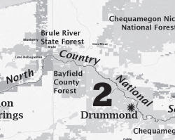
 This segment is mapped by the SHTA, Border Route Trail and Kekekabic Trail
 See Superior Hiking Trail Association