Notice: I've taken a part-time job, and it's definitely affecting my blogging time. I'll continue to add content here as often as possible. Pertinent guest posts are always welcome.

-

Saturday, February 28, 2009

Will Stimulus Money Benefit the North Country Trail?

a news release of Outdoor Industry Association, with additional comments

The Forest Service, National Park Service (NPS) and the Bureau of Land Management (BLM) are working overtime to meet tight deadlines in identifying projects eligible for funding in the economic stimulus bill. The American Reinvestment and Recovery Act, signed by President Obama last week, directs $3 billion to the Department of Interior and $1 billion to the Forest Service to fund road and trail projects, building and campground maintenance, abandoned mine restoration and to fire mitigation projects.

Interior Secretary Ken Salazar has asked the NPS and BLM to identify their highest priority projects in time to submit a list to the White House by March 3 and plans to hire a "stimulus czar" to oversee the dollars. The Interior Department will also launch a website listing each project, its cost, a chronicle of its progress and the number of jobs created.

The Forest Service is operating under similarly tight deadlines. Each regional forest submitted its priority projects to the headquarters office last week and will submit its proposed list to the White House the first week of March.

Agencies have been told they should submit a mix of projects including trail and campground restoration and that the highest priority will be placed on projects that will create the most private sector jobs.

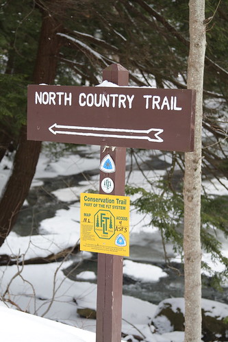
The National Park Service is the federal agency that oversees the North Country Trail. And the Forest Service is the largest single landowner along the length of the trail. Yet, it is unclear just how much, if any, of this money will benefit the NCT. Agencies have been scrambling to provide projects which can be funded.

The agencies will put private sector contracts out for a bid in the next few months and plan to open regional offices around the country to facilitate the bidding process. Congress has said all the stimulus money must be obligated by September 2010.

Due to the burdens of other federal laws, such as environmental policy, archeological assessments, laws which restrict land purchase, and more, it could be very difficult to create projects and obligate funds by the deadline. Many of the National Forests have been in the process of closing campgrounds, removing infrastructure and cutting back on staff due to budget shortfalls. Let's hope that some of this money can reverse this trend.

Thursday, February 26, 2009

Watch for Wooly Adelgid in New York

wooly adelgid
wooly adelgid on hemlock (photo from Cayuga Trails Club)
from the Cayuga Trails Club

The Hemlock Woolly Adelgid is an exotic pest from Asia first found in the U.S. in 1951 near Richmond, Va. Sadly, it has found its way into the Cayuga basin. According to a USDA pest alert, this pest threatens the health and sustainability of eastern hemlock (Tsuga canadensis) in our area, and the Carolina hemlock (Tsuga caroliniana) further south. If you spot any in the area of Ithaca, New York, please contact Mark Whitmore at the Natural Resources Department at Cornell.

See Saving the Hemlocks
See Wooly Adelgid Found in Michigan

Kim Fishburn to Give Yosemite Programs

Yosemite
Merced River Valley in Yosemite (photo by Kim Fishburn)
contributed by Kim Fishburn

Kim is a hiker and supporter of the Superior Hiking Trail, which is concurrent with the North Country Trail in Minnesota. He has also done extensive hiking in the west and will be giving 3 programs in Minneapolis this next week.

I've hiked in Yosemite for over 25 years and covered about 2/3 of the trails in the park. I'll be showing pictures of the various areas of the park to help you plan a trip. You'll also need to know about changes in bear regulations in the Sierras so I'll show you which website to go to. If you've been thinking of hiking the John Muir or Tahoe Yosemite Trail I'll also show you the public transportation options available to get to and around the Sierras. I'll also cover the weather, when to go, and things to think about when flying with a backpack.

I always like it when I get a lot of people at these slide shows. I'm thinking of putting another one together on the other areas of California that I've hiked.

At the end I'm going to show a couple of slides from a trail building weekend I did last year on the SHT and try to drum up some bodies for this year. I'm also planning on mentioning the Border Route Trail and the North Country Trail.

I need to get back up on the SHT before the snow melts and see about finishing the final 50 miles I need to finish the main part of that trail. I'll probably do another slide show on SHT then. I was going to through hike it starting last Memorial Day but by the time I got to Grand Marais I was cold wet & miserable and my left foot was killing me. 3 days later they got 3 to 5 inches of rain. I'm so glad I missed that. Anyway, I thought it would be good to do a slide show showing the different seasons on the trail.


March 2, 7 pm, REI Roseville, 1955 County Rd B2 W, Roseville, MN 55113, (651) 635-0211

March 4, 7 pm, REI Maple Grove, 11581 Fountains Drive, Maple Grove, MN 55369, (763) 493-7861

March 7, 2 pm, REI Bloomington, 750 W American Blvd, Bloomington, MN 55420, (952) 884-4315

See Out Hiking, Kim's web page

Wednesday, February 25, 2009

Owasippe Plans 13th Manistee Quest

Owasippe Patch
a news release of the Scarlet Sassafras


Registered Boy Scouts or Venturers who will be age 13 by January 1 of the year of the trek may participate in the Manistee Quest. The trek or "Quest" is a 5-day and 4-night excursion that will follow the North Country National Trail with optional rendezvous with the Muskegon, Pere Marquette, Pine, or Manistee Rivers for day or overnight float trips... "all the streams of the Potawatomi". All treks will be accompanied by a trained Owasippe trail guide. Two of the above-mentioned rivers are "white-water" routes and should be traversed by experienced canoeists only.

Separate canoe trips of 1-3 days in length can be arranged by any Owasippe unit but "combo" treks consisting of both backpacking and canoeing must enroll through the Manistee Quest Program. Troops interested in one-day hikes along the North Country Trail, 10-20 milers, may also make these arrangements through CAC but must also provide their own leadership.

Special issue patches will be available for completed treks.

The Manistee Quest operates from a staffed section camp at Owasippe devoted solely to administering backpacking treks and canoe float trips through the Manistee National Forest east and north of Owasippe. From this base camp, older Scouts or Venturers will receive training in specific skills necessary for their selected trek, get detailed instructions regarding their gear and route, participate in a mini-trek prior to their departure, and enjoy some recreation activities before and after their trek.

More information regarding registration and 2009 fees can be obtained at the Scarlet Sassafras

Glad We Aren't the South Country Trail !

hikers move to side of road sign
from the Eye on Miami blog

Brought to my attention by "Grumpy Gord," a proud member of "Other Hikers of Note." (see sidebar). Thank you Gordy! If you have trouble reading it, right click and choose View Image to see it full size.

Monday, February 23, 2009

Jennifer Takes a "Tiny Hike"

NCT trailhead
photo by Jennifer Schlick
from the blog Walking Home "Tiny Hike", by Jennifer Schlick, used with permission, Feb 22, 2009

Nine A.M. Six inches of fresh powder… I wonder if I will need my snow shoes. But no, someone was here before the powder and packed me a nice base.

“They” are predicting 24-hours of lake effect snow starting later this afternoon. A few early-arriving clouds are practicing off and on, ocassionally allowing sunlight through to add a sparkle to the snow.

The wind is in a particularly creative mood...

See Tiny Hike for the rest of the story, a map, and lots more pictures.

Sunday, February 22, 2009

Finger Lakes Land Trust Partners with Tompkins County to Preserve Trail

hiker on winter trail
on the Finger Lakes Trail
based on a news article in the Ithaca Journal, "Protecting our woodland walk," by Krisy Gashler, Feb 21, 2009

The Finger Lakes Trail is a model of land use agreements with private property owners. But that is also one of its greatest weaknesses. Many of those agreements are secured with only a handshake.

Andy Zepp, executive director of the Finger Lakes Land Trust said, “there's a wonderful story about the Finger Lakes Trail and how private property owners and volunteers ... have made this wonderful resource available.” But he also warned that there is risk in the future.

Property once in farmland is being sold and sub-divided. An agreement with one landowner can suddenly need to be negotiated with ten owners. Zepp said that Ithaca (New York) is the largest city close to the trail, thus making it a “proving ground” for growth issues.

The Finger Lakes Trail runs from Allegheny State Park in the western Southern Tier of NY to the Catskill Mountains, a length of 562 miles. There are several side branches. The North Country Trail is concurrent with the FLT for about 300 miles, turning north on the Onondaga Branch and connecting with the Link Trail on its way to the Adirondacks.

In the past few years, three sections of trail near Ithaca have required changes when property owners asked the FLT to leave their land. John Andersson is president of the Cayuga Trails Club that maintains 82 miles of the FLT through Tompkins and part of Schuyler counties.

"We're concerned that it seems to be happening a little more frequently in the past few years and it's getting harder to find additional nearby landowners," Andersson said. "It's not because landowners aren't receptive to us in general, it's really because the parcels are getting smaller. As time goes by, people divvy the land up more."

If an agreement cannot be reached with a different landowner then the trail must move to the road. Andersson cited one case where a landowner died and his children did not want the trail. That resulted in a seven-mile roadwalk. He explained that they have a new route in that area now, near Caroline, NY, but there are four owners to deal with, not just one. “You can’t do that in a weekend,” he added. Most of the people who negotiate for the trail are volunteers.

Sometimes trail users create problems. Intrusion by motorized vehicles, allowing dogs to run off-leash, being rude to landowners and disobeying posted rules can result in a loss of permission. People tend to think that if they are in the woods that it must be public land. Sometimes property owners just decide that they don’t want the hassle.

Recently the Finger Lakes Land Trust and the Tompkins County planning department have joined forces to consider long-range planning for the trail. They have received a state grant for the planning. With the aid of a consultant they are interviewing property owners, assessing the trail, and holding public meetings. They hope to have an initial report in late spring, Zepp said.

One of the conclusions is sure to be to try to secure more permanent easements for the trail. In some cases these legal agreements are already in place. Charlie Elrod of Enfiled purchased his land with a legal easement in place and he has no problem with that. He and his wife even maintain the trail as volunteer trail adopters. "I just think it's so important that people have opportunities to get out and enjoy this beautiful countryside we live in, and if we can facilitate or help that effort along by keeping the trail through here, so much the better," Elrod said.

Zepp said the two key issues in sustaining the trail are better planning for its long-term future and a financial commitment.

Friday, February 20, 2009

Buckeye Trail to Celebrate 50th Anniversary

Buckeye Trail logo

from the Buckeye Trail Association

BTA 50th Anniversary Annual Meeting - Camp McPherson

Make plans now to attend the 50th Buckeye Trail Annual Meeting from June 12-14. This celebration will prove to be a once in a lifetime event you won’t want to miss. This year’s Annual Meeting will continue all the traditions you associate with Annual Meetings—the hikes, the programs, the camaraderie. But the special celebration associated with our 50th birthday means that there will be several added and unique features.

For one thing, this year’s conference has been moved to June 12-14, so there will be no worries about Ohio’s sneaky April snows. And the venue has been changed to a centrally located site so that folks from all across the state can attend easily. The BTA has booked Camp McPherson near Danville to host this special celebration. Camp McPherson is a full service site that offers a wide range of accommodations. In addition to camping and dorm style facilities, there are also a limited number of motel type rooms available.

Even the menus have been carefully selected for your dining pleasure. An added feature is a band that has been added for a Saturday night barn dance. The annual business meeting has been moved to Sunday to provide you with a more active Saturday program of speakers, hikes and special events. And while the site is not along the BT, it is conveniently near the Mohican region that offers ample opportunity for short and long hikes as well as canoeing.

There are many special events planned in a year long celebration of the 50th birthday of the BTA. But the biggest of all will be the Annual Meeting from June 12-14 at Camp McPherson near Danville. The schedule and registration forms are available on the annual meeting page, but be sure to save the date and book now to get your choice of accommodations for this very special celebration.

Registration: 4:00 p.m. at Camp McPherson on Friday. The annual business meeting will take place at 9:00 a.m. on Sunday the 14th.

For nearly 1444 miles, the Buckeye Trail winds around Ohio, reaching into every corner of the state. From a beachhead on Lake Erie near Cleveland, to an hilltop overlooking the Ohio River in Cincinnati, a hiker can experience a little or all that Ohio has to offer.

First envisioned in the late 1950’s as a trail from the Ohio River to Lake Erie, the Buckeye Trail evolved into a large loop, branching both north and east from Cincinnati. The separate legs rejoin in the Cuyahoga Valley National Park near Cleveland, and complete the trip to the lake. Because it is a loop, it is also in essence, endless. You may start a hike at any point and hike as long as you want without ever reaching an end!

The North Country Trail is concurrent with the Buckeye Trail for approximately 800 miles.

See Buckeye Trail Association

Thursday, February 19, 2009

Transportation Enhancements Remain in Stimulus Package

from the Rails-to-Trails Conservancy

Transportation Enhancements have been used to benefit the North Country Trail in some specific instances. These funds can not be used for single-track backcountry trail. However they are often invaluable for solving some pedestrian problems. For example, they can be used to add a pedestrian lane to bridges, safe road crossings, urban routes which might also be used by school children or commuters, etc. -JHY

Last week, we asked you to speak up for active transportation in the American Recovery and Reinvestment Act of 2009. You took action, loudly asking our elected officials to protect Transportation Enhancements (TE), the nation's largest federal funding source for trails, walking and bicycling.

You spoke up, and Congress listened.

Our congressional representatives recognized the role walking and biking play in a balanced transportation system, and allocated $825 million to TE. While this is less than two percent of transportation funding in the recovery package, it represents a doubling of TE spending for communities in the next year.

These hundreds of millions of dollars for TE will allow communities across the country to create jobs by building trails and other infrastructure immediately, while simultaneously addressing congestion, environmental concerns, the obesity epidemic and economic challenges in the long-term.

TE is a long-standing program that has historically enjoyed bi-partisan support. Its place within the stimulus package, however, heralds the recognition among elected leaders that active transportation infrastructure is a smart way to create jobs in the short-term, while resulting in long-term economic and other benefits.

The victory of this TE funding represents more than just dollars-- it represents job creation, community connectivity and a step forward in recognizing the tremendous benefits of trails, walking and biking.

See Trails, walking and biking earn $825 million in stimulus To spark jobs, active transportation
See Some Transportation Enhancements Remain in Stimulus Package
See Transportation Enhancement Funding - Source and Eligible Uses

Reaching Out to Young Members

hikers
hikers on the NCT (photo by J Young)
based on a news article in the Albany Times-Union, "Hikers take steps to find young blood," by Alan Wechsler, Feb 18, 2009

Last fall, Bruce Matthews, Executive Director of the North Country Trail Association met with hiking volunteers in upstate New York. He commented on the average age of the participants. “It is striking, the paucity of young people attending these events,” said Matthews, while chatting with the group at a Delmar restaurant.

He noted that the average age appeared to be mid-60's. This is a demographic of many outdoor clubs. The Schenectady Wintersports Club is attempting to reach out to younger participants by starting a chapter for 18-30 year olds. A Taconic Hiking Club member, Colin Campbell– age 72, said, ““If you’re in your early 40s, you’re a young member in our club.”.

One problem is that younger people often have less time, juggling work and family responsibilities. Even the Adirondack Mountain Club is working hard to bring in younger members by planning more family-friendly activities. “We’re aging out,” said Deborah Zack, director of membership and development at the ADK.

There are plenty of young people hiking, paddling, rock climbing, skiing, etc. It just seems to be difficult to get them to join existing groups. Some clubs are trying new ways of making contact with people, for example through social sites like Facebook. Young people generally don’t want to have structured meetings, or perhaps even designated leadership roles.

Groups need young members to take up the reins of advocacy for trails as well as building and maintenance of the actual pathways. Yet the differences in outlook can create friction between the groups. The future of trail creation and advocacy depends on bringing the generations together.

“We love these [older] folks — they’ve got expendable income and they’ve got time,” said Matthews.“ But the reality is we have 10 to 15 years left with them. If we had a 20-year-old, we’d have a lifetime.”

Wednesday, February 18, 2009

Cherry Run Suspension Bridge

Cherry Run suspension bridge
Cherry Run suspension bridge, Pennsylvania
condensed from the North Star, the magazine of the North Country Trail Association, by Karen Klos

The Baker Trail carries the North Country Trail southward from Allegheny National Forest in Pennsylvania, and there has always been a need for a bridge across Cherry Run near Crooked Creek Lake. Previously the trail went right through the creek, normally about a foot deep, and sometimes flooding to over six! Two other bridges had been located here, but each was washed out by hurricane waters. This new suspension bridge is six feet higher, and flexible.

The bridge was designed and built by Keith Klos, President of the Allegheny National Forest Chapter of the NCTA. Keith constructed the bridge at home, and then transported the pieces to the site. The upright posts were set in concrete on June 14, 2008. In July the cables were installed. 235 bags of Sackrete were used for the foundation. Four strands of 5/8" cable were strung between the posts with the anchor points 20 feet behind the posts. On August 2, the decking sections were hoisted and set into place using a trolley strung on an overhead cable.

Cherry Run suspension bridge
stairs to the bridge surface
U-bolts were used to secure the decking to the lower cables. 36 support cables were then strung to the upper 5/8" cables. On August 3, railings were bolted to these support cables with a top handrail, a middle rail, and bottom kick rail.

The bridge was funded by the Rachel Carson Trails Conservancy and the work performed by a network of volunteers from the Baker Trail, North Country Trail and Butler Outdoor Club, totaling over 500 hours. The bridge is on US Army Corps of Engineers land, and their permission was easily secured for the project.

Tuesday, February 17, 2009

NCT Hopes to Benefit from Stimulus Package

comments from Bruce Matthews, NCTA Executive Director

As a quick update on the status of our efforts to provide Senator Levin (D-MI) with NCT projects for possible inclusion in the economic stimulus bill, here is a quote from Senator Levin's floor speech last Friday:

"Additionally, the conference committee legislation contains $750 million for the National Park Service (NPS). The NPS has a significant backlog of deferred maintenance projects that can be started within the next 18 months which will create jobs and help restore and enhance our national treasures. Michigan's four National Park units and the North Country National Scenic Trail have significant funding needs, and a number of projects have been delayed for years. I am hopeful that the NPS will direct a sizable portion of the $750 million included in the package to address the significant needs of Michigan's parks and trails."

In working with Senator Levin and his staff to include appropriate projects to help build/maintain the NCNST in Michigan I have been singularly impressed. He reached out to us, and his staff has followed through with us at every turn. I'm pretty darn impressed.

I sincerely hope, as the NCTA advocacy team ramps up for Hike the Hill (the week devoted to visiting congressional representatives and reporting on how the NCTA has used the money appropriated over the year) next week, that we can start to build this kind of relationship with the rest of the Congressional delegations representing the states and districts of the North Country Trail. Here's a great example of how it can work!

Read Senator Levin's full speech
Contact Bruce Matthews

Monday, February 16, 2009

"New" NCT Clubs Members

Gary & Gail Rasanen
Gary & Gail Rasanen with their Karelian Bear Dogs (photo by J Young)
by Joan H. Young

This entry into the unofficial long-distance hiking clubs of the North Country Trail is long overdue. However, for readers of this blog, let me first explain the "clubs."

A few years ago, in an attempt to at least begin to collect names of people who have hiked more than 200 miles of the North Country Trail, I asked folks to notify me when they had reached that milestone. That's figurative, of course, we'd be happy for blazes on some of the trail, let alone actual mile markers! Most people have been eager to share their accomplishments, and are willing to have their names added to the web site.

There are eight people who have now followed the entire North Country Trail. The first was Carolyn Hoffman who hiked and biked the route before there was much trail completed. She chose to ride a bicycle over the road sections, but she is generally recognized as the first person to follow the complete route. Since then Peter Wolfe, Chet Fromme, Ed Talone, Andy Skurka, Allen Shoup, Don Beattie, and Bart Smith have completed the entire North Country Trail on foot.

I'm next closest to completion with 3518 miles done... more miles than Carolyn covered and fast closing on Chet, who did not do the Arrowhead route. The trail has evolved and grown since then. And there is one person who plans to attempt a thru-hike this coming summer. I'll introduce you to him in a future post.

But there are quite a few people who have successfully hiked a nice chunk of the NCT beyond their own back yards. Their info is now linked from the sidebar of this blog as well as from the North Country Trail Association web page. You can click on the footprints and a popup will open- no ads.

OK, back to Gary and Gail. Last spring I was hiking the NCT in Michigan's Upper Peninsula near Marquette. I met a couple, with 3 dogs, who were also out hiking. It seems that they are working their way across the UP, and they estimated their total miles at just over 200. And they may have added to it last summer. They've hiked most everything from the Two-Hearted River to Grand Marais, and also from Marquette to the Porkies.

I have to offer them my apologies for the belated addition of their names and photo. First I had to wait till I could afford to get my films developed. And then I had to find the paper with their names and info. But I finally got it all together. So welcome to the clubs, Gary and Gail Rasanen!

If you have hiked more than 200 different miles of the North Country Trail, please let me know. J. Young
See Running Bear Dog for more about the Rasanens and their dogs

Saturday, February 14, 2009

Superior Hiking Trail Reports 2008 Accomplishments

Superior Hiking Trail
one of the many spectacular views to be had from the Superior Hiking Trail
(photo by J Young)
extracted from the Superior Hiking Trail 2008 Annual Report

Although not 100% official yet, for all practical purposes the North Country Trail is concurrent with the Superior Hiking Trail along Lake Superior's north shore.

Gayle Coyer, SHT Association Executive Director reports, "We had a great season on the trail." On National Trails Day, June 7, the completion of 6.2 miles of new trail near Two Harbors was celebrated. Also completed were 8 miles of trail between Two Harbors and Duluth. Over 65 volunteers contributed almost 1000 hours of time to accomplish these tasks.

Bridges are an ongoing maintenance issue on the SHT due to narrow gorges with very high water at certain times of the year. Bridges at Mission Creek, Cascade Creek, and Indian Camp Creeks had to be replaced in 2008. A large rain event in June damaged a number of bridges, moved puncheon and felled trees. Cleanup from that storm took a great deal of time.

Ongoing maintenance of trails is always a time-consuming project. Volunteers performed maintenance and submitted inspection reports on 60 trail sections, 82 campsites and 48 trailheads.

Keep in mind that the SHT is 200 miles, and the overall NCT is 4600 miles. One can begin to get a sense of the scope of dedication and time involved in creating and maintaining this trail. The SHT has their inventory and work well-organized.

Coyer concluded, "I want to thank all of our members and friends. We really appreciate your support and look forward to another great year!"

See Minnesotans, Support the Arrowhead!

Friday, February 13, 2009

Some Transportation Enhancements Remain in Stimulus Package

from Safe Routes to School

The U.S. House and Senate are expected to vote today or tomorrow on a $789 billion economic stimulus package that provides $27.5 billion to modernize roads and bridges, and includes a 3% set-aside of each state’s share of the $27.5 billion for the Transportation Enhancements program, which is a primarily source of bicycle and pedestrian infrastructure funding, which can also be used for Safe Routes to School. At least half of funds must be obligated by states within 120 days and the remainder within one year, or the U.S. Secretary of Transportation can recall unobligated funds.

Also included is $8.4 billion to increase public transportation and improve transit facilities; $8 billion for investment in high-speed rail; and $1.5 billion for a discretionary surface transportation grant program to be awarded competitively by the Secretary of Transportation. The Federal Highway Administration (FHWA) and Federal Transit Administration have issued guidance to assist state and local agencies in preparing for implementation of the stimulus bill. The guidance includes Q&As and actions that can be taken to expedite economic recovery projects.

In other sections of the bill, there are other possible funding sources for bicycle and pedestrian infrastructure.
  • States will be receiving $53.6 billion in state fiscal stabilization funding. States must use 18.2% of their funding – or $9.7 billion – for public safety and government services. An eligible activity under this section is to provide funding to K-12 schools and institutions of higher education to make repairs, modernize, and renovate to meet green building standards. LEED’s green standards for schools include bicycle and pedestrian facilities and access to the school.
  • $3.1 billion is provided for the Energy Efficiency and Block Grant Program, which provides formula funding to cities, counties, and states to undertake a range of energy efficiency activities. One eligible use of funding is for bicycle and pedestrian infrastructure.
  • And a total of $1 billion is included for a Prevention and Wellness fund at the US Department of Health and Human Services. However, specific funding for the Healthy Communities program, which provides funding to local communities to pursue community wellness activities address critical problems like obesity, was not included.

See the text of the bill

Thursday, February 12, 2009

Fewer Northeastern Minnesota Moose

moose on an island
moose on the edge of a small island in the Boundary Waters Canoe Area near the Kekekabic/ NC Trail (photo by J Young)
a news release of Minnesota DNR

Northeastern Minnesota’s 2008 moose survey estimates a population of 7,600 animals. This is similar to last year’s count, but related factors suggest that the population is continuing to decline.

“The raw survey numbers were similar,” said Mark Lenarz, the Minnesota Department of Natural Resources (DNR) wildlife researcher overseeing moose research. “But a historically low calf survival rate, a steadily declining hunter-success ratio, and a higher than normal non-hunting mortality rate all continue to suggest a downward trend in the moose population.”

Minnesota’s 2008 non-hunting mortality moose rate was 17 percent, down 3 percent from the 20 percent average rate reported during the past seven years. Elsewhere in North America, between 8 and 12 percent of moose generally die from causes other than hunting.

Moose remain abundant enough in the state to support a bulls-only hunt for a limited number of Minnesotans. But the percentage of hunters who successfully harvested a bull moose has steadily declined from 61 percent in 2001 to 45 percent in 2008.

Members of the DNR’s moose advisory committee are identifying management practices and research opportunities that may forestall the decline of Minnesota’s moose population. The committee will make recommendations to the DNR later this year.

Aerial moose surveys have been conducted each year since 1960 in the northeast. The Fond du Lac band and 1854 Treaty Authority contributed funding and provided personnel for the survey.

See the aerial survey report and additional information about Minnesota’s moose population

Wednesday, February 11, 2009

Secretary of Interior Ken Salazar Endorses Funding for LWCF

from the National Recreation and Parks Association

The Land and Water Conservation Fund has been the source of funds for many projects that benefit the North Country Trail. JHY

In a departure from what NRPA has heard for a number of years from the Department of the Interior about the potential for increased funding for the Land and Water Conservation Fund, newly confirmed Secretary of the Interior Ken Salazar has indicated a willingness to look at ways to creatively fund LWCF. Salazar said at a press conference on January 28, that he would like to see more funding to the LWCF program, possibly from the proceeds of oil and gas leasing royalties in a program similar to one he started in Colorado when he was head of the Colorado Department of Natural Resources.

Ken Salazar has long been a champion of the Land and Water Conservation Fund. When he was a Senator from Colorado, he joined forces with Sen. Lamar Alexander (R-TN) in a bi-partisan effort to ensure that new lease revenues from expanded drilling in the eastern Gulf of Mexico were dedicated to the LWCF state assistance program in the Energy Security Act of 2006, the first time such dedicated funding was ever applied to LWCF since its inception in 1965.

Secretary Salazar said at the press conference, “I would like to see, with programs like the Land and Water Conservation Fund, if we might be able to do a similar thing with oil royalty reform, to engage in a similar type of effort across the country. We are just putting out ideas now but we will look at what we can do.” He also said, “Maybe as we deal with the royalty reform issue we might be able to create a revenue stream for the Land and Water Conservation Fund and we can do for all states the kinds of things we did in Colorado with the Great Outdoors Colorado program.”

This is welcome news, indeed, from the new Secretary of the Interior, and NRPA will be looking for ways to engage him further in a dialogue of how the “royalty-relief” funds could be used for LWCF purposes.

Update on Omnibus Public Lands Bill

The Omnibus Public Lands Bill (S22), already passed by the Senate, was scheduled for a vote in the House of Representatives today. However, a Rules Committee meeting scheduled for yesterday afternoon was canceled, and the bill is unlikely to reach the floor today.

Passage of the bill will provide Willing Seller authority for the North Country Trail, and a host of other benefits for land preservation and recreation across the nation.

Letters of support for this bill have been sent to Congress by:
  • American Hiking Society, 1/14/09
  • American Rivers, 1/9/09
  • The Conservation System Alliance, 2/5/09
  • Campaign for America's Wilderness, 2/6/09
  • Earthjustice, 2/9/09
  • Letter from 46 organizations supporting National Landscape Conservation System, 5/29/07
  • Letter from faith organizations, 2/2/09
  • National Parks Conservation Association, 2/9/09
  • National Wildlife Federation, 2/6/09
  • Letter from outdoor industry leaders supporting National Landscape Conservation System
  • Republicans for Environmental Protection, 1/15/09
  • Letter from 40+ river organizations, 2/6/09
  • Sierra Club, 2/9/09
  • Letter from sportsmen's organizations, 2/10/09
  • The Nature Conservancy, 2/9/09
  • Trout Unlimited, 2/9/09
  • The Wilderness Society, 1/28/09

There will likely be a Motion to Recommit. If this motion is successful it would be very likely to kill the bill for this Congress because of the procedural hurdles it would face in the event it is sent back to the Senate. Representatives are being urged to vote no on any such motion by all the above groups.

See Willing Seller Needs Your Help Now
See Senate Passes Omnibus Public Lands Act
See Michigan Rep Wants to Remove Beaver Basin from Wilderness Plan

Tuesday, February 10, 2009

Glimpses from the Adirondacks

Cold River
Cold River on the Northville-Placid Trail (photo by J Young)
by Joan Young

Most of the people who visit this blog because they have an interest in the North Country Trail are aware that last summer Marie and I had the chance to connect a couple of previous hikes in the Adirondacks of New York. In so doing, we saw some of the proposed route for the NCT. We began our hike at the western end of the High Peaks, and connected to the proposed NCT route via the Northville-Placid Trail (NPT). The picture above is the Cold River. This will not be along the NCT, but is a pretty typical looking Adirondack scene.

The NPT is a valley trail. It is not rugged, and hardly hilly. It does not lend itself to great vista views. The NPT crosses the proposed North Country route somewhere near Cedar Lakes. When we reached this point we left the NPT and began to follow the NCT. Just beyond that turn we caught this one glimpse of the Adirondack peaks through the trees. That is the kind of view future NCT hikers will need to content themselves with. Of course, one can always take a side trip.

a glimpse of Mt. Marcy
A glimpse of a peak through the trees, possibly Mt. Marcy judging from its symmetry
(photo by J Young)


One real treat along the proposed NCT route is Horn Lake. There is already abandoned trail which leads past the lake (one must take an extra five minute hike at a turnoff to actually reach the lake). It will not take a great deal of work to re-open this trail to hikers, and there is a campsite near the lakeshore.

Horn Lake
Horn Lake (photo by J Young)


Once we left the Adirondacks, we continued on to Rome, New York. At Forestport we joined what is, at this time, the easternmost segment of official North Country Trail. The spillway below the dam at Forestport on the Black River is extraordinarily beautiful.

below the dam at Forestport on the Black River
a New England aster beside the Black River in Forestport
(photo by J Young)


The trail then follows the Black River Feeder Canal on its way to Boonville and the Black River Canal. Along these miles of towpath trail one can view any number of locks and other historic structures. Pictured here is one viaduct which allows a creek to flow beneath the canal. The trail moves from left to right through the picture on the flat green space above the stone arch.

a creek passing beneath the Black River Feeder Canal
a creek passing beneath the Black River Feeder Canal near Boonville
(photo by J Young)


As you all know I keep saying, the thing that marks the North Country Trail is the diversity of landscapes and experiences to be found along its length. These are just a few of those moments from the summer of 2008.

See The Essential Adirondacks for a short article about this hike
See Triple Play in the ADKs for a longer story of this hike

Monday, February 9, 2009

Spring Floods Predicted for Red River of the North

red river oxcart sign
photo by J Young
a news release of NOAA

The North Country Trail currently crosses the river at Fort Abercrombie. Ed.

NOAA is alerting residents in the Red River Valley, which separates North Dakota and Minnesota, of the potential for significant flooding in their communities this spring. Several factors led to this early projection. The area has received between 200 and 300 percent of normal precipitation since September 2008 and December saw 23 days of snow, leaving water content of snowpack at 170 to 300 percent above normal.

“Based on the amount of rain and snowfall in the Red River Basin over the past few months, we’re forecasting a 50 to 75 percent chance of major flooding there this spring,” said Scott Dummer, hydrologist in charge at the North Central River Forecast Center. “NOAA, along with emergency management and local government officials, is communicating the flood risk early to help residents prepare in advance.”

Residents in the region can monitor the flood threat online, where NOAA posts frequent updates of local conditions and forecasts using detailed graphics of specific locations and properties along the river.

Mark Frazier, head of NOAA’s weather forecast office in Grand Forks said this outlook is a moving target that will change as weather conditions within the Red River Basin evolve in the coming months.

“Right now we’re making people aware of the potential for major flooding and asking communities to be prepared should our forecast come to fruition,” Frazier said. “The flood outlook will become more precise as we get closer to the spring thaw, so we’re asking residents to prepare now and continue monitoring the situation.”

NOAA Hydrologic Resources to monitor water height

Natural Repellant Found as Effective as Deet

alt text
Ixodes scapularis, the black-legged or deer tick (photo from Michigan State University)

a news release of the Entomological Society of America

Isolongifolenone, a natural compound found in the Tauroniro tree, also known as Bastard Bulletwood, of South America, has been found to effectively deter biting of mosquitoes and to repel ticks, both of which are known spreaders of diseases such as malaria, West Nile virus, and Lyme disease.

Derivatives of isolongifolenone have been widely and safely used as fragrances in cosmetics, perfumes, deodorants, and paper products, and new processing methods may make it as cheap to produce as DEET.

The authors found that isolongifolenone deters the biting of two kinds of mosquitoes more effectively than the widely used synthetic chemical repellent DEET (N,N-diethyl-3-methyl benzamide) in laboratory bioassays. Furthermore, it repelled blacklegged ticks and lone star ticks as effectively as DEET. The two species most repelled are Aedes aegypti (L.) and Anopheles stephensi Liston.

Since “isolongifolenone is easily synthesized from inexpensive turpentine oil feedstock,” the authors write, “we are therefore confident that the compound has significant potential as an inexpensive and safe repellent for protection of large human populations against blood-feeding arthropods.”

In addition, a new, patented method developed by the authors to efficiently produce isolongifolenone would make it even more cost effective.

The results of this research are presented in the latest issue of Journal of Medical Entomology in an article by Aijun Zhang et. al titled “Isolongifolenone: A Novel Sesquiterpene Repellent of Ticks and Mosquitoes.”

The full text of the article is available at The Entomological Society of America, with a subscription.
See Big Mosquitoes are Safer Mosquitoes
See Researchers Put the Bite on Mosquitoes

Sunday, February 8, 2009

Permitted Uses ?

alt text


I'm not sure where this actually is (it's from the Telegraph.co.uk archive), but I think we can be glad that it's not on the NCT!

Of course there are places where both uses are permitted, but not posted quite so poorly!

Saturday, February 7, 2009

Valley City - Segment Spotlight

Valley City Welcome


selections from a news article in Prairie Business Magazine, with additional comments

Doug Anderson, director of marketing and communications at Valley City State University, has served as president of the chamber of commerce since August. “I love the beauty of the area, the amenities, the scenery, the activities, hiking trails and the ability to walk to work on a nice day. In the cities I was making a one-hour commute each way to and from work. Here, there’s time to enjoy life and I like working at VCSU, where I’ve really grown my marketing and communication skills.”

City and university officials are hoping to hear more stories like that in the future. Valley State is embarking on several unique programs designed to support local development objectives as well as meet local employment needs.

Summer 2009 the North Country Trail Association annuual conference will return to pictureque Valley City. A total of 11 bridges span the Sheyenne River in addition to the Bald Hill Dam 10 miles northeast of town, which impounds 27-mile-long Lake Ashtabula. Completed trail long the lake is one of the most scenic North Dakota segments of the NCT.

Valley City was founded in 1872 beside the Sheyenne River and the community adopted the name ‘Hi-Liners’ as a result of an amazing engineering and design feat. The 1908 opening of a single track railroad bridge took two years to build and still remains one of the highest (162 feet above the Sheyenne River) and longest (3,860 feet) bridges of its kind in the United States.

Hi-Liner Bridge
Hi-Liner Bridge, Valley City (photo by J Young)


The city is now focused on building bridges to the future and adding needed infrastructure and amenities. “The biggest thing we do is try to find the right partners for projects and then we are tenacious in pursuit of our goals,” said Bobby Koepplin, manager of rural development for Cass County Electric Cooperative in town and former chair of the local development group. “If you don’t ask, you don’t get. Koepplin is also about to begin a term as president of the board of the North Country Trail Association.

Economic activity has increased over the years in this scenic and hilly community of about 7,000 residents. This drive to improve the community’s quality of living has resulted in a long list of amenities for residents and visitors, including the Sheyenne River Valley National Scenic Highway and the Sheyenne River Valley Chapter of the North Country Trail Association, which connects seven states.

Planet Walk
Planet Walk, Valley City (photo by J Young)


Here, the North Country Trail follows the Planet Walk which winds out of town through Medicine Wheel Park. Marked boulders are placed at proportional distances from the recreated Native American Medicine Wheel. When hikers reach Pluto, the trail leaves the cement and returns to natural surface.

“We really are focusing on the quality of place here in Valley City and up and down the valley,” said Mary Lee Nielson, a second generation mayor taking up the mantle of leadership previously held by her father.

As they did in 2002, Valley City is ready to welcome North Country Trail enthusiasts July 30- Aug 2, 2009.

See North Country Trail Association for more details about the conference.

Grand Rapids Writer Enjoys Bowman Lake & NC Trail Loop

alt text

the Bowman Lake Trail offers skiers a variety of deep snow terrain, including remote-feeling bowls in the forest. (photo by Howard Meyerson)

The following is an excerpt from a story which we believe is worthy of reading, but would lose too much of its charm if it were re-written for presentation on this blog. Please link through for the rest of the story, but hurry back! ... Editor

by Howard Meyerson

Two hours along the deep, snowy trail, we were still debating the merit of having set off on cross-country skis and leaving the snowshoes in the car. But that would soon change.

Fritz Seegers, of Kalamazoo, and I were shuffling through deep snow, watching big deer bound through the woods ahead. It was 11 degrees with a wind-chill close to zero. The ice had built up on Seegers' beard.

We hadn't seen another soul all day, but that's how we like it: remote, quiet and wild feeling, with a bit of a challenge thrown in.

The Bowman Lake Trail in the Manistee National Forest was proving to be all of that...

finish the story at the Grand Rapids Press

These links are checked on the date of the article. As the article ages, some links may become invalid
See Get Off The Couch
See New Trail at Bowman Lake is Complete


Friday, February 6, 2009

Upper Peninsula Sturgeon River Land Purchase Complete

Ottawa National Forest Plain
NCT above the Sturgeon River Gorge currently passes through a dry plain with no views of the gorge (photo by J Young)
from a news release of the Michigan DNR

Preserves wildlife habitat, secures four miles of the North Country National Scenic Trail and opens up thousands of acres of public land

Michigan Department of Natural Resources (DNR) recently was awarded a Michigan Natural Resources Trust Fund grant to help purchase 681 acres of pristine wilderness along the famed Sturgeon River in Baraga County from The Conservation Fund, a national land and water conservation organization. The acquisition completes a deal that preserves a total of 1,054 acres of former We Energies land in two counties in Michigan’s Upper Peninsula, including approximately 5.6 miles of waterfront property along the Sturgeon River. This NCT segment is located in Baraga County on Map M-13.

“We deeply appreciate The Conservation Fund for, once again, working with a private landowner to permanently protect lands for the North Country National Scenic Trail," said Tom Gilbert, National Park Service superintendent of the North Country National Scenic Trail.

Federally designated as a Wild and Scenic River, the Sturgeon River possesses remarkable scenic, recreational, geologic, fish and wildlife, historic and cultural value. The Sturgeon flows through rugged terrain, creating dramatic gorges, waterfalls and rapids well known to paddlers and nature enthusiasts. Its abundant populations of trout make it a popular destination for anglers. The North Country National Scenic Trail parallels the river for more than four miles, but currently never offers any views of the spectacular gorge. It is unclear whether this purchase will allow for a re-route of the trail closer to the gorge. However, it does secure Tibbets Falls, a popular destination just east of the Oren Krumm Shelter.

The property also connects with neighboring state lands, Copper Country State Forest, to form a continuous 30-mile stretch of public land along the river and secures a critical four-mile segment of the North Country National Scenic Trail.

“This acquisition will protect a special place in the western Upper Peninsula for current and future Michigan citizens and visitors to enjoy for generations,” said Michigan DNR Director Rebecca Humphries. “It also protects critical deer wintering habitat and areas where bald eagles and ospreys nest. Further, it helps reduce land fragmentation across the Upper Peninsula when these large parcels of land go on the market.”

Sturgeon River
Sturgeon River (photo MI DNR)


Bruce Matthews, executive director of the North Country Trail Association, commented, “It offers yet another example of public/private partnerships working on behalf of the public interest for today and the future. We’re fortunate at the North Country Trail Association to be supported in our efforts by the vision and foresight of The Conservation Fund, Michigan DNR and We Energies.”

The Conservation Fund

American Hiking Society Urges Support for Omnibus Bill Passage in House

American Hiking Society Logo
UPDATE The Partnership for the National Trails System reports that the vote will be Wednesday, Feb 11, and that it will be really close. Please contact your Representative!

a news release of the American Hiking Society

American Hiking Society needs your help TODAY to urge the House to pass the Senate Omnibus Public Land Management Act (S. 22), an important bill that will protect and recognize some of the most significant hiking opportunities and natural resources in America. Two weeks ago, this bill passed by a comfortable margin in the Senate, but the House will be a greater challenge. In fact, if this legislation receives a single amendment, no matter how apparently well-intentioned, it would be effectively "killed," and years of hard work, compromise, and thousands of miles of trail could suffer. Without making your voice heard, this bill could "die" in the House and never become law.

This bill will have greater positive effects on the hiking experience than any other legislation considered this year. This bill is a "bundle" of more than 100 different pieces of legislation, including language to designate the Arizona National Scenic Trail, the New England National Scenic Trail, the Ice Age Floods National Geologic Trail, and the Washington - Rochambeau Revolutionary Route National Historic Trail. This legislation also authorizes several important feasibility studies of National Historic Trails and gives federal land management agencies the tools to protect trails by acquiring land within their Congressionally designated corridors. Notably, this "bundle" contains the National Landscape Conservation System Act - simple, straightforward legislation that will recognize the incredible natural and recreational resources of the Bureau of Land Management's National Landscape Conservation System, including more than 5,000 miles of National Scenic and Historic Trails.

Ask your Representative to protect these trails and incredible hiking opportunities and ensure that the BLM's Conservation System will be permanently protected!

Contact your Representative, and ask him or her to support bill S 22, the Omnibus Public Lands Bill.
See Michigan Rep Wants to Remove Beaver Basin from Wilderness Plan
See Senate Passes Omnibus Public Lands Act

Wednesday, February 4, 2009

Forest Service Will Consider Temporary Wilderness Marking on Kek

trail work on the Kekekabic
trail work in March 2008 on the Kek (photo by Martin Kubik)
a news release of Boundary Waters Advisory Committee

The Boundary Waters Advisory Committee (BWA Committee) and US Forest Service officials met recently to discuss trail management in the Boundary Waters Canoe Area in the Superior National Forest.

Last year’s rescue of two Duluth hikers lost on the Kekekabic Trail in the BWCAW, along with the 1999 windstorm, two major fires, and a number of other Search and Rescue operations in the wilderness over the last several years, has moved the Forest Service to reconsider whether trail markers should be placed on indistinct trails in the wilderness. Five hiking organizations, the BWA Committee, the Kekekabic Trail Club (KTC), the Border Route Trail Association (BRTA), the North Country Trail Association (NCTA) and the 3M Club Outdoor Club support marking of a troublesome 13 mile long section of the Kekekabic Trail and segments of the Border Route Trail where the path has been obliterated by the past fire.

At the meeting, the BWA Committee offered, subject to the Forest Service approval, to send out a survey team to locate and reconnect missing links of tread on the Kekekabic Trail. The USFS is presently reviewing several options for wilderness appropriate marking once the trail tread is located. Marking would be temporary and most likely removed once a tread is re-established, through use and by surrounding vegetation, which may take several years.

Both parties agreed that a low number of hikers caused the trails to become obscure. The Kekekabic and other wilderness trails are less then 10 inches wide, overgrown with grass and crowded by brush, raspberries and balsam fir branches. In contrast, portages are worn down to bare gravel and are typically 3 to 6 feet wide.

BWA Committee and the USFS discussed ways to increase volunteer recruitment and train crew leaders. Safety of participants is of paramount importance, since the trail maintenance is done in the wilderness and crew leaders need to have people, safety and outdoor skills.

The BWA Committee, along with the Kekekabic Trail Club, are organizing several BWCA trail maintenance trips on the Eagle Mountain , Brule Lake Trail, Snowbank and Kekekabic trails in 2009. Trip dates will be posted on the BWA Committee site http://www.meetup.com/Friends-of-BWCA-Trails/ and www.kek.org.

The USFS expressed appreciation for “photo essays,” report from survey hikes and trail clearing trips, posted on www.bwac.smugmug.com. “Photo-essays help us see what the trail conditions are like in the wilderness and the work volunteers are doing,” said Jon Benson, USFS wilderness trail manager. “Your work does not go unnoticed,“ concluded Steve Schug, Assistant District Ranger, Gunflint Ranger District.

See Kubik to Speak About the Condition of the Kek
See Lost on Kekekabic Trail – Update

Communications Director Resigns


from Bruce Matthews, Executive Director, North Country Trail Association

I know you'll all join me in thanking Mary Meehan for her contributions and wishing her future success as she departs NCTA. We've learned much through her tenure and made progress in some key areas. As we consider next steps we will continue to build upon a solid communications platform that meets our member expectations and advances our Association agenda.

Mary's departure leaves some major holes to fill and no doubt creates some questions about what's next. The rest of the staff are working on short-term solutions, most notably to try to keep the new website launch on track, but also to keep to production schedules for North Star and Blue Blazes Bulletin. Please do let me know any questions or concerns, particularly if you are left with a project hanging in mid air. We may not know that and need you to close the loop so we can respond.

We will be coordinating key folks in building a solid strategy for next steps. We'll be looking at NCTA's broad staffing needs, in communications as well as trail management/administration, advocacy (state and national) and development. We have an opportunity to reflect current needs and landscapes and will move decisively in filling this position in the next few months. We have an opportunity to take a page from our new President as we're encouraged to embrace the change that's needed.

Contact Bruce Matthews

Another Google Maps Example in the Manistee

example of Google Map
NCT / Manistee River Trail Loop

from Matt Rowbottham, NCTA GIS Coordinator

The NCTA is hoping to use Google Maps to inventory the North Country Trail. It would be an immense task, as is nearly everything associated with this trail. But Matt Rowbottham has high hopes.

This example is a combination of the North Country Trail and the Manistee River Trail in the Manistee National Forest near Mesick, Michigan. This is a highly popular weekend backpacking destination loop. The NCT (west) side of the loop is maintained by the Spirit of the Woods Chapter. The east side is in need of a great deal of work, but a recently formed group, the Manistee River Trail Association, hopes to begin improvements.

Matt says that he's already been sharing data with agencies and volunteers this way. To inventory this 4600 mile trail will be a lot of data. "Maybe we can crash the Google server," Matt joked.

See Spirit of the Woods Chapter
See Manistee River Trail Association
See NCT-MRT Loop on Google Maps
See Cayuga Trails Club Builds Inventory Map with Google

Tuesday, February 3, 2009

Ken Salazar Confirmed as 50th Secretary of the Interior

Ken Salazar
Ken Salazar was unanimously confirmed and sworn in as Secretary of the Interior.(photo from DOI)
from a news release of theDepartment of the Interior

Ken Salazar, a fifth-generation Coloradan who served as the state’s U.S. Senator, Attorney General and Director of Natural Resources, was confirmed January 20, 2009 by a unanimous vote in the U.S. Senate to become the 50th Secretary of the Interior

“I am honored to have been chosen for this position and look forward to working with President Obama on our nation’s energy and natural resource challenges,” Salazar said. “I will be a strong and forceful advocate for the wise stewardship of our nation’s land and water resources, I will help us build a clean energy economy for the twenty-first century, and I will work to restore the integrity of the nation-to-nation relationship with our Native American communities.”

“My first priority at Interior is to lead the Department with openness in decision-making, high ethical standards and respect for scientific integrity,” Salazar emphasized. “I will work for a more proactive and balanced stewardship to protect our national parks and open spaces, restore our Nation’s rivers, resolve our water supply challenges and address the challenges faced by our Native American communities.”

Salazar, who has vigorously advocated the expanded use of clean, renewable energy technologies, will oversee 500 million acres of public lands managed by Interior that include some of the nation's largest sources of wind, solar and geothermal energy. He will lead a Department with 67,000 employees and an annual budget of about $18.6 billion, including annual and permanent funding.

After settling in New Mexico four centuries ago, Salazar's family planted roots in Colorado's San Luis Valley, where they have farmed and ranched the same land for five generations. Raised on a remote ranch without electricity or telephone, Salazar learned the values of hard work, family, and faith. Thanks to his parents’ lessons, he and his seven brothers and sisters all became first generation college graduates.

A farmer for more than thirty years, Salazar was a partner with his family in El Rancho Salazar. He and his wife have owned and operated small businesses, including a Dairy Queen and radio stations in Pueblo and Denver. Salazar worked for eleven years as a water and environmental lawyer with some of the top firms in the West. During his time in the private sector and as Colorado’s Attorney General, Salazar worked on cases from the trial courts to the Colorado and United States Supreme Courts.

He received his law degree from the University of Michigan in 1981 and a political science degree from Colorado College in 1977. He also received honorary doctorates of law from Colorado College in 1993 and the University of Denver in 1999. Salazar and his wife, Hope, have two daughters, Melinda and Andrea, and one granddaughter, Mireya.

A biography of Secretary Salazar and his official image are available online at the Department of the Interior

Monday, February 2, 2009

Emergency Beacons Switch to 406 MHz

SARSAT System Overview
SARSAT System Overview (credit NOAA)
a news release of NOAA

NOAA Satellites Helped Rescue 283 People in 2008
Emergency Beacons Switch Exclusively to 406 MHz Frequency Feb 1


NOAA satellites were key factors in the rescues of 283 people throughout the United States and its surrounding waters in 2008. In each incident, NOAA satellites detected and located a distress signal from an emergency beacon and relayed the information to first responders on the ground

“With every rescue made, a tragedy was avoided,” said Mary E. Kicza, assistant administrator for NOAA Satellite and Information Service. “Each year NOAA satellites show their versatility by helping us forecast the weather, learn more about our environment and contribute to these life saving rescues.”

NOAA’s polar-orbiting and geostationary satellites, along with Russia’s Cospas spacecraft, are part of the international Search and Rescue Satellite Aided Tracking system, called COSPAS-SARSAT. This system uses a network of satellites to quickly detect and locate distress signals from emergency beacons on board aircraft and boats and from handheld personal locator beacons.

When a satellite finds the location of a distress signal within the United States or its surrounding waters, the information is relayed to the SARSAT Mission Control Center at NOAA’s Satellite Operations Facility in Suitland, Md. From there, it is sent to a Rescue Coordination Center, operated by either the U.S. Air Force, for land rescues, or the U.S. Coast Guard, for water rescues.

2008 SARSAT Rescue Highlights
  • Two people were rescued near Port Aranas, Texas, when their disabled boat was swamped by 12-foot waves.
  • An injured hiker was rescued after using his personal locator beacon while hiking in a remote area near Hemet, Calif. The rescue became even more challenging when mountain lions were spotted nearby.
  • A pilot was rescued about 70 miles southeast of Galena, Alaska, after his Cessna plane crashed into trees.
  • Alaska topped the list for the most saves in the United States, with 49 lives rescued in 2008. Rounding out the top five states were: New Jersey, with 18 rescued; Florida, with 15 rescued; Hawaii, with 14 rescued; and California, with 12 rescued.

Older Beacons must be Replaced
Starting on Feb. 1, 2009, NOAA satellites will only receive signals from the new 406 MHz frequency beacons. The older emergency beacons, operating on the 121.5 and 243 MHz frequencies, will no longer be detected by SARSAT. Signals from the 406 MHz beacons can be detected instantly, are more accurate, and offer global coverage. NOAA has provided advance notice of the switch since 2000.

“It’s vital that anyone with the old 121.5 MHz beacon make the switch to 406 MHz beacons immediately so their distress signals can be heard,” said Chris O’Connors, program manager for NOAA SARSAT. “Plans for this changeover started in 2000 and we want everyone that relies on these devices to have the proper equipment.”

Now in its 27th year, COSPAS-SARSAT has been credited with supporting more than 24,000 rescues worldwide, including 6,045 in the United States and its surrounding waters.

NOAA understands and predicts changes in the Earth's environment, from the depths of the ocean to the surface of the sun, and conserves and manages our coastal and marine resources.

Cayuga Trails Club Builds Inventory Map with Google

Google map segment
mapped section in long map view
from the Cayuga Trails Club

With trail organizations, including the NCTA, needing to work on creating a data base of structures on their trail, the Cayuga Trails Club (CTC) of New York has taken advantage of Google's free Maps program. The CTC maintains about 90 miles of the Finger Lakes Trail system. 23 of those miles are official North Country Trail miles, but more are concurrent without being certified.

With Google Maps the club entered the route of the trail, and then each flag shows the location of a structure. One can zoom in and out, and change the map type from political to terrain, to a satellite view.

Google map segment
mapped segment south of Ithaca, New York, in terrain view


Google map segment
mapped segment southwest of Ithaca, New York, in satellite view


Finally, you can click on any flag, or a list in the sidebar, to see the feature located at that point. Here a group displays some picnic tables.

Google map segment
pop-up box appears when a flag is clicked


Data inventories such as this are not only interesting, but they are becoming increasingly required for groups as they seek funding. If trail organizations can not show specific structures with ages, conditions, replacement timelines and costs, funding may often be denied. The Cayuga Trails Club is to be commended for creating such a great resource.

In addition to the FLT/NCT the club built and maintains the Cayuga Trail on the campus of Cornell University. They conduct hikes on trails in the Ithaca area on a regular basis.

See Cayuga Trails Club Google Map Inventory
See Cayuga Trails Club