Notice: I've taken a part-time job, and it's definitely affecting my blogging time. I'll continue to add content here as often as possible. Pertinent guest posts are always welcome.

-

Monday, June 18, 2012

The Arrowhead Reroute- Guest Post

alt text
Doug Boulee

a guest post by Doug Boulee, who recently hiked this section of the NCT

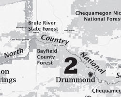
Preparing for my next section hike of the N.C.T., it was found that the Superior Hiking Trail is technically not part of the North Country National Scenic Trail.
When authorized by the U.S. Congress in 1980 the proposed route of the N.C.T. traveled from south of Duluth northwest toward Grand Rapids, Minnesota. Most of that original one hundred miles led through mosquito infested wetlands.


Over two decades of development, it became apparent to the builders, maintainers and hikers of the trail that the original pathway was flawed, passing through undesirable terrain, not suiting the scenic objective on which the trail was founded. The idea to use the Superior Hiking Trail, Border Route Trail and Kekekabic Trail known as the Arrowhead Reroute, was introduced about ten years ago by those
same creators and users. Eventually it became the sensible and assumed route.

There is now hope of introducing a bill to congress that would finally make the five hundred mile Arrowhead Reroute the official pathway of the North Country National Scenic Trail. I would not consider this a merger by any means. It will not be renamed or even relabeled. The Superior Hiking Trail will continue to be built, maintained and managed by the S.H.T. Association and its volunteers to the highest standards that I have just witnessed. In addition, the bill would provide greater resources and funding through the National Park Service.

Putting it simply (to me), this bill will provide a right of passage over an extremely beautiful and scenic pathway. The introduction of this bill, however, is nothing simple and will be a very long process in gathering the support, from both the U.S. Congress and the public to get it passed. For more information and current updates, go to and LIKE facebook.com/ArrowheadReRoute

This segment is mapped by the SHTA, Border Route Trail and Kekekabic Trail

See Superior Hiking Trail Association

Monday, February 20, 2012

Wisconsin Develops Statewide Brochure


segment of Wisconsin NCT brochure

from Todd McMahon

Last year at Canoecopia we handed out around 2500 National Park Service North Country Trail Brochures. Those brochures are nice, but they really don't have very much information on getting people involved with the local chapters of the NCT

What we really needed was a brochure that featured the all three of the Wisconsin Chapters of the NCT. After I met with Bill Menke on Tuesday, I started working on such a brochure. It is an 8.5 x 11 Tri-fold brochure.

The Brochure is designed to help recruit people to work on the trail and it highlights the 110 mile continuous section in Wisconsin.

This segment is on NCTA maps WI-01, 02, 03

See the Wisconsin Brochure (a pdf)


Monday, February 13, 2012

Ham Lake Fire Took More than Trees

hikers on burned trail
trail area burned by Ham Lake fire in 2007(photo by JHY)

by jhy with an excerpt from the Dartmouth Alumni Magazine

The Ham Lake Fire of May 2007 burned over 75,000 acres in both Canada and the United States in the Boundary Waters region of Minnesota. I burned across two sections of the Kekekabic Trail, part of the NCT.

The fire was accidentally started by life-long camper Steve Posniak. He escaped the fire itself, but became a victim when the Forest Service decided to prosecute him for causing the blaze. He eventually committed suicide, thus becoming the one life lost as a result of the Ham Lake Fire.

An article in the Dartmouth Alumni Magazine tells his poignant story. It begins:

"In preparation for his beloved annual spring canoe trip to northern Minnesota, all winter long Steve Posniak could be seen walking through the alleys of his Washington, D.C., neighborhood carrying 50-pound weights. As a stocky man in his 60s, Posniak wanted to be sure he was strong enough to portage alone, carrying gear on his back and a canoe overhead across miles of trails that connect more than a thousand lakes sprinkled throughout the Superior National Forest. "

Read the rest of the excellent article at the Dartmouth Alumni Magazine


Saturday, February 11, 2012

Contact Your Senator to Save Transportation Enhancement Money!

US capitol

from American Trails and other sources

Although the North Country Trail seeks to be mostly single-track woods trail, there are many places where our uses overlap with trails which are aided by these funds. One critical area is adding pedestrian walkways to bridges.

If you care about the NCT, please contact your Senator today! Voting could occur as early as Monday.

Last week, the House of Representatives dealt non-motorized transportation a serious blow by passing a bill that would eliminate Transportation Enhancements. This funding helps pay for things like multi-use trails, and the Safe Routes to School program.

Highway proponents have always complained about the requirement to cover other forms of transportation, other than powered vehicles. Media coverage of projects that seem frivolous hasn't helped.

Now, it's the Senate's turn. If you care about getting around for transportation and/or recreation without burning gas, please send an email today! Links below should make it as easy as possible.

The Senate's version of the transportation bill (MAP-21) does NOT include dedicated funding for the Recreational Trails Program. However, Senator Klobuchar (D-MN) will present an amendment to restore dedicated funding to RTP at the appropriate time. (The amendment could be offered as early as next week.) This would restore RTP authorization as a stand-alone program, as well as fund it at 2009 levels.

ACTION NEEDED: PLEASE CALL and ask your Senators to support Senator Klobuchar's amendment to restore dedicated funding for the Recreational Trails Program in the Senate transportation bill (MAP-21).

"ASK" FOR SENATORS:

As a user-pay/user-benefit program, dedicated funding for the RTP should be included in the Senate transportation bill (MAP-21). Will you support the Klobuchar amendment to MAP-21, which restores dedicated funding for the Recreational Trails Program? This amendment makes the Senate bill consistent with language that is already in the House bill.

There is a similar campaign to support an amendment to protect Enhancements and Safe Routes to School sponsored by Senator Cardin (D-MD) and Senator Cochran (R-MS) in the Senate transportation bill


See Talking Points
See Find Your Senator
See read more at American Hiking


Monday, January 23, 2012

Continental Divide Trail Alliance Disbands

Continental Divide Trail

from the Continental Divide Trail Alliance

Most of the National Scenic Trails are fortunate to have a non-profit organization that supports the governmental agency charged with managing their trail. For the North Country Trail, our managing agency is the National Park Service, and the organization is the North Country Trail Association.

Without these groups, which rally volunteers, prod legislators to notice trails, provide training and support, not to mention publicity, a trail may be in existence, but it is less well known, and less well cared for.

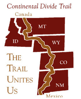
This week, sadly, the organization which supported the Continental Divide Trail, one of the "Triple Crown," (Appalachian, Pacific Crest, and CDT) has disbanded for lack of funds. The agency which oversees the CDT is the National Forest Service.

The CDTA writes:
Increasing pressures from development in the West, rising land costs, and challenges with the longstanding down cycle in the economy threaten the completion of the Trail. Despite the strong level of financial support from so many of you, overall contributions and other revenues in recent years have significantly declined. These revenues are the life blood of nonprofit organizations like the CDTA.

Consequently, the CDTA Board of Directors has made the very difficult and painful decision to cease operations of the CDTA. The financial condition of the organization has been unstable and deteriorating for a number of years. We have not been able to raise the necessary financial resources to sustain the continued operations of the organization.
If you love a trail, please support it financially in any amount you can. The existence of an organization is not a given, even for a federally authorized trail.


See Continental Divide Trail

Thursday, January 12, 2012

Help NCTA Win $100,000 in Marketing Services

Vote at Vote for $100K in Marketing Services for NCTA

Yes, you read that right. This is a voter-decided charity where ten organizations will win $100,000 each in marketing services. Most of the charities are Michigan based (that's where the offer comes from).

I appreciate the little win that you readers all just helped me get, but this vote is much more important, and you can potentially help nine other non-profits as well as the North Country Trail Association. If you are not from Michigan, don't pass it by. There are groups that should appeal to you. Many are animal rescues, women and youth support, faith-based organizations, aid to the disabled and homeless, and lots more.

We just ask that you choose North Country Trail Association as one of your votes!

The list is alphabetical, so you'll find us between New Hope Center for Grief Support, and Novi Athletic Boosters. Just scroll down!

Check ten boxes, then scroll to the bottom and hit Submit.

If there was ever a time to rouse yourself to action this is it! Great benefit to NCTA, and an easy voting process. You do have to enter your name and email, but that's all- no complex sign-up. Vote one time; you're done.

Vote at Vote for $100K in Marketing Services for NCTA

Sunday, January 1, 2012

Winter Hike on the FLT/NCT

view from TenKate Bridge
view from TenKate Bridge (photo by Terry McConnell)

by Terry McConnell

What better way to end the calendar year than with a hike on the FLT? Earlier in hunting season I had "knocked off" the long road walk of M20 along Route 11 and W. River Road, and in early October I had hiked the eastern half of M19, returning to my car on Babcock Hollow Road along the orange blazed "Dabes diversion". That left the mostly-trail segment from River Road to the top of Virgil Mt still to be done. Together with the return trip, the leg would fall neatly into my 15-20 mile sweet spot, so I slung on my day pack and headed west and uphill from my car on River Road.

From River Road the trail heads steeply uphill along the scenic rim of a small river gorge, quickly to emerge smack in the back yard of somebody's house. "Sure hope they're members," I thought as I gingerly crept by within 5 feet of a picture window, trying my best to look like a normal part of the scenery. Further along I snapped a quick cell phone pic looking upstream at the Tenkate bridge, my shaky hands conspiring with the laws of optics to produce an interesting effect I never could have gotten with forethought.

Trail conditions can be summarized in one word: slippery! Above 1600 ft. there was a uniform 1-2 inch layer of slushy snow that required a kind of stiff-legged strut to navigate any grade steeper than 5%, and which made side hill traverses dicey and dangerous. On downhill stretches through Tuller Hill SF I worked to perfect a primitive form of 'skiing' on hiking boots made possible by this slick layer. The speed gained thereby partially made up for the slow-going, but nevertheless I emerged on Carson Road a good hour behind schedule.

Read the rest of Terry's interesting adventure at Finger Lakes Trail email group, and consider joining to always know what's going on.

This segment is on FLT map M19


Wednesday, December 28, 2011

Chief Noonday Chapter's Huge Cleanup Project of 2011

alt text
Jason Buckner, left, and Mary Rebert work to clear tree limbs blocking a path on the North County Trail near Battle Creek (photo by Aaron Ogg)

based on a news article in the Grand Rapids Press

As a result of a bad blowdown in May of 2011, the Chief Noonday Chapter has been working all year to clean up the North Country Trail through Kimball Pines.

Wind gusts between 75 and 100 miles per hour sheared the tops off dozens, if not hundreds, of trees during the Memorial Day weekend storm, and the entire character of the trail was changed. However, the volunteers were primarily concerned with making it hikeable once again.


This segment is on NCTA map MI-02

See Chief Noonday Chapter of the NCTA

Wednesday, December 21, 2011

Royal River Bluff
Royal River bluff from the Border Route on the Minnesota Arrowhead (photo by jhy)

received from Ed Solstad esolstad@pressenter.com


The Border Route (northern portion of the Minnesota Arrowhead North Country Trail) is doing well in comparison to the other trails, being No. 2 in use for 2009 and No. 1 in 2010 & 2011. In 2009 the Kekekabic Trail was No. 1. The Kek is also part of the NCT, just to the west of the Border Route.

The Forest Service recently issued this report of all Boundary Waters Canoe Area Wilderness trail entry points permits.

In 2009, 2010, and 2011, the Kek had 76, 51, 45 permits issued, respectively.

The Border Route, for the same three years was 42,54, and 55.

Ed says, "Thanks go out to all of you that have helped in our maintenance efforts. Without your dedication, the trail wouldn't be what is is today."

See the full Trail Use Report (an xls file)

This segment is in the Border Route guide

See Border Route Trail

Monday, December 19, 2011

Wisconsin Eagle Scout Clears NCT


based on a news story in the Northland News Center

Jonathon Gilbertson of Ashland, Wisconsin recently received his Eagle Scout award in a ceremony with two other boys. For his project Jonathan cleared the North Country Trail in one of the Chequamegon Forest's designated wilderness areas. (Could be Porcupine Lake or Rainbow Lake- the article did not specify)

"All the trees we cut out we used a cross cut saw and a hand saw. The brush was cut with little clippers and we had to haul it back by ourselves." said Gilbertson.

This segment is on NCTA map WI-02

See Chequamegon Chapter of the NCTA


Saturday, December 17, 2011

Hiking Allegany State Park

stream in Allegany State Park
a stream in Allegany State Park, NY (photo by Pat Coate)

from Mon@arch's Nature Blog used with permission

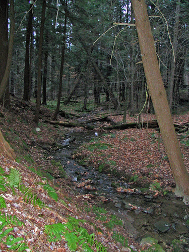
Pat Coate, of Mon@arch Nature Blog, recently took a hike on the North Country/Finger Lakes Trail in Allegany State Park, New York. This is the westernmost section in NY, just before the trail slips into Pennsylvania.

She writes, "The section of the trail along Brown Hollow looked down on a babbling brook whose sound was drowned out by the constant sloshing of many feet through the deep carpet of fallen leaves."

"The following weekend my family hiked the other end of the FLT in Allegany State Park. The trail starts off of exit 19 (Red House Lake exit) on Bay State Road. This too is a beautiful trail. The trail climbs fairly steadily from 1440’ to 2060’ over about a 2 mile stretch, including switchbacks. There are glimpses of the Allegheny River to the west and some nice rock formations along the way."

Follow the link above to read the rest of her entry and see more pictures.

This segment is on FLT map M1/CT1

See Finger Lakes Trail

Friday, December 16, 2011

Still Time to Comment on Manistee NF Quiet Areas

alt text
Bowman Lake Semi-Primitive Area (photo by jhy)

by JHY

You have until December 23 to comment on the following situation in the Manistee.

Some people may be aware of a lawsuit brought against the Manistee National Forest which has required them to consider increasing the number of acres set aside for quiet sports. This has set off a huge firestorm among hunting, snowmobiling, and ATV interests. These groups have strongly organized to oppose the proposals. From the Forest Service perspective, it has created a huge amount of paperwork and chewed up time which could not be spent doing other things.

Personally, I have mixed feelings about the whole thing. I deplore the amount of money it has taken the Forest Service to prepare alternative solutions and all the accompanying documentation. However, I do agree with the basic idea that quiet recreation often gets the short end of the stick.

You may have seen media coverage of this issue if you live in Michigan. All the news reports I've seen have made it sound as if hunters and motorized vehicles will be banned from the whole forest. The media seems to have worked hard to make this as hot of an issue as possible.

In truth, only 70,000 acres, out of a million in the forest, will be affected. That's less than 1% of the land!

In addition to recreational uses, the Forest has included rare plants, wildlife management, and timber management in their SEIS (Supplemental Environmental Impact Statement), but these are outside the scope of this blog post.

It's really hard to sift through the documents to the crux of the issue, but I believe I've got it right... I made a couple of phone calls, and have searched the web for info from others who have read all the paperwork. The Forest has prepared three alternatives:

  • A. Do nothing. This would leave all areas as they are- open to the same uses.
  • B. Combine all semiprimitive nonmotorized areas into a single management area and ban hunting in addition to the current ban on motorized vehicles. This is the FS preferred alternative because it creates the least amount of additional work (about 64,000 acres). See additional comments below.
  • C. Change all semiprimitive motorized areas to nonmotorized, thus increasing the nonmotorized areas by 17,000 acres. This would ban both hunting and motorized use.


The North Country Trail passes through all three of the existing semiprimitive nonmotorized areas. These are the Manistee River SPA, Bowman Lake SPA, and Condon Lakes West SPA. Therefore, with either B or C, there will be increased places where one can walk on the NCT without encountering hunters. If Alternative C is implemented, then the Loda Lake Motorized SPA would also become nonmotorized, creating a fourth "quiet" area along the NCT. Condon Lakes East would also become nonmotorized, and this is adjacent to the trail.

Opponents say that there is so much noise encroaching from adjacent properties that this whole idea is silly. And of course, there has been the huge outcry that the Forest is trying to ban "noisy" users from the whole Forest. It's just not true.

The court decision stated that "the [Forest] Service failed to identify the various recreation preferences of user groups. Specifically, just because the Forest Plan may allow a variety of "activities" (i.e., snowshoeing, snowmobiling, hunting, cross-country skiing, bird watching) does not mean that the Plan is adequate. Rather, the Service should focus on the "quality" of those recreational opportunities and the recreational preferences for the users." Finally, someone noticed that low-tech users do not receive a quality experience in shared areas!

This post has gotten long. There is a nice table comparing the alternatives at The Alternatives. This is a pdf which lists the alternatives, and has a chart near the end.

If you would like to see more of a quality experience for hikers, with little actual impact on hunters and motorized users of the Forest, please send a comment and endorse Alternative B or C. The deadline is Dec 23, 2011.

HOW TO COMMENT • U.S. Mail - Send written comments to Lee Evison, Forest Planner, Huron-Manistee National Forests, 1755 S. Mitchell Street, Cadillac, MI 49601 • Fax - 231-775-5551 • Electronic - comments-eastern-huron-manistee@fs.fed.us (Comments sent via email should contain the subject line "Forest Plan SEIS"

This segment is on NCTA map MI-04, and MI-05

See Index to all the Manistee National Forest Documentation on the SEIS.

Thursday, December 15, 2011

Years of Low Acorn Production Can Boost Lyme Risk

alt text
white oak acorns (photo by jhy)

based on a news article in the New York Times

The Northeast is experiencing a year of low acorn production, in contrast to Michigan, where I found the forest floor layered with sweet acorns. But I was not aware that the variations in acorn production can have an influence on the prevalence of Lyme Disease the next year. Here's how it works.

Acorn production normally runs in a series of high and low production years. That's a given. It's what happens when a good year is followed by a lean year that things get interesting for the humans who spend time in the woods. When acorn production is up, the wildlife that depends on the nuts for food flourish, and their populations rise. If a good year is followed by a year of few acorns the large populations of squirrels, mice, and ground-nesting birds will crash, as they will have a hard time finding enough food.

Of course, when the wildlife increases, so do the tick populations. And when the wildlife dies off, all those ticks will be looking for fresh blood. Humans in the woods make them very happy.

So, if you live in the Northeast, be sure to take your DEET to the woods next spring!


Wednesday, December 14, 2011

Still Time to Comment on Hydrofracking in New York

alt text
how the Marcellus Shale is located in relation to the North Country Trail. Right click the map to enlarge or follow the FLT link below to see the full-size version (graphic from the Finger Lakes Trail Conference)


based on a press release from the New York DEC

In New York City, on November 30, the New York State Department of Environmental Conservation held its fourth and final public hearing on the agency's draft SGEIS, draft regulations and draft stormwater permit for high-volume hydraulic fracturing. Previous hearings were held in Dansville, Binghamton and Loch Sheldrake.

In total, approximately 6,000 people attended the hearings, which each had an afternoon and evening session, and approximately 590 people gave verbal comments. An additional 669 written comments were also submitted at the hearings.

Hydrofracking will have a strong impact on the North Country Trail simply because the Marcellus Shale bed underlies so much of the area through which the trail passes.

"The turnout of 6,000 people at the hearings demonstrates how strongly New Yorkers feel about this important issue," DEC Commissioner Joe Martens said. "Nearly 600 individuals took the time to voice their opinions."

"I appreciate the public's unprecedented attendance and attention to this issue. The comments made at the hearings will be seriously considered as we move forward with developing the final rules and conditions. I encourage New Yorkers to continue to read the documents and submit their feedback to DEC before the comment period ends on January 11."

See to submit comments on High-Volume Hydraulic Fracturing

This affects all FLT maps M1-M33 and NCTA map PA-01, 02, 03

See Marcellus Shale Gas Drilling and the NCT


Tuesday, December 13, 2011

Continuing Mineral Extraction Controversy in the Allegheny National Forest

alt text
Allegheny National Forest Hills in autumn (photo by jhy)

based on news articles in the Pittsburgh Post-Gazette: In Rebuttal / Two different standards and Stand up for states' rights

The problems of mineral and timber extraction in the Allegheny National Forest of Pennsylvania are an old and bitter news item. For the issues of oil and gas drilling the problem is intensified by the fact that the Forest does not own the sub-surface rights. Thus, the government has no legal right to prevent the industry from taking what is legally theirs.

Problems arise, however, due to the fact that oil wells, tanks, roads and pipelines have to be built on the surface in order to extract the minerals. This infrastructure does intrude on the landscape that belongs to the National Forest. Many law suits over these issues have been brought over the years. With the recent hoopla about the potential for the development of the Marcellus Shale, and hydrofracturing processes, the issue is hot once again.

Because there are nearly 100 miles of North Country Trail within the Allegheny National Forest, the trail is often impacted.

The legal issues surrounding the Allegheny battles are much more complex than recreation vs industry. Two-century-old laws concerning the acquisition and uses of federal land come into play. Recently the U.S. Third Circuit Court of Appeals held that the Allegheny National Forest has almost no authority to permit (or not) the surface infrastructure needed to extract sub-surface minerals.

Those who feel that the modern recreational uses of National Forests is paramount in importance are outraged.

The battle goes on. Meanwhile, be prepared to see plenty of oil and gas rigs in Pennsylvania and Ohio along the trail.

This segment is on NCTA map PA-01

See Allegheny National Forest Chapter of the NCTA


Friday, December 9, 2011

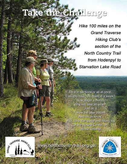
Take the Grand Traverse Hikers 100-Mile Challenge

alt text

from the Grand Traverse Hiking Club

Can you hike 100 miles in a week?
In 10 days? That would be just 10 miles a day!
Could you do it in a month?
Could you hike 100 miles within one year?

If you can do any of the above, completing the 100 miles maintained by their chapter, Grand Traverse Hiking Club will award a decal and certificate and a Michigan NCT patch.

A Hiking Log has been developed to record each section with the date completed. You can do the sections in any order you want. The requirement is to travel the whole 100 miles of our section of trail under your own power in one year.


This segment is on NCTA map MI-05, 06

See Grand Traverse Hiking Club Chapter of the NCTA

Thursday, December 8, 2011

An October Hike in the UP

fall leaves
frosty fall leaves (photo by lily)

excerpted from Serendipitous Intentions (used with permission)

The exact location of this North Country Trail hike is not identified, but the pictures are beautiful. Go visit Lily and read the rest of her entry!

"After a short drive and vehicle staging, we were on the trail by 9:45, Dunloe in the lead, K and then me bringing up the rear. It was chilly, but beautiful...and the smell of the woods? Heavenly. I kept breathing deeply to take in more of the scent. I love the rich, heavy scent of the woods when they are wet."

"Oh yes, we went up, and then we went down and around, turning this way and that as the trail led us. The trail is well marked with blazes and we had no question about which direction to go."

This segment is on NCTA map MI-10 (I think)


Wednesday, December 7, 2011

Ash Cave- One of Ohio's Wonders


video by BuckeyeTrailTV

Ash Cave, in Ohio's Hocking Hills (central southeast) is one of the premier attractions. Here is an excerpt from North Country Cache concerning the area.

"On Tuesday we approach the spectacular Ash Cave, the largest rock wall in Ohio. A chunky, blocky overhang spreads across the head of a gorge, and beneath this overhang, a high and shallow cave defines the end of the declivity. The entire rock face is covered with fine, powdery gray ash. The origins of the ash are lost in the history of the indigenous peoples. Perhaps the ashes come from centuries of fires, lit to warm bodies, cook meals, or host council meetings. Or perhaps the cave was used for less innocent purposes; another theory has it that gunpowder was made there. Nearby are natural saltpeter mines, necessary to make the explosive powder."

Never discount Ohio for interesting sights!

Buy North Country Cache

This segment is on Buckeye Trail Map "Old Man's Cave"

See Buckeye Trail Association


Tuesday, December 6, 2011

Announcement Concerning NPS Superintendent


received from Bruce Matthews, Executive Director, NCTA

I just got off the phone with NPS Regional Director Mike Reynolds, who informed me of a drastic change in the NPS's plans. You'll recall we were expecting to welcome Dr. Wade Vagias early in January as our new North Country/Ice Age NST Superintendent. As I understand it, Wade's formerly temporary detail to Yellowstone NP, which involved developing/implementing the Yellowstone's winter management plan, has suddenly taken on more urgency/priority within the NPS. Wade's position became permanent and that's where he is staying.

Mike Reynolds was very apologetic. He is pursuing some immediate as well as longer term options to help us get the administrative coverage we need.

I will keep you posted on further developments. Insofar as my previous request to chapter and affiliate/partner leadership to let me know of upcoming events, please do keep them coming. At the very least we will use this list to help us make staff travel decisions.

Thank you, and let me know your questions.

Contact Bruce Matthews
See New National Park Service NCNST Superintendent Named


Monday, December 5, 2011

Three New Bridges in Newaygo County, MI

One Year, Three Bridges from Paul Haan on Vimeo.


from the Western Michigan Chapter of the NCTA

The bridges span Bear Creek, Rattlesnake Creek and Second Cole Creek. Great accomplishment!


This segment is on NCTA map MI-04

See Western Michigan Chapter of the NCTA