Notice: I've taken a part-time job, and it's definitely affecting my blogging time. I'll continue to add content here as often as possible. Pertinent guest posts are always welcome.

-
Showing posts with label Grand Traverse Hiking Club. Show all posts

Friday, December 9, 2011

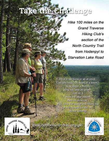
Take the Grand Traverse Hikers 100-Mile Challenge

alt text

from the Grand Traverse Hiking Club

Can you hike 100 miles in a week?
In 10 days? That would be just 10 miles a day!
Could you do it in a month?
Could you hike 100 miles within one year?

If you can do any of the above, completing the 100 miles maintained by their chapter, Grand Traverse Hiking Club will award a decal and certificate and a Michigan NCT patch.

A Hiking Log has been developed to record each section with the date completed. You can do the sections in any order you want. The requirement is to travel the whole 100 miles of our section of trail under your own power in one year.


This segment is on NCTA map MI-05, 06

See Grand Traverse Hiking Club Chapter of the NCTA

Wednesday, January 5, 2011

A View of the NCT

Manistee River in Winter
Manistee River (photo from GHTC newsletter)

by Arlen Matson

Hidden under wind blown Lake Michigan ice crystals, our portion of the NCT lies deep in freshly fallen snow. A blizzard attempts to blow it off the path; instead random drifts careen off the trunks of trees. Vertical blue blazes remain through this white season on guard to direct any attempt by a hiker on snowshoes or skis to find some destination.

The summer caterpillars and their silky parachute cords have vanished from sight. Even the imprints on the tread from the trail crew laden with tools and heavy planks are only history from labors well done. Adopters too have their cuttings submerged in a true Michigan winter.

This is an invitation for you to enter into the “treasures of the snow. Valley of the Giants
Valley of the Giants (photo from GHTC newsletter)


This segment is on NCTA map MI-05

See Grand Traverse Hiking Club Chapter of the NCTA

Monday, September 6, 2010

Guide to Hodenpyl Reroute

portion of map of Hodenpyl reroute on North Country Trail

by JHY

The Grand Traverse Hikers Club chapter of the NCTA has worked hard over the past several years to complete about 15 new miles of trail. One could argue that some of it is one of the prettiest pieces of trail in the whole lower peninsula of Michigan. But there have been a lot of questions about finding the new section.

The trail association has issued, this summer, a new edition of the official map MI-05. However, the Grand Traverse Hikers have also created a guide to the section. It includes a general overview map, with trailheads, campsites, and text to describe each section. The entire brochure is available at Northern Exposure and Fletcher Campgrounds. However, the map and guide info is available as a pdf download below.

Also check the Trail Wiki at northcountrytrail.org for a complete description of the section. Please add any comments you have to the Wiki.

This segment is on NCTA map MI-05

See Wiki Guide
See GTHC brochure, p 1 a pdf

Tuesday, January 19, 2010

No. 12/15 To No. 19 Road Reroute

bridge and steps
bridge (photo by Arlen Matsen)

OutdoorBlips: vote it up!
if you like this article, click the Blip chiclet!
from the Grand Traverse Hiking Club NCTA Chapter Newsletter, Dec 2009 used with permission

by Arlen Matsen

Phase 3 of last year’s Hodenpyl - NCT Reroute was completed on November 2. This new section of the NCT measures 4.7 miles from the corner of No.12 and 15 roads to its terminal point where it reconnects to the NCT at No.19 Road. There is parking at No.12/15 Road, and another lot adjacent to Harvey Bridge at No.19 Road.

This reroute was built from August to mid- November by our Trail Crew of 32 workers. It is our most rugged section of hiking trail and involves eleven stream crossings, and numerous steep ravines. Bridges are in place, water bars built, steps installed, trees blazed the familiar blue, and signage erected where necessary.

Never was there a section of trail built that involved so much benching into clay, while working through an unusually wet October. Heavy were our shoes as they became laden with Manistee River clay, but the views of the river, and the sound of rushing creeks in the ravines gave us an inspiring contact with a truly wilderness setting. On two occasions we brought an orange plastic sled from home to help carry decking to the bridge sites, while we used Ed’s wagon to do the same. The skillful use of 4x6’s, 2x4’s, 2x6’s, 6x6’s, nails, spikes, drills, Pulaskis, McCleods, bowsaws, loppers, levels, hammers, flagging, and miles of walking classify all of this crew as “Pros”.

trail steps
Sara's steps (photo by Arlen Matsen)
We secured two grants from the NCTA totaling $1306 to pay for some of the materials. The more we worked, the more needs we discovered, so another grant from the NPS for $286 was secured. The ravines and streams challenged us again for more funding. As we began to approach rifle deer hunting season, a 16-foot bridge needed to be built and adjacent 17 steps up the Big Ravine. Deena Barshney and Sara Cockrell came to the rescue and both wrote checks to cover the need of an additional $850. So, when you are out hiking the new NCT, about a mile from Harvey Bridge, you will discover two very special places. We call them Deena’s Bridge and Sara’s Steps, a most surprising legacy indeed; our crew and club are grateful.

An outstanding feature of this reroute is that there are at least 12 scenic vistas along the Manistee River. At the eastern end of this section of trail, where the new trail joins the existing NCT, coming from Wheeler Creek, there is a fantastic overlook which some of us believe exceeds even the Highbanks Rollway site. You may wind up with muddy boots, but the hike is worth it. And hopefully the trail is wide enough so you won’t be scratched by many of those thorn bushes (puckerbush) and hawthornes. True, there aren’t the flowers of the Hodenpyl area, but you can try to spot the unusual blue beech trees.
Manistee River
Manistee River (photo by Ed Morse)


On the subject of the Highbanks Rollway, the section of trail leading to it has been faithfully maintained for many years by Fred & Kathy Sabel and Larry & Donna Dodd. It has been included in their reports as a place needing restoration due to trashing and erosion. Dick Naperala, John Heiam and I will propose to the Cadillac DNR when we meet for our annual meeting that this site be given particular attention as a special place worth stabilizing and protecting.

This segment is on NCTA map MI-05

See Grand Traverse Hiking Club Chapter of the NCTA
Tuesday, October 27, 2009

Infected by the H1-K1-NG Bug

Marilyn Hoogstraten
Marilyn Hoogstraten (photo by JHY)

OutdoorBlips: vote it up!
if you like this article, click the Blip chiclet!
by JHY

Marilyn Hoogstraten may have been infected with a serious virus. It begins with a little worm of an idea drilling its way into the brain. There it waits and festers, feeding on the cells of a 9 to 5 job and a “normal” life until one day it erupts into a feverish desire to run into the woods carrying only a pack and two sticks... Yes, Marilyn is one of the many who grew up wanting to hike a long trail.

With a smile and the swing of a hiking stick, Marilyn confessed to a dream from long ago of hiking the Appalachian Trail. Her story seemed an echo of my own. She married, raised two children, still no time to hike. Then retirement arrived and she started a new business as an outgrowth of a beloved hobby, her talents as a photographer. And she did well. But all those summer weddings prevented her from taking hikes beyond the day excursions of her local club the Grand Traverse Hikers (which is also a chapter of the North Country Trail Association). “I was spending a whole lot of time sitting in front of a computer, and I gained weight” she explained with a grimace.

Then one day she knew she had to do it. She decided that her goal would be to hike all of the North Country Trail in Michigan that wasn’t road walk. That idea didn’t last long! If she was going to do a state, she would have to do all of it. Besides, she wanted to start in March and the southernmost Michigan sections are on roads. Now she has only about 150 miles of the NCT’s 600 in the Lower Peninsula yet to walk. “I’ve only started the UP,” she explained. Her hike near Brevort Lake was one of the most difficult with much of the trail knee-deep in water in the early spring. She began to wonder if she was cut out for hiking rugged trails, but, she said, “I always found the next road or trailhead and then realized that I could do it.”

hiker on foggy morning
Marilyn hikes in fog in the Manistee National Forest (photo by JHY)
All of her miles this year have been day hikes. “I want to get a new pack and try thru-hiking,” Marilyn added. “Maybe next year.” She often hikes with friends so that they can put a car at each end of the day’s walk. Tuesday, she walked from Timber Creek on US 10 to 96th St, the Lake / Newaygo County line. She emailed me, and I spotted her in exchange for an interview. Her plan was to camp at Highbanks that night, and friends would be joining her for the next day’s walk. “The logistics of making this hike happen have been challenging,” she admitted.

Her hope was to lose some weight through all the hiking. “But I was so hungry after hiking for three days in a row that I would gain five pounds,” she chuckled. “I lost that, then gained some back. I’m still too heavy,” she admitted. But she also pointed out that she is proof than anyone with a strong desire can walk out their door and take on a long trail. You don’t have to be young and slim, with the limbs and metabolism of a race horse. You just need to have a passion. A map is good too...

Both walking alone and in the company of others give her pleasure. “It’s really nice to camp with one or two friends,” she acknowledged. She really likes the variety of experiences on the NCT. Rural roads can be as interesting as the forests. She’s enjoying the colors of fall the best of all the seasons so far.

As we parted at Wingleton Road she was heard mumbling things like “Maybe I’ll order the Wisconsin maps.” Or, “I could hike most of Ohio in the winter; one of my daughters lives there.” Oh, yes, Marilyn’s infection has become quite serious...


See Marilyn's Journal
See A Hike with Marilyn and Maggie for more pictures from that hike


Sunday, June 28, 2009

Mesick / Hodenpyl Reroute Officially Opened

speaker at trail opening
Suzie Kanine speaks during the grand opening ceremony of the rerouted North Country Trail in Mesick
based on a news article in the Cadillac News

On Saturday, June 20, the official grand opening for the NCT re-route near Hodenpyl Dam was celebrated. This 12-mile off-road trail section provides the longest walk along a single body of water in Michigan's lower peninsula.

Arlen Matson, administrative trails coordinator for Grand Traverse Hiking Club, explained that the re-route takes the trail off county roads, which is never a final route for the trail. The new trail is welcomed by hikers who describe it as very scenic and peaceful.

The celebration lasted all day long and included events such as a fishing tournament, tour of Hodenpyl Dam, picnic and hikes or canoeing. The event was sponsored by Consumers Energy, the Northern Exposure Campground, and the Grand Traverse Hiking Club. Much of the route is on Consumers property. Northern Exposure has also allowed the trail to cross their campground. This of course, provides easy access for long-distance hikers. The trail-building work has been done by the Grand Traverse Hikers.

The final 3.5 miles of the new route are awaiting permission from the Michigan DNR. This section is from No. 15 road to No. 19 Road (Harvey Bridge Road), just east of M-37.

See Grand Traverse Hikers Club

Saturday, June 6, 2009

Senator Levin Meets Nimblewill Nomad

Senator Carl Levin, Nimblewill Nomad, Bruce Matthews Senator Carl Levin greets NimblewillNomad while NCTA Director Bruce Matthews looks on (photo by JHY)
by JHY

At the Grand Traverse Hiking Club National Trails Day event this morning, NCT thru-hiker Nimblewill Nomad (Eb Eberhart) was welcomed by about 50 people. Everyone gathered at Guernsey Lake State Forest Campground just west of Kalkaska, Michigan.

The club was celebrating the official opening of the connection of the TART and KART trails with a new section of the North Country Trail. Another reason to celebrate the new trail section is that these miles of NCT will no longer be concurrent with the Shore-to-Shore horseback riding trail.

Senator Carl Levin attended the festivities and presented NCTA Executive Director Bruce Matthews with a ceremonial copy of the Omnibus Public Lands Act which (among other things) gives the NCT authority to buy land from willing sellers.

Senator Carl Levin presents Bruce Matthews with a copy of the Omnibus Public Lands Act Senator Carl Levin presents Bruce Matthews with a copy of the Omnibus Public Lands Act (photo by JHY)


After the opening ceremonies participants took part in one of three activities: a hike, a bike ride, or kayaking. A morning in the woods is always great when it is followed by grilled hot dogs, potluck salads and desserts!

cooking hotdogs on a portable grill Hot dog lunch follows the morning activities (photo by JHY)


See North Country Trail Gains Willing Seller Authority
See Nimblewill Nomad's Journal

Saturday, December 20, 2008

Grand Traverse Jan Program

Grand Traverse Chapter logo
from the Grand Traverse Hiking Club Chapter of the NCTA

Tuesday, January 20, 2009
at 7 PM in Classrooms A & B at MCHC

Hiking in Torres del Paine (Chilean Patagonia) with Nancy Fleming and Bill Schafer Torres del Paine National Park is a Chilean National Park filled with ountains, glaciers, lakes and rivers. Don’t miss this opportunity to hear about their trip to this isolated wonderland.