 a Michigan map (photo by Sage) |
if you like this article, click the Blip chiclet!
Excerpted from the blog Sage Covered Hills, used with permission
"Trisket and I headed out to the North Country Trail late this morning. It was a perfect day for hiking as we’d had our first freeze of the season overnight."
Sage was hiking in Michigan's lower peninsula west of Hastings, between MI-179 and MI-37, early in October this year.
"My lunch counter was carpeted with fresh pine straw. Leaning up against a tree, I ate my lunch, sharing a bit with the dog. Then I wrote in my journal and read a chapter titled "The Practice of Getting Lost" in An Altar in the World: A Geography of Faith by Barbara Brown Taylor. I did not get lost; after all I had my map with me (see the photo). We’ll, at least I didn’t get lost in a geographical sense, but when I hike I do often find myself getting lost in my thoughts and that’s a good thing.
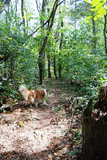
 Triskit enjoys the hike (photo by Sage) |
Sage is a frequent NCT hiker, as he lives only about 10 miles from the trail. Read the rest of this post and see more pictures at Sage Covered Hills
See Sage Enjoys NCT Near Yankee Springs for another of his NCT hikes.


2 comments:
In my blog, I don't think too many people got the joke about the leaf as my map--I notice you pointed it out as "a Michigan map." Thanks for your work in promoting the NCT and hiking in general.
Hi sage... maybe it needs a mushroom to mark the exact location! Thanks for sharing your hike with us.
Post a Comment